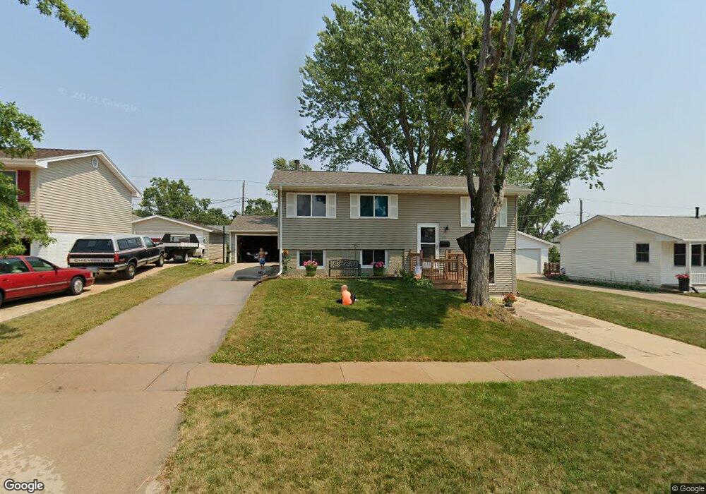
213 Lenora Dr NW Cedar Rapids, IA 52405
Cherry Hill Park NeighborhoodEstimated Value: $187,000 - $221,621
4
Beds
2
Baths
1,589
Sq Ft
$133/Sq Ft
Est. Value
About This Home
This home is located at 213 Lenora Dr NW, Cedar Rapids, IA 52405 and is currently estimated at $211,155, approximately $132 per square foot. 213 Lenora Dr NW is a home located in Linn County with nearby schools including Junction City Elementary School, Hoover Elementary School, and Kentucky Tech - Ashland Reg Tech Center.
Ownership History
Date
Name
Owned For
Owner Type
Purchase Details
Closed on
Apr 30, 2021
Sold by
Riniker Laura A and Mackenzie Laura A
Bought by
Mackenzie Laura A
Current Estimated Value
Home Financials for this Owner
Home Financials are based on the most recent Mortgage that was taken out on this home.
Original Mortgage
$108,238
Outstanding Balance
$88,215
Interest Rate
3%
Mortgage Type
New Conventional
Estimated Equity
$122,940
Purchase Details
Closed on
Aug 26, 2008
Sold by
Benda Julia A and Benda Kenneth K
Bought by
Riniker Laura A
Home Financials for this Owner
Home Financials are based on the most recent Mortgage that was taken out on this home.
Original Mortgage
$139,000
Interest Rate
5.5%
Mortgage Type
Purchase Money Mortgage
Create a Home Valuation Report for This Property
The Home Valuation Report is an in-depth analysis detailing your home's value as well as a comparison with similar homes in the area
Home Values in the Area
Average Home Value in this Area
Purchase History
| Date | Buyer | Sale Price | Title Company |
|---|---|---|---|
| Mackenzie Laura A | -- | None Listed On Document | |
| Riniker Laura A | $138,500 | None Available |
Source: Public Records
Mortgage History
| Date | Status | Borrower | Loan Amount |
|---|---|---|---|
| Open | Mackenzie Laura A | $108,238 | |
| Previous Owner | Riniker Laura A | $139,000 |
Source: Public Records
Tax History Compared to Growth
Tax History
| Year | Tax Paid | Tax Assessment Tax Assessment Total Assessment is a certain percentage of the fair market value that is determined by local assessors to be the total taxable value of land and additions on the property. | Land | Improvement |
|---|---|---|---|---|
| 2025 | $2,994 | $207,500 | $35,500 | $172,000 |
| 2024 | $3,202 | $196,300 | $35,500 | $160,800 |
| 2023 | $3,202 | $179,700 | $30,600 | $149,100 |
| 2022 | $3,062 | $160,700 | $30,600 | $130,100 |
| 2021 | $2,958 | $156,800 | $27,400 | $129,400 |
| 2020 | $2,958 | $142,700 | $22,600 | $120,100 |
| 2019 | $2,864 | $141,400 | $22,600 | $118,800 |
| 2018 | $2,780 | $141,400 | $22,600 | $118,800 |
| 2017 | $2,759 | $133,200 | $22,600 | $110,600 |
| 2016 | $2,759 | $129,800 | $22,600 | $107,200 |
| 2015 | $2,833 | $133,102 | $22,575 | $110,527 |
| 2014 | $2,648 | $133,102 | $22,575 | $110,527 |
| 2013 | $2,586 | $133,102 | $22,575 | $110,527 |
Source: Public Records
Map
Nearby Homes
- 208 Lenora Dr NW
- 229 Jacolyn Dr NW
- 4819 Ford Ave NW
- 272 Peace Ave NW
- 281 Jacolyn Dr NW
- 4975 Kesler Rd NW
- 5127 Holly Ave NW
- 408 Jacolyn Dr NW
- 4622 1st Ave NW Unit E
- 4619 1st Ave SW Unit 3
- 106 Leroy St NW
- 150 Meadowlark Ln NW
- 56 Julia Ann Dr NW
- 4819 Fruitwood Ln NW
- 3600 Midway Dr NW
- 3724 2nd Ave SW
- 5530 Skyline Dr NW
- 3416 Sue Ln NW
- 3509 E Ave NW Unit D
- 5720 Gordon Ave NW
- 203 Lenora Dr NW
- 218 Alma Dr NW
- 228 Alma Dr NW
- 233 Lenora Dr NW
- 191 Lenora Dr NW
- 218 Lenora Dr NW
- 238 Alma Dr NW
- 245 Lenora Dr NW
- 179 Lenora Dr NW
- 200 Lenora Dr NW
- 238 Lenora Dr NW
- 250 Alma Dr NW
- 180 Alma Dr NW
- 180 Lenora Dr NW
- 250 Lenora Dr NW
- 257 Lenora Dr NW
- 169 Lenora Dr NW
- 213 Alma Dr NW
- 255 Drinkward St NW
- 251 Drinkward St NW