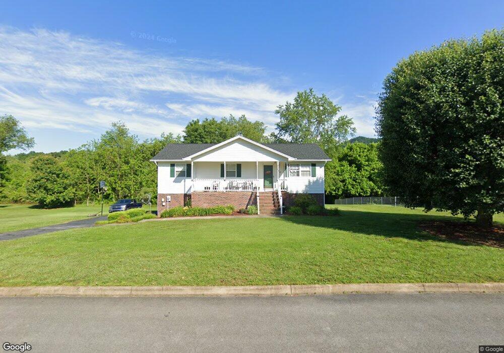
213 Lindas Way Bristol, TN 37620
Estimated Value: $221,496 - $277,000
--
Bed
2
Baths
1,144
Sq Ft
$226/Sq Ft
Est. Value
About This Home
This home is located at 213 Lindas Way, Bristol, TN 37620 and is currently estimated at $258,874, approximately $226 per square foot. 213 Lindas Way is a home located in Sullivan County with nearby schools including Bluff City Elementary School, Sullivan East Middle School, and Sullivan East High School.
Ownership History
Date
Name
Owned For
Owner Type
Purchase Details
Closed on
Dec 23, 1998
Current Estimated Value
Create a Home Valuation Report for This Property
The Home Valuation Report is an in-depth analysis detailing your home's value as well as a comparison with similar homes in the area
Home Values in the Area
Average Home Value in this Area
Purchase History
| Date | Buyer | Sale Price | Title Company |
|---|---|---|---|
| -- | $10,000 | -- |
Source: Public Records
Tax History Compared to Growth
Tax History
| Year | Tax Paid | Tax Assessment Tax Assessment Total Assessment is a certain percentage of the fair market value that is determined by local assessors to be the total taxable value of land and additions on the property. | Land | Improvement |
|---|---|---|---|---|
| 2024 | $849 | $34,000 | $5,275 | $28,725 |
| 2023 | $818 | $34,000 | $5,275 | $28,725 |
| 2022 | $818 | $34,000 | $5,275 | $28,725 |
| 2021 | $818 | $34,000 | $5,275 | $28,725 |
| 2020 | $821 | $34,000 | $5,275 | $28,725 |
| 2019 | $821 | $31,950 | $5,275 | $26,675 |
| 2018 | $815 | $31,950 | $5,275 | $26,675 |
| 2017 | $815 | $31,950 | $5,275 | $26,675 |
| 2016 | $870 | $33,800 | $5,250 | $28,550 |
| 2014 | $779 | $33,804 | $0 | $0 |
Source: Public Records
Map
Nearby Homes
- Tbd Hill Dr
- 2158 Vance Tank Rd
- TBD Sweet Knobs Trail
- 1237 White Top Rd
- 143 Lazy Acres
- 496 Pleasant Grove Rd
- 3493 Weaver Pike
- 1026 Deer Harbour Rd
- 159 Peoples Rd
- 292 Peters Rd
- 403 Martindale Rd
- 302 Martindale Rd
- 101 Timberlane Rd
- 1056 White Top Rd
- 316 Timberlane Rd
- 4045 Weaver Pike
- 1476 Silver Grove Rd
- 100 Martindale Rd
- 305 Sunnybrook Dr
- 301 El Paso Dr
- 217 Lindas Way
- 216 Lindas Way
- 220 Lindas Way
- 209 Lindas Way
- 212 Lindas Way
- 221 Lindas Way
- 265 Springfield Dr
- 279 Springfield Dr
- 224 Lindas Way
- 249 Springfield Dr
- 1762 Vance Tank Rd
- 208 Lindas Way
- 208 Linda's Way
- 287 Springfield Acres
- 287 Springfield Dr
- 241 Springfield Dr
- 1754 Vance Tank Rd
- 225 Lindas Way
- 295 Springfield Dr
- 205 Lindas Way