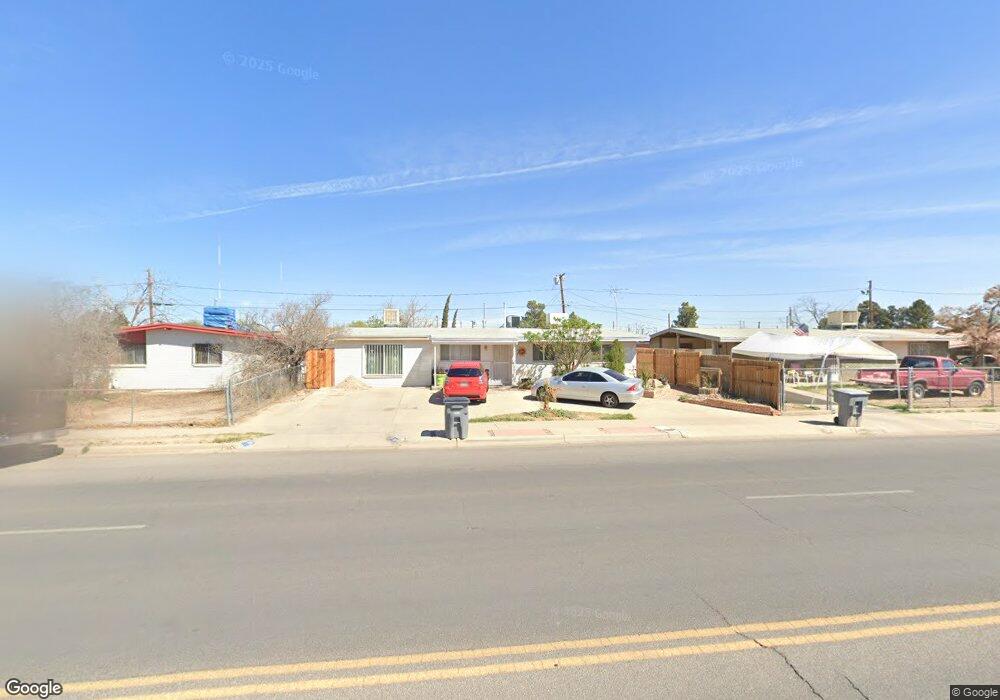
213 Mccarthy Ave El Paso, TX 79915
Thomas Manor NeighborhoodEstimated Value: $154,000 - $182,000
3
Beds
3
Baths
1,325
Sq Ft
$128/Sq Ft
Est. Value
About This Home
This home is located at 213 Mccarthy Ave, El Paso, TX 79915 and is currently estimated at $170,065, approximately $128 per square foot. 213 Mccarthy Ave is a home located in El Paso County with nearby schools including Thomas Manor, Riverside Middle School, and Riverside High School.
Ownership History
Date
Name
Owned For
Owner Type
Purchase Details
Closed on
Jan 26, 2006
Sold by
Vargas Maria L and Vargas Luis G
Bought by
Perez Lucila
Current Estimated Value
Purchase Details
Closed on
May 5, 2000
Sold by
Perez Lucila
Bought by
Vargas Luis G and Vargas Maria L
Purchase Details
Closed on
May 4, 1998
Sold by
Perez Reyes Rosa M and Reyes Pio Dejesus
Bought by
Perez Lucila
Home Financials for this Owner
Home Financials are based on the most recent Mortgage that was taken out on this home.
Original Mortgage
$40,450
Interest Rate
7.09%
Mortgage Type
Seller Take Back
Purchase Details
Closed on
Apr 5, 1993
Sold by
Perez Rosa M
Bought by
Perez Lucila
Home Financials for this Owner
Home Financials are based on the most recent Mortgage that was taken out on this home.
Original Mortgage
$40,450
Interest Rate
5.88%
Mortgage Type
Purchase Money Mortgage
Create a Home Valuation Report for This Property
The Home Valuation Report is an in-depth analysis detailing your home's value as well as a comparison with similar homes in the area
Home Values in the Area
Average Home Value in this Area
Purchase History
| Date | Buyer | Sale Price | Title Company |
|---|---|---|---|
| Perez Lucila | -- | None Available | |
| Vargas Luis G | -- | -- | |
| Perez Lucila | -- | -- | |
| Perez Lucila | -- | None Available |
Source: Public Records
Mortgage History
| Date | Status | Borrower | Loan Amount |
|---|---|---|---|
| Previous Owner | Perez Lucila | $40,450 | |
| Previous Owner | Perez Lucila | $40,450 | |
| Closed | Perez Lucila | $13,400 | |
| Closed | Vargas Luis G | $0 |
Source: Public Records
Tax History
| Year | Tax Paid | Tax Assessment Tax Assessment Total Assessment is a certain percentage of the fair market value that is determined by local assessors to be the total taxable value of land and additions on the property. | Land | Improvement |
|---|---|---|---|---|
| 2025 | $1,651 | $124,155 | -- | -- |
| 2024 | $1,651 | $112,868 | -- | -- |
| 2023 | $1,608 | $102,607 | $0 | $0 |
| 2022 | $2,897 | $93,279 | $0 | $0 |
| 2021 | $2,756 | $100,615 | $12,321 | $88,294 |
| 2020 | $2,435 | $77,090 | $12,321 | $64,769 |
| 2018 | $2,424 | $77,951 | $12,321 | $65,630 |
| 2017 | $2,452 | $80,227 | $12,321 | $67,906 |
| 2016 | $2,452 | $80,227 | $12,321 | $67,906 |
| 2015 | $1,862 | $80,227 | $12,321 | $67,906 |
| 2014 | $1,862 | $82,005 | $12,321 | $69,684 |
Source: Public Records
Map
Nearby Homes
- 261 Gladys Ave
- 222 Kelvin Ave
- 310 Kelvin Ave
- 7798 Rosedale St
- 104 Chip Way
- 7860 Porche St
- 7632 Franklin Dr Unit 1-2
- 7869 Jersey St
- 7925 Broadway Dr
- 7907 Alameda Ave
- 140 Teakwood Rd
- 7859 Rosemary St Unit A
- 423 N Carolina Dr
- 368 Milton Rd
- 404 Lesa Ln
- 436 Emerson St Unit 1-7
- 411 San Pablo Place
- 412 Lesa Ln
- 3 Atkinson Way
- 537 Emerson St
- 217 Mccarthy Ave
- 209 Mccarthy Ave
- 232 Gladys Ave
- 228 Gladys Ave
- 236 Gladys Ave
- 221 Mccarthy Ave
- 205 Mccarthy Ave
- 240 Gladys Ave
- 224 Gladys Ave
- 225 Mccarthy Ave
- 220 Mccarthy Ave
- 224 Mccarthy Ave
- 216 Mccarthy Ave
- 212 Gladys Ave
- 244 Gladys Ave
- 228 Mccarthy Ave
- 212 Mccarthy Ave
- 201 Mccarthy Ave
- 229 Mccarthy Ave
- 232 Mccarthy Ave
Your Personal Tour Guide
Ask me questions while you tour the home.