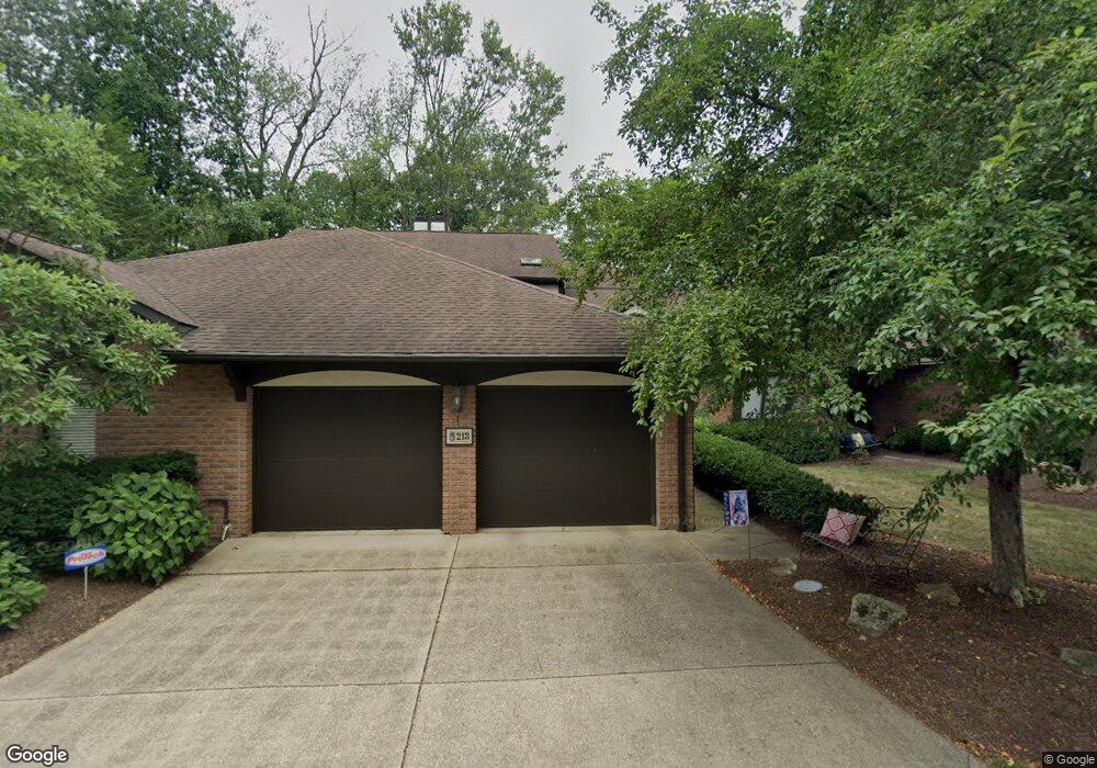
213 N Circle Dr Unit 213 Canton, OH 44709
Edgefield NeighborhoodEstimated Value: $280,000 - $416,000
2
Beds
4
Baths
3,212
Sq Ft
$106/Sq Ft
Est. Value
About This Home
This home is located at 213 N Circle Dr Unit 213, Canton, OH 44709 and is currently estimated at $340,042, approximately $105 per square foot. 213 N Circle Dr Unit 213 is a home located in Stark County with nearby schools including Robert A. Taft Elementary School, Glenwood Intermediate School, and GlenOak High School.
Ownership History
Date
Name
Owned For
Owner Type
Purchase Details
Closed on
Aug 23, 2011
Sold by
Degraff Victoria S
Bought by
Schott Jennifer K
Current Estimated Value
Home Financials for this Owner
Home Financials are based on the most recent Mortgage that was taken out on this home.
Original Mortgage
$132,000
Outstanding Balance
$91,310
Interest Rate
4.55%
Mortgage Type
New Conventional
Estimated Equity
$248,732
Purchase Details
Closed on
Mar 30, 2001
Sold by
Degraff Charles D and Degraff Victoria S
Bought by
Degraff Victoria S
Create a Home Valuation Report for This Property
The Home Valuation Report is an in-depth analysis detailing your home's value as well as a comparison with similar homes in the area
Home Values in the Area
Average Home Value in this Area
Purchase History
| Date | Buyer | Sale Price | Title Company |
|---|---|---|---|
| Schott Jennifer K | $165,000 | None Available | |
| Degraff Victoria S | -- | -- |
Source: Public Records
Mortgage History
| Date | Status | Borrower | Loan Amount |
|---|---|---|---|
| Open | Schott Jennifer K | $132,000 |
Source: Public Records
Tax History Compared to Growth
Tax History
| Year | Tax Paid | Tax Assessment Tax Assessment Total Assessment is a certain percentage of the fair market value that is determined by local assessors to be the total taxable value of land and additions on the property. | Land | Improvement |
|---|---|---|---|---|
| 2025 | -- | $86,390 | $12,290 | $74,100 |
| 2024 | -- | $86,390 | $12,290 | $74,100 |
| 2023 | $2,818 | $68,470 | $15,720 | $52,750 |
| 2022 | $1,416 | $68,470 | $15,720 | $52,750 |
| 2021 | $2,609 | $68,260 | $15,720 | $52,540 |
| 2020 | $2,626 | $61,010 | $14,350 | $46,660 |
| 2019 | $2,603 | $61,010 | $14,350 | $46,660 |
| 2018 | $2,563 | $61,010 | $14,350 | $46,660 |
| 2017 | $2,633 | $57,830 | $12,640 | $45,190 |
| 2016 | $2,637 | $57,830 | $12,640 | $45,190 |
| 2015 | $2,644 | $57,830 | $12,640 | $45,190 |
| 2014 | $1,028 | $62,690 | $13,760 | $48,930 |
| 2013 | $1,519 | $62,760 | $13,760 | $49,000 |
Source: Public Records
Map
Nearby Homes
- 1603 S Main St Unit B
- 1653 Greenway Rd SE Unit 202
- 1801 49th St NW
- 1690 Carlton Ave SE
- 256 Everhard Rd SW
- 1480 Northfield Ave SE
- 1381 Circle Hill Rd SE
- 139 Maplecrest St SW
- 1055 Easthill St SE
- 500 Heatherwood St SW
- 4646 Woodside Ave NW
- 2521 44th St NW
- 2525 44th St NW
- 2309 43rd St NW
- 1338 Shiloh Run SE
- 1293 Westview Cir SE
- 218 Bonnett St SW
- 1331 Shiloh Run SE
- 1341 Shiloh Run SE
- 4628 Westwood Ave NW
- 211 N Circle Dr
- 215 N Circle Dr Unit 215
- 203 N Circle Dr
- 221 N Circle Dr Unit 221
- 131 Brookview Dr SW
- 133 Brookview Dr SW
- 201 N Circle Dr
- 135 Brookview Dr SW
- 103 N Circle Dr Unit 103
- 223 N Circle Dr
- 117 Brookview Dr SW
- 101 N Circle Dr
- 115 N Circle Dr
- 130 Brookview Dr SW Unit 130
- 100 N Circle Dr
- 231 Brookview Dr SW Unit 231
- 220 Brookview Dr SW Unit 220
- 104 N Circle Dr
- 1617 S Main St
- 134 Brookview Dr SW Unit 134