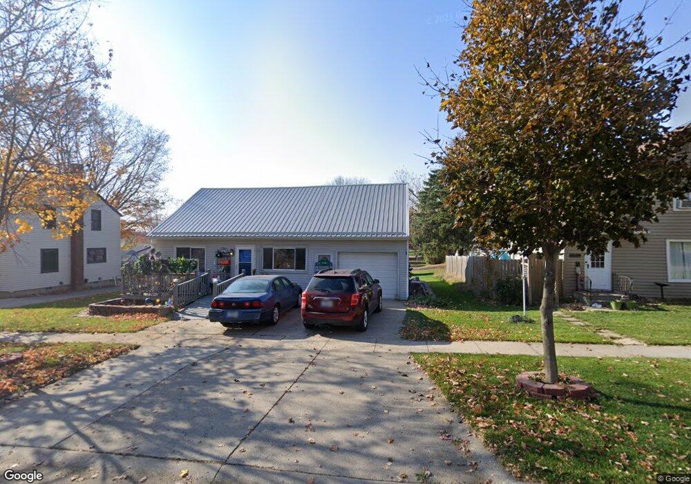
213 N Dwight St Conrad, IA 50621
Estimated Value: $129,000 - $149,000
3
Beds
2
Baths
1,442
Sq Ft
$99/Sq Ft
Est. Value
About This Home
This home is located at 213 N Dwight St, Conrad, IA 50621 and is currently estimated at $143,443, approximately $99 per square foot. 213 N Dwight St is a home located in Grundy County with nearby schools including BCLUW Elementary School, BCLUW Middle School, and BCLUW High School.
Ownership History
Date
Name
Owned For
Owner Type
Purchase Details
Closed on
Mar 20, 2025
Sold by
Owings Thomas E and Owings Terri L
Bought by
Cwf 2025 Llc
Current Estimated Value
Home Financials for this Owner
Home Financials are based on the most recent Mortgage that was taken out on this home.
Original Mortgage
$32,000
Outstanding Balance
$31,621
Interest Rate
6.89%
Mortgage Type
Credit Line Revolving
Estimated Equity
$111,822
Purchase Details
Closed on
Nov 16, 2024
Sold by
Owings Gloria J
Bought by
Owings Thomas E
Purchase Details
Closed on
Dec 21, 2009
Sold by
Owings Richard D and Owings Richard Dick
Bought by
Owings Richard D and Owings Gloria J
Create a Home Valuation Report for This Property
The Home Valuation Report is an in-depth analysis detailing your home's value as well as a comparison with similar homes in the area
Home Values in the Area
Average Home Value in this Area
Purchase History
| Date | Buyer | Sale Price | Title Company |
|---|---|---|---|
| Cwf 2025 Llc | $65,000 | None Listed On Document | |
| Owings Thomas E | -- | None Listed On Document | |
| Owings Thomas E | -- | None Listed On Document | |
| Owings Richard D | -- | -- |
Source: Public Records
Mortgage History
| Date | Status | Borrower | Loan Amount |
|---|---|---|---|
| Open | Cwf 2025 Llc | $32,000 |
Source: Public Records
Tax History Compared to Growth
Tax History
| Year | Tax Paid | Tax Assessment Tax Assessment Total Assessment is a certain percentage of the fair market value that is determined by local assessors to be the total taxable value of land and additions on the property. | Land | Improvement |
|---|---|---|---|---|
| 2025 | -- | $132,900 | $13,360 | $119,540 |
| 2024 | -- | $120,270 | $13,360 | $106,910 |
| 2023 | -- | $120,270 | $13,360 | $106,910 |
| 2022 | $0 | $100,990 | $11,450 | $89,540 |
| 2021 | $0 | $100,990 | $11,450 | $89,540 |
| 2020 | $1,408 | $84,060 | $11,450 | $72,610 |
| 2019 | $1,408 | $84,060 | $11,450 | $72,610 |
| 2018 | $0 | $77,920 | $11,450 | $66,470 |
| 2017 | -- | $77,920 | $11,450 | $66,470 |
| 2016 | $0 | $77,920 | $0 | $0 |
| 2015 | -- | $78,720 | $0 | $0 |
| 2014 | -- | $78,720 | $0 | $0 |
Source: Public Records
Map
Nearby Homes
- 401 Farmers
- 405 Farmers
- 109 N Lincoln St
- 401 N Vernon St Unit 22
- 405 N Vernon St Unit 21
- 409 N Vernon St Unit 20
- 413 N Vernon St Unit 19
- 417 N Vernon St Unit 18
- 707 Circle Dr
- 214/216 E Lillian Ave Unit Lot 25/26
- 206/208 E Lillian Ave Unit Lot 29/30
- 218/220 E Lillian Ave Unit Lot 23/24
- 210/212 E Lillian Ave Unit Lot 27/28
- 410 N Vernon St Unit 40
- 421 N Vernon St Unit 17
- 414 N Vernon St Unit 41
- 414 N Vernon St
- 418 N Vernon St
- 418 N Vernon St Unit 42
- 202 E Lillian Ave
- 209 N Dwight St
- 311 E Maple St
- 307 E Maple Ave
- 205 N Dwight St
- 216 N Dwight St
- 310 E Maple St
- 314 E Maple Ave
- 212 N Dwight St
- 204 N Dwight St
- 201 N Dwight St
- 404 E Maple Ave
- 306 N Dwight St
- 204 N Vernon St
- 208 N Vernon St
- 405 E Maple Ave
- 305 N Dwight St
- 216 N Vernon St
- 210 N Vernon St
- 406 E Maple Ave
- 406 E Maple St