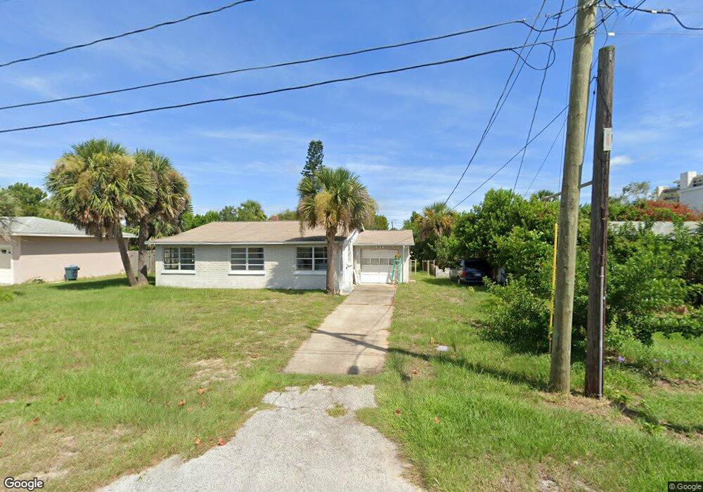
213 Osceola Ave Ormond Beach, FL 32176
Estimated Value: $245,000 - $460,000
2
Beds
2
Baths
1,612
Sq Ft
$210/Sq Ft
Est. Value
About This Home
This home is located at 213 Osceola Ave, Ormond Beach, FL 32176 and is currently estimated at $338,446, approximately $209 per square foot. 213 Osceola Ave is a home located in Volusia County with nearby schools including Ormond Beach Middle School, Seabreeze High School, and St Brendan Catholic School.
Ownership History
Date
Name
Owned For
Owner Type
Purchase Details
Closed on
Nov 29, 2017
Sold by
Miller Yvonne
Bought by
Miller Tammy Lynn and Miller Tammy L
Current Estimated Value
Purchase Details
Closed on
Aug 20, 2014
Sold by
Miller Dorothy
Bought by
Miller Dorothy and Miller Tammy
Purchase Details
Closed on
Apr 10, 2002
Sold by
Miller Dorothy
Bought by
Miller David Michael
Purchase Details
Closed on
Nov 15, 1977
Bought by
Miller Dorothy
Purchase Details
Closed on
Aug 15, 1976
Bought by
Miller Dorothy
Create a Home Valuation Report for This Property
The Home Valuation Report is an in-depth analysis detailing your home's value as well as a comparison with similar homes in the area
Home Values in the Area
Average Home Value in this Area
Purchase History
| Date | Buyer | Sale Price | Title Company |
|---|---|---|---|
| Miller Tammy Lynn | -- | Attorney | |
| Miller Dorothy | -- | Attorney | |
| Miller David Michael | -- | -- | |
| Miller Dorothy | $10,100 | -- | |
| Miller Dorothy | $29,000 | -- |
Source: Public Records
Tax History Compared to Growth
Tax History
| Year | Tax Paid | Tax Assessment Tax Assessment Total Assessment is a certain percentage of the fair market value that is determined by local assessors to be the total taxable value of land and additions on the property. | Land | Improvement |
|---|---|---|---|---|
| 2026 | $4,408 | $281,225 | $151,560 | $129,665 |
| 2025 | $4,408 | $281,225 | $151,560 | $129,665 |
| 2024 | $3,936 | $307,181 | $151,560 | $155,621 |
| 2023 | $3,936 | $287,663 | $88,560 | $199,103 |
| 2022 | $3,383 | $223,090 | $74,160 | $148,930 |
| 2021 | $3,265 | $196,552 | $60,480 | $136,072 |
| 2020 | $2,883 | $163,749 | $55,872 | $107,877 |
| 2019 | $2,798 | $157,599 | $50,634 | $106,965 |
| 2018 | $2,659 | $145,795 | $48,190 | $97,605 |
| 2017 | $2,532 | $136,975 | $48,151 | $88,824 |
| 2016 | $2,349 | $118,671 | $0 | $0 |
| 2015 | $2,348 | $114,208 | $0 | $0 |
| 2014 | $2,138 | $103,552 | $0 | $0 |
Source: Public Records
Map
Nearby Homes
- 101 Lucky Dr
- 111 S Atlantic Ave Unit 505
- 111 S Atlantic Ave Unit 502
- 111 S Atlantic Ave Unit 702
- 111 S Atlantic Ave Unit 1104
- 111 S Atlantic Ave Unit 803
- 111 S Atlantic Ave Unit 304
- 89 S Atlantic Ave Unit 401
- 89 S Atlantic Ave Unit 404
- 89 S Atlantic Ave Unit 1006
- 89 S Atlantic Ave Unit 103
- 55 Vining Ct
- ELLE Plan at Tide's Edge - Tides Edge
- CALI Plan at Tide's Edge - Tides Edge
- HAYDEN Plan at Tide's Edge - Tides Edge
- 113 S Halifax Dr
- 39 Bosarvey Cir
- 123 Arlington Way
- 0 0 Unit MFRO6285485
- 67 Ocean Shore Blvd