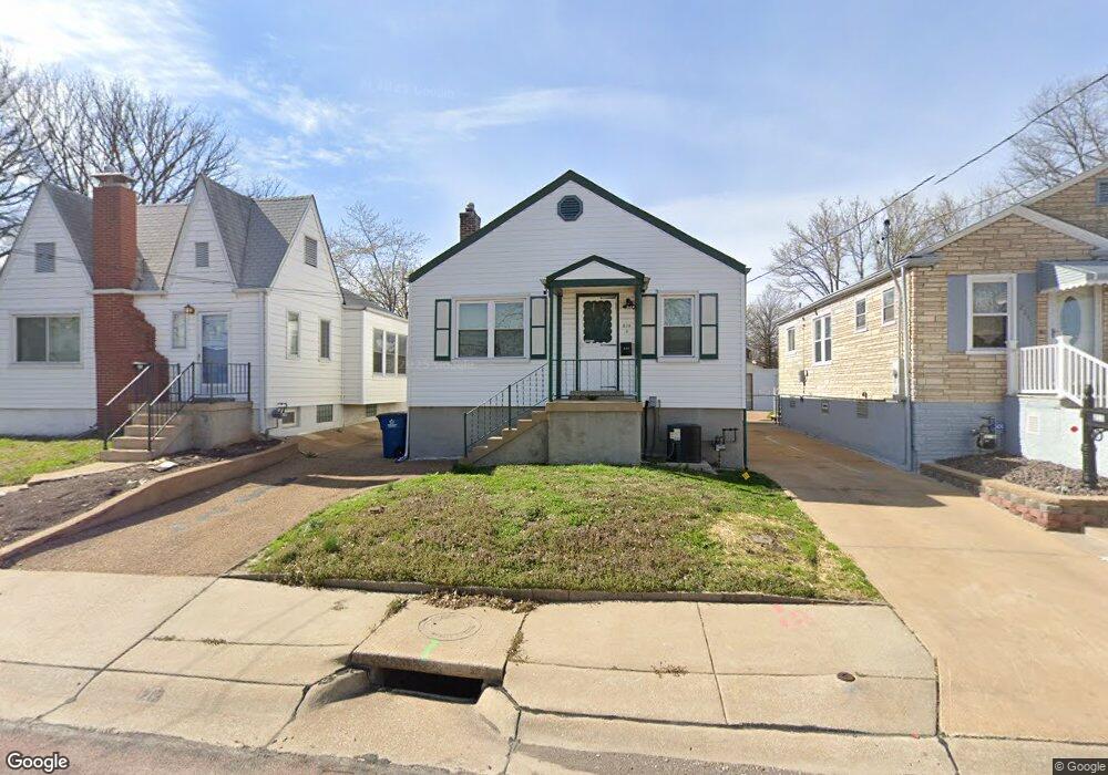
213 Runyon Ave Saint Louis, MO 63125
Lemay NeighborhoodEstimated Value: $155,718 - $184,000
2
Beds
1
Bath
956
Sq Ft
$182/Sq Ft
Est. Value
About This Home
This home is located at 213 Runyon Ave, Saint Louis, MO 63125 and is currently estimated at $173,680, approximately $181 per square foot. 213 Runyon Ave is a home located in St. Louis County with nearby schools including Hancock Place Elementary School, Hancock Place Middle School, and Hancock Place High School.
Ownership History
Date
Name
Owned For
Owner Type
Purchase Details
Closed on
Aug 25, 2022
Sold by
Dtkm Llc
Bought by
Sobeck Deborah
Current Estimated Value
Purchase Details
Closed on
Jun 21, 2021
Sold by
Dalba Robert N
Bought by
Dtkm Llc
Purchase Details
Closed on
Mar 13, 2017
Sold by
The Thomas M Blassie & Diane M Blassie T
Bought by
Dalba Robert N
Home Financials for this Owner
Home Financials are based on the most recent Mortgage that was taken out on this home.
Original Mortgage
$115,000
Interest Rate
4.19%
Mortgage Type
Unknown
Purchase Details
Closed on
Jan 22, 2016
Sold by
Limpert Emil C and Limpert Dorothy I
Bought by
The Thomas M Blassie & Diane M Blassie T
Create a Home Valuation Report for This Property
The Home Valuation Report is an in-depth analysis detailing your home's value as well as a comparison with similar homes in the area
Home Values in the Area
Average Home Value in this Area
Purchase History
| Date | Buyer | Sale Price | Title Company |
|---|---|---|---|
| Sobeck Deborah | -- | -- | |
| Dtkm Llc | $107,684 | None Available | |
| Dalba Robert N | $130,000 | Investors Title Co Clayton | |
| The Thomas M Blassie & Diane M Blassie T | $30,000 | Investors Title Co Clayton |
Source: Public Records
Mortgage History
| Date | Status | Borrower | Loan Amount |
|---|---|---|---|
| Previous Owner | Dalba Robert N | $115,000 |
Source: Public Records
Tax History Compared to Growth
Tax History
| Year | Tax Paid | Tax Assessment Tax Assessment Total Assessment is a certain percentage of the fair market value that is determined by local assessors to be the total taxable value of land and additions on the property. | Land | Improvement |
|---|---|---|---|---|
| 2025 | $2,086 | $31,460 | $11,190 | $20,270 |
| 2024 | $2,086 | $26,710 | $4,480 | $22,230 |
| 2023 | $1,982 | $26,710 | $4,480 | $22,230 |
| 2022 | $1,893 | $21,660 | $5,170 | $16,490 |
| 2021 | $1,732 | $21,660 | $5,170 | $16,490 |
| 2020 | $1,677 | $20,030 | $5,170 | $14,860 |
| 2019 | $1,673 | $20,030 | $5,170 | $14,860 |
| 2018 | $1,262 | $13,110 | $3,950 | $9,160 |
| 2017 | $1,240 | $13,110 | $3,950 | $9,160 |
| 2016 | $1,033 | $10,470 | $1,730 | $8,740 |
| 2015 | $1,036 | $10,470 | $1,730 | $8,740 |
| 2014 | $1,157 | $12,470 | $3,250 | $9,220 |
Source: Public Records
Map
Nearby Homes
- 3733 Comstock Dr
- 3708 Comstock Dr
- 4023 Healy Ct
- 5321 Tesson Ct
- 514 E Dallas Ct
- 8439 Tennessee Ave
- 4140 Tesson St
- 8626 Shoss Ave
- 3806 Waller Ave
- 8523 Idaho Ave
- 4338 Seibert Ave
- 3651 Germania St
- 3624 Steins St
- 622 Kayser Ave
- 3619 Steins St
- 252 Wachtel Ave
- 4530 Grasso Ave
- 610 Kayser Ave
- 8015 Carlsbad Dr
- 241 Dammert Ave