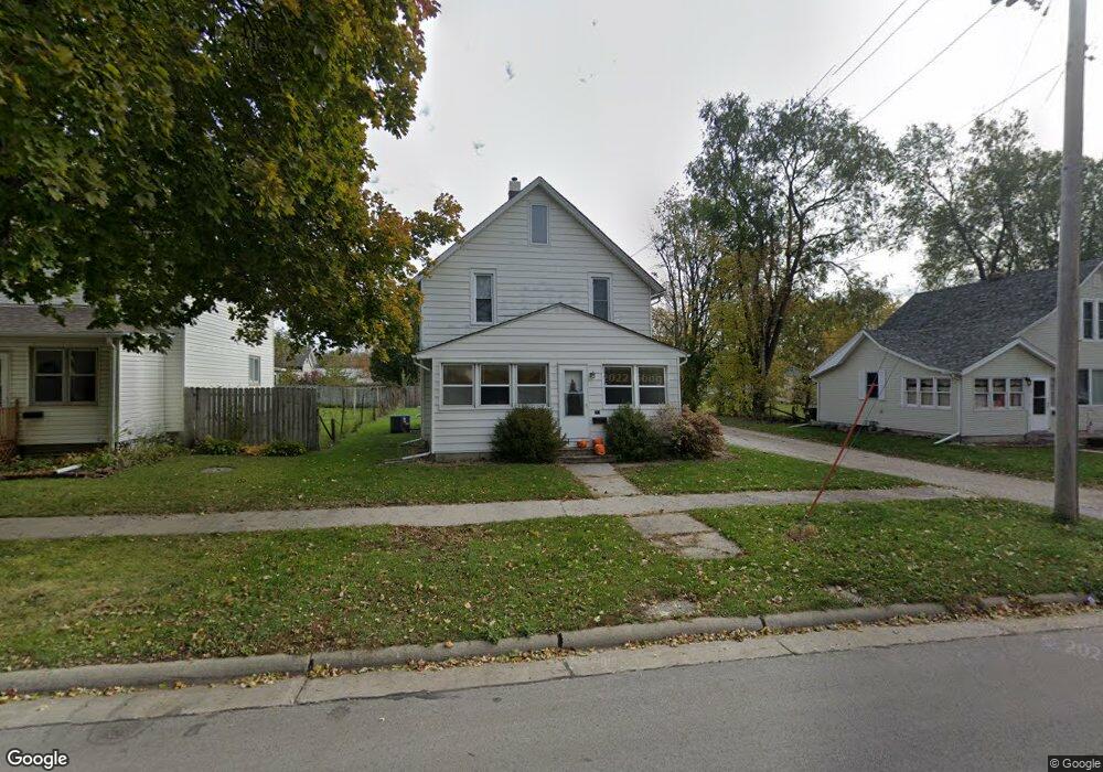
213 S 20th St Fort Dodge, IA 50501
Estimated Value: $67,515 - $76,000
3
Beds
1
Bath
1,248
Sq Ft
$56/Sq Ft
Est. Value
About This Home
This home is located at 213 S 20th St, Fort Dodge, IA 50501 and is currently estimated at $70,379, approximately $56 per square foot. 213 S 20th St is a home located in Webster County with nearby schools including Fort Dodge Middle School, Fort Dodge Senior High School, and St. Edmond Catholic School.
Ownership History
Date
Name
Owned For
Owner Type
Purchase Details
Closed on
Jun 14, 2010
Sold by
Municipal Housing Agency Of The City Of
Bought by
Johnson Tammie S and Johnston Darlene B
Current Estimated Value
Home Financials for this Owner
Home Financials are based on the most recent Mortgage that was taken out on this home.
Original Mortgage
$35,100
Outstanding Balance
$23,616
Interest Rate
5.05%
Mortgage Type
New Conventional
Estimated Equity
$46,763
Create a Home Valuation Report for This Property
The Home Valuation Report is an in-depth analysis detailing your home's value as well as a comparison with similar homes in the area
Home Values in the Area
Average Home Value in this Area
Purchase History
| Date | Buyer | Sale Price | Title Company |
|---|---|---|---|
| Johnson Tammie S | $39,000 | None Available |
Source: Public Records
Mortgage History
| Date | Status | Borrower | Loan Amount |
|---|---|---|---|
| Open | Johnson Tammie S | $35,100 |
Source: Public Records
Tax History Compared to Growth
Tax History
| Year | Tax Paid | Tax Assessment Tax Assessment Total Assessment is a certain percentage of the fair market value that is determined by local assessors to be the total taxable value of land and additions on the property. | Land | Improvement |
|---|---|---|---|---|
| 2025 | $1,148 | $56,720 | $5,410 | $51,310 |
| 2024 | $1,148 | $53,160 | $5,410 | $47,750 |
| 2023 | $988 | $53,160 | $5,410 | $47,750 |
| 2022 | $958 | $40,400 | $5,410 | $34,990 |
| 2021 | $1,140 | $40,450 | $5,410 | $35,040 |
| 2020 | $1,140 | $45,720 | $5,410 | $40,310 |
| 2019 | $966 | $43,640 | $10,460 | $33,180 |
| 2018 | $948 | $46,630 | $9,510 | $37,120 |
| 2017 | $830 | $40,920 | $0 | $0 |
| 2016 | $1,047 | $40,920 | $0 | $0 |
| 2015 | $808 | $40,920 | $0 | $0 |
| 2014 | $792 | $40,920 | $0 | $0 |
Source: Public Records
Map
Nearby Homes
- 1717 2nd Ave S
- 1723 3rd Ave S
- 1902 1st Ave N
- 2021 2nd Ave N
- 617 S 19th St
- 1522 3rd Ave S
- 2102 2nd Ave N
- 1930 2nd Ave N
- 401 S 15th St
- 2003 3rd Ave N
- TBD- Lot 7 1st Ave S
- TBD Lot 10 1st Ave S
- TBD Lot 8 1st Ave S
- TBD- Lot 6 1st Ave S
- TBD Lot 11 1st Ave S
- 1628 2nd Ave N
- Parcel 0727226007
- Parcel 0727226005
- Regency West Ct Place
- Parcel 0727226006
- 207 S 20th St
- 217 S 20th St
- 2015 2nd Ave S
- 205 S 20th St
- 2017 2nd Ave S
- 2010 3rd Ave S
- 2006 3rd Ave S
- 225 S 20th St
- 1929 2nd Ave S
- 210 S 21st St
- 1928 3rd Ave S
- 2016 3rd Ave S
- 1923 2nd Ave S
- 216 S 21st St
- 2022 3rd Ave S
- 2025 2nd Ave S Unit Khaliki equity LLC
- 2025 2nd Ave S
- 2002 2nd Ave S
- 1919 2nd Ave S
- 1922 3rd Ave S