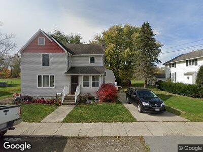
213 S Main St Wayland, NY 14572
Estimated Value: $120,000 - $141,963
3
Beds
2
Baths
1,812
Sq Ft
$73/Sq Ft
Est. Value
About This Home
This home is located at 213 S Main St, Wayland, NY 14572 and is currently estimated at $132,741, approximately $73 per square foot. 213 S Main St is a home located in Steuben County with nearby schools including Wayland Cohocton Middle School and Wayland Cohocton High School.
Ownership History
Date
Name
Owned For
Owner Type
Purchase Details
Closed on
Aug 17, 2022
Sold by
Abbey Jon W
Bought by
Parker Josiah
Current Estimated Value
Home Financials for this Owner
Home Financials are based on the most recent Mortgage that was taken out on this home.
Original Mortgage
$103,790
Outstanding Balance
$99,891
Interest Rate
5.51%
Mortgage Type
Purchase Money Mortgage
Estimated Equity
$34,018
Purchase Details
Closed on
Jul 15, 1996
Create a Home Valuation Report for This Property
The Home Valuation Report is an in-depth analysis detailing your home's value as well as a comparison with similar homes in the area
Home Values in the Area
Average Home Value in this Area
Purchase History
| Date | Buyer | Sale Price | Title Company |
|---|---|---|---|
| Parker Josiah | $107,000 | None Available | |
| -- | -- | -- |
Source: Public Records
Mortgage History
| Date | Status | Borrower | Loan Amount |
|---|---|---|---|
| Open | Parker Josiah | $103,790 | |
| Closed | Parker Josiah | $7,500 | |
| Previous Owner | Abbey Jon W | $10,000 | |
| Previous Owner | Abbey Jon W | $50,000 |
Source: Public Records
Tax History Compared to Growth
Tax History
| Year | Tax Paid | Tax Assessment Tax Assessment Total Assessment is a certain percentage of the fair market value that is determined by local assessors to be the total taxable value of land and additions on the property. | Land | Improvement |
|---|---|---|---|---|
| 2024 | $3,699 | $93,300 | $9,900 | $83,400 |
| 2023 | $3,278 | $93,300 | $9,900 | $83,400 |
| 2022 | $2,752 | $93,300 | $9,900 | $83,400 |
| 2021 | $2,803 | $88,000 | $9,300 | $78,700 |
| 2020 | $2,243 | $88,000 | $9,300 | $78,700 |
| 2019 | $2,254 | $88,000 | $9,300 | $78,700 |
| 2018 | $2,254 | $88,000 | $9,300 | $78,700 |
| 2017 | $2,237 | $88,000 | $9,300 | $78,700 |
| 2016 | $2,211 | $88,000 | $9,300 | $78,700 |
| 2015 | -- | $88,000 | $9,300 | $78,700 |
| 2014 | -- | $88,000 | $9,300 | $78,700 |
Source: Public Records
Map
Nearby Homes
- 209 Lincoln St
- 114 Hamilton St
- 405 2nd Ave
- 415 2nd Ave
- 2681 Ste Rte 21 Lot 13
- 2050 Dieter Rd
- 11021 County Route 92
- 2139 County Route 90
- 11388 Gross Hill Rd
- 11125 Chapel St
- 11797 Reservoir Rd
- 3311 State Route 21
- 6745 Moose Rd
- 63620 State Route 415
- 3530 State Route 21
- 8471 Alpaugh Rd
- 10207 Lackawanna Rd
- 23 Perrys Way
- 8477 Hudson Rd
- 0 Gibson St Unit R1517418