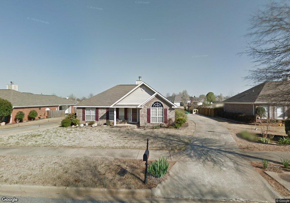
213 Silverstone Ln Alabaster, AL 35007
Estimated Value: $277,383 - $300,000
Studio
1
Bath
1,516
Sq Ft
$192/Sq Ft
Est. Value
About This Home
This home is located at 213 Silverstone Ln, Alabaster, AL 35007 and is currently estimated at $290,846, approximately $191 per square foot. 213 Silverstone Ln is a home located in Shelby County with nearby schools including Thompson Intermediate School, Thompson Middle School, and Thompson High School.
Ownership History
Date
Name
Owned For
Owner Type
Purchase Details
Closed on
Oct 5, 2007
Sold by
Glenn Kim K
Bought by
Allen Sylvia F
Current Estimated Value
Purchase Details
Closed on
Jan 23, 2006
Sold by
Lawton Shawn P and Lawton Marissa B
Bought by
Glenn Kim K
Home Financials for this Owner
Home Financials are based on the most recent Mortgage that was taken out on this home.
Original Mortgage
$104,930
Interest Rate
6.21%
Mortgage Type
Fannie Mae Freddie Mac
Purchase Details
Closed on
Sep 30, 2002
Sold by
Old South Builders
Bought by
Lawton Shawn P and Lawton Marissa B
Home Financials for this Owner
Home Financials are based on the most recent Mortgage that was taken out on this home.
Original Mortgage
$127,257
Interest Rate
6.21%
Mortgage Type
FHA
Create a Home Valuation Report for This Property
The Home Valuation Report is an in-depth analysis detailing your home's value as well as a comparison with similar homes in the area
Home Values in the Area
Average Home Value in this Area
Purchase History
We collect this data history from publicly available records. To have your information removed, we recommend requesting removal directly through your county’s website.
| Date | Buyer | Sale Price | Title Company |
|---|---|---|---|
| Allen Sylvia F | $151,000 | None Available | |
| Glenn Kim K | $149,900 | None Available | |
| Lawton Shawn P | $129,255 | -- |
Source: Public Records
Mortgage History
We collect this data history from publicly available records. To have your information removed, we recommend requesting removal directly through your county’s website.
| Date | Status | Borrower | Loan Amount |
|---|---|---|---|
| Previous Owner | Glenn Kim K | $104,930 | |
| Previous Owner | Lawton Shawn P | $127,257 |
Source: Public Records
Tax History
| Year | Tax Paid | Tax Assessment Tax Assessment Total Assessment is a certain percentage of the fair market value that is determined by local assessors to be the total taxable value of land and additions on the property. | Land | Improvement |
|---|---|---|---|---|
| 2025 | $1,395 | $25,840 | $0 | $0 |
| 2024 | $1,366 | $25,300 | $0 | $0 |
| 2023 | -- | $23,480 | $0 | $0 |
| 2022 | $0 | $20,880 | $0 | $0 |
| 2021 | $848 | $17,840 | $0 | $0 |
| 2020 | $848 | $17,420 | $0 | $0 |
| 2019 | $848 | $16,460 | $0 | $0 |
| 2017 | $756 | $14,760 | $0 | $0 |
| 2015 | $727 | $14,220 | $0 | $0 |
| 2014 | $710 | $13,900 | $0 | $0 |
Source: Public Records
Map
Nearby Homes
- 216 Silverstone Ln
- 134 Horseshoe Cir
- 154 Silverstone Ln
- 204 Sunrise Ct
- 109 Morning Mist Trail
- 136 Morning Mist Trail
- 810 County Road 24
- 636 Jamestown Cir
- 332 Tanglewood Cir
- 409 Yorktown Ct
- 413 Yorktown Ct
- 417 Yorktown Ct
- 313 Tanglewood Cir
- 748 Jamestown Cir
- 704 Jamestown Cir
- 137 Tanglewood Dr
- 728 Jamestown Cir
- 137 Revolutionary Way
- 216 Shelby Farms Bend
- 353 Union Loop
- 209 Silverstone Ln
- 217 Silverstone Ln
- 205 Silverstone Ln
- 221 Silverstone Ln
- 116 Blue Sky Ln
- 110 Blue Sky Ln
- 220 Silverstone Ln
- 212 Silverstone Ln
- 104 Blue Sky Ln
- 225 Silverstone Ln
- 208 Silverstone Ln
- 201 Silverstone Ln
- 202 Silverstone Ln
- 121 Blue Sky Ln
- 226 Silverstone Ln
- 173 Silverstone Ln
- 198 Silverstone Ln
- 229 Silverstone Ln
- 117 Blue Sky Ln
- 113 Blue Sky Ln
Your Personal Tour Guide
Ask me questions while you tour the home.