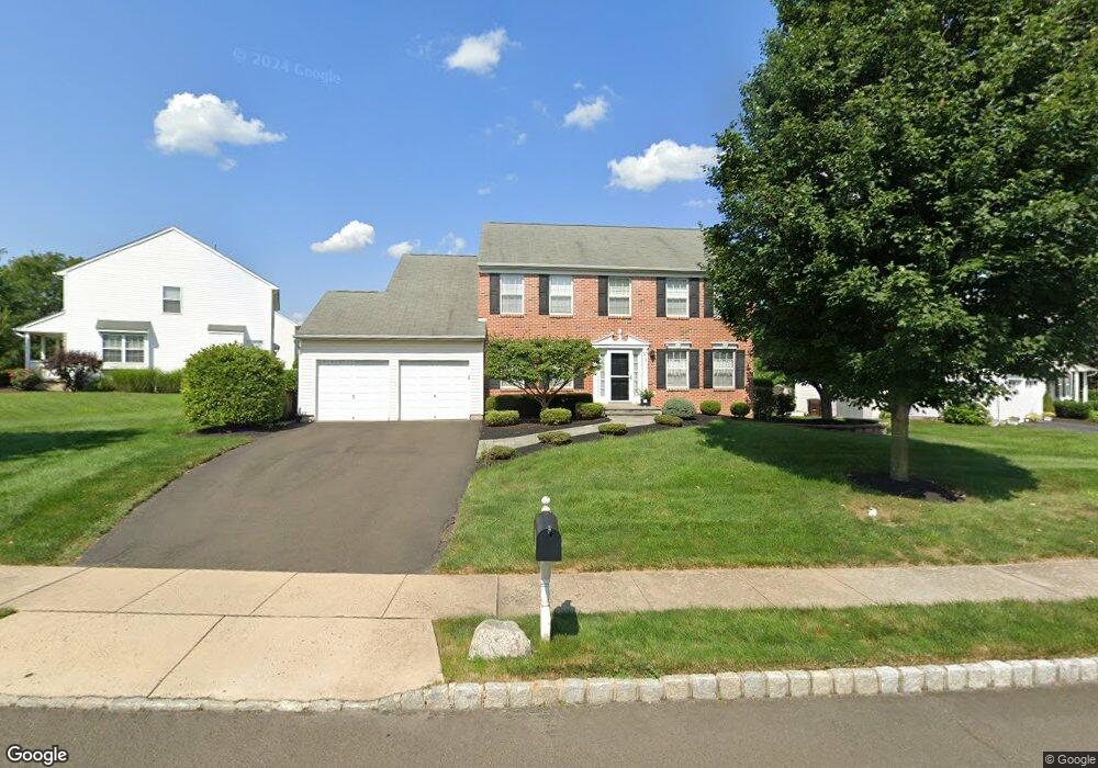
213 Snapdragon St Warrington, PA 18976
Estimated Value: $797,870 - $891,000
4
Beds
3
Baths
2,840
Sq Ft
$300/Sq Ft
Est. Value
About This Home
This home is located at 213 Snapdragon St, Warrington, PA 18976 and is currently estimated at $852,968, approximately $300 per square foot. 213 Snapdragon St is a home located in Bucks County with nearby schools including Mill Creek Elementary School, Unami Middle School, and Central Bucks High School - South.
Ownership History
Date
Name
Owned For
Owner Type
Purchase Details
Closed on
Oct 1, 2010
Sold by
Lin Daniel Y and Lin Christina S
Bought by
Lin Daniel Y and Lin Christina S
Current Estimated Value
Home Financials for this Owner
Home Financials are based on the most recent Mortgage that was taken out on this home.
Original Mortgage
$357,400
Outstanding Balance
$236,326
Interest Rate
4.39%
Mortgage Type
New Conventional
Estimated Equity
$616,642
Purchase Details
Closed on
Jan 15, 2006
Sold by
Panero James G and Royce Rebecca K
Bought by
Lin Daniel Y and Sette Christina J
Home Financials for this Owner
Home Financials are based on the most recent Mortgage that was taken out on this home.
Original Mortgage
$71,535
Interest Rate
6.27%
Mortgage Type
Credit Line Revolving
Purchase Details
Closed on
Jun 29, 2000
Sold by
Lower State Lp
Bought by
French Craig W
Home Financials for this Owner
Home Financials are based on the most recent Mortgage that was taken out on this home.
Original Mortgage
$252,700
Interest Rate
8.5%
Create a Home Valuation Report for This Property
The Home Valuation Report is an in-depth analysis detailing your home's value as well as a comparison with similar homes in the area
Home Values in the Area
Average Home Value in this Area
Purchase History
| Date | Buyer | Sale Price | Title Company |
|---|---|---|---|
| Lin Daniel Y | -- | None Available | |
| Lin Daniel Y | $476,900 | None Available | |
| French Craig W | $274,325 | -- |
Source: Public Records
Mortgage History
| Date | Status | Borrower | Loan Amount |
|---|---|---|---|
| Open | Lin Daniel Y | $357,400 | |
| Closed | Lin Daniel Y | $71,535 | |
| Closed | Lin Daniel Y | $381,520 | |
| Previous Owner | French Craig W | $252,700 |
Source: Public Records
Tax History Compared to Growth
Tax History
| Year | Tax Paid | Tax Assessment Tax Assessment Total Assessment is a certain percentage of the fair market value that is determined by local assessors to be the total taxable value of land and additions on the property. | Land | Improvement |
|---|---|---|---|---|
| 2025 | $8,388 | $45,440 | $8,280 | $37,160 |
| 2024 | $8,388 | $45,440 | $8,280 | $37,160 |
| 2023 | $7,766 | $45,440 | $8,280 | $37,160 |
| 2022 | $7,613 | $45,440 | $8,280 | $37,160 |
| 2021 | $7,528 | $45,440 | $8,280 | $37,160 |
| 2020 | $7,528 | $45,440 | $8,280 | $37,160 |
| 2019 | $7,483 | $45,440 | $8,280 | $37,160 |
| 2018 | $7,399 | $45,440 | $8,280 | $37,160 |
| 2017 | $7,299 | $45,440 | $8,280 | $37,160 |
| 2016 | $7,277 | $45,440 | $8,280 | $37,160 |
| 2015 | -- | $45,440 | $8,280 | $37,160 |
| 2014 | -- | $45,440 | $8,280 | $37,160 |
Source: Public Records
Map
Nearby Homes
- 3237 Pickertown Rd
- 3302 Applewood Ct
- 803 Sweet Cherry St
- 406 Primrose Place
- 3174 Wier Dr E Unit E
- 3146 Wier Dr E Unit E
- 3220 Wier Dr W Unit W
- 418 Homestead Cir
- 430 Homestead Cir
- 719 S Settlers Cir
- 3159 Bristol Rd
- 73 Tradesville Dr Unit 80
- 73 Tradesville Dr
- 1 Mill Creek Dr
- 3 Mill Creek Dr
- 5 Mill Creek Dr
- Redfield Elite Plan at Doylestown Walk
- Vetri Plan at Doylestown Walk
- 15 Mill Creek Dr
- 2 Mill Creek Dr
- 209 Snapdragon St
- 310 Aster Way
- 221 Snapdragon St
- 207 Snapdragon St
- 212 Snapdragon St
- 214 Snapdragon St
- 208 Snapdragon St
- 311 Aster Way
- 218 Snapdragon St
- 216 Snapdragon St
- 308 Aster Way
- 223 Snapdragon St
- 206 Snapdragon St
- 220 Snapdragon St
- 205 Snapdragon St
- 210 Snapdragon St
- 222 Snapdragon St
- 204 Snapdragon St
- 306 Aster Way
- 225 Snapdragon St