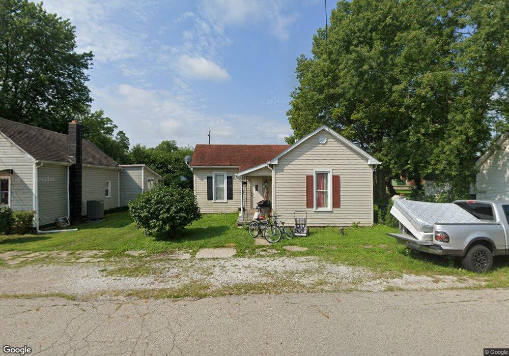
213 W Burnside Ave Fairland, IN 46126
Estimated Value: $148,000 - $231,000
2
Beds
1
Bath
1,230
Sq Ft
$141/Sq Ft
Est. Value
About This Home
This home is located at 213 W Burnside Ave, Fairland, IN 46126 and is currently estimated at $173,351, approximately $140 per square foot. 213 W Burnside Ave is a home located in Shelby County with nearby schools including Triton Central Elementary School, Triton Central Middle School, and Triton Central High School.
Ownership History
Date
Name
Owned For
Owner Type
Purchase Details
Closed on
Dec 14, 2020
Sold by
Gaudio Janet
Bought by
Deo Volente Llc
Current Estimated Value
Purchase Details
Closed on
Jan 10, 2017
Sold by
U S Bank Na
Bought by
Gaudio Janet
Purchase Details
Closed on
Nov 3, 2016
Sold by
Collins Patty L and Harrison Patty Lou
Bought by
U S Bank Na
Create a Home Valuation Report for This Property
The Home Valuation Report is an in-depth analysis detailing your home's value as well as a comparison with similar homes in the area
Home Values in the Area
Average Home Value in this Area
Purchase History
| Date | Buyer | Sale Price | Title Company |
|---|---|---|---|
| Deo Volente Llc | -- | None Available | |
| Gaudio Janet | $20,100 | Meridian Title Corporation | |
| U S Bank Na | $16,800 | None Available |
Source: Public Records
Tax History Compared to Growth
Tax History
| Year | Tax Paid | Tax Assessment Tax Assessment Total Assessment is a certain percentage of the fair market value that is determined by local assessors to be the total taxable value of land and additions on the property. | Land | Improvement |
|---|---|---|---|---|
| 2024 | $1,604 | $80,200 | $6,000 | $74,200 |
| 2023 | $1,467 | $79,200 | $5,900 | $73,300 |
| 2022 | $1,462 | $76,500 | $5,900 | $70,600 |
| 2021 | $1,278 | $65,900 | $5,900 | $60,000 |
| 2020 | $1,362 | $68,100 | $5,900 | $62,200 |
| 2019 | $3,096 | $60,100 | $5,900 | $54,200 |
| 2018 | $1,100 | $55,000 | $5,900 | $49,100 |
| 2017 | $1,052 | $52,600 | $5,900 | $46,700 |
| 2016 | $287 | $55,300 | $5,900 | $49,400 |
Source: Public Records
Map
Nearby Homes
- 212 W Burnside Ave
- 105 W Jackson St
- 303 S Edgerton St
- 5240 W 400 N
- 5081 N 500 W
- 5442 W 400 N
- 3917 N 525 W
- 4450 W 300 N
- 3179 W 400 N
- 5684 N Vinton Hills Dr
- 5682 N Michigan Rd
- 5739 N Clover Maple Dr
- 5134 W 600 N
- 3389 W 300 N
- 7234 N Christopher Ln
- 7326 N 500 W
- 7243 N 600 W
- 3107 N 100 W
- 2900 N Michigan Rd
- 3348 W 800 N
- 211 W Burnside Ave
- 215 W Burnside Ave
- 209 W Burnside Ave
- 207 W Burnside Ave
- 208 W Burnside Ave
- 216 W Burnside Ave
- 218 W Burnside Ave
- 206 W Burnside Ave
- 205 W Burnside Ave
- 221 W Burnside Ave
- 310 W Burnside Ave
- 201 W Clark Ln
- 203 W Burnside Ave
- 302 W Burnside Ave
- 208 N Plum St
- 201 W Burnside Ave
- 305 W Burnside Ave
- 210 N Mulberry St
- 306 W Burnside Ave
- 209 N Plum St