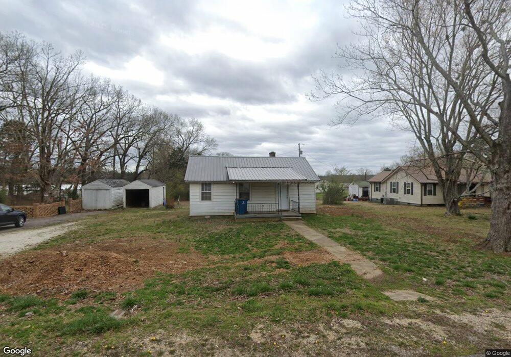
213 Watson St Camden, TN 38320
Estimated Value: $65,876 - $119,000
--
Bed
1
Bath
714
Sq Ft
$127/Sq Ft
Est. Value
About This Home
This home is located at 213 Watson St, Camden, TN 38320 and is currently estimated at $90,719, approximately $127 per square foot. 213 Watson St is a home located in Benton County with nearby schools including Camden Elementary School, Briarwood School, and Camden Junior High School.
Ownership History
Date
Name
Owned For
Owner Type
Purchase Details
Closed on
Jan 22, 2020
Sold by
Ward Billy Rayburn
Bought by
Ward Mark
Current Estimated Value
Purchase Details
Closed on
Jul 25, 2016
Sold by
Ward Billy
Bought by
Ward Billy and Ward Faye
Purchase Details
Closed on
Oct 5, 1993
Bought by
Ward Billy and Ward Faye
Purchase Details
Closed on
Dec 16, 1989
Bought by
Karl Mary and Larry Duncan
Purchase Details
Closed on
Dec 19, 1963
Bought by
Mrs Lettie Duncan
Create a Home Valuation Report for This Property
The Home Valuation Report is an in-depth analysis detailing your home's value as well as a comparison with similar homes in the area
Home Values in the Area
Average Home Value in this Area
Purchase History
| Date | Buyer | Sale Price | Title Company |
|---|---|---|---|
| Ward Mark | -- | -- | |
| Ward Billy | $9,533 | -- | |
| Ward Billy | $16,000 | -- | |
| Karl Mary | -- | -- | |
| Mrs Lettie Duncan | -- | -- |
Source: Public Records
Tax History Compared to Growth
Tax History
| Year | Tax Paid | Tax Assessment Tax Assessment Total Assessment is a certain percentage of the fair market value that is determined by local assessors to be the total taxable value of land and additions on the property. | Land | Improvement |
|---|---|---|---|---|
| 2025 | $266 | $15,825 | $0 | $0 |
| 2024 | $266 | $7,250 | $1,750 | $5,500 |
| 2023 | $266 | $7,250 | $1,750 | $5,500 |
| 2022 | $266 | $7,250 | $1,750 | $5,500 |
| 2021 | $266 | $7,250 | $1,750 | $5,500 |
| 2020 | $266 | $7,250 | $1,750 | $5,500 |
| 2019 | $283 | $7,150 | $1,750 | $5,400 |
| 2018 | $283 | $7,150 | $1,750 | $5,400 |
| 2017 | $283 | $7,150 | $1,750 | $5,400 |
| 2016 | $283 | $7,150 | $1,750 | $5,400 |
| 2015 | $285 | $7,150 | $1,750 | $5,400 |
| 2014 | $245 | $7,150 | $1,750 | $5,400 |
| 2013 | $245 | $6,214 | $0 | $0 |
Source: Public Records
Map
Nearby Homes
- 144 Post Oak Ave
- 166 Westview St
- 180 Post Oak Ave
- 107 Melton Ave
- 172 W Main St
- 156 W Main St
- 103 Highway 641 N
- 121 Washington Ave
- 77 Highway 641 S
- 122 W Lake St
- 1 Maple Ave
- 136 N Forrest Ave
- 116 N Church Ave
- 1762 Washington Ave
- 335 Mount Carmel Rd
- 129 S Forrest Ave
- 186 N Forrest Ave
- 1 Post Oak Rd
- 121 Davidson St
- 162 Factory St