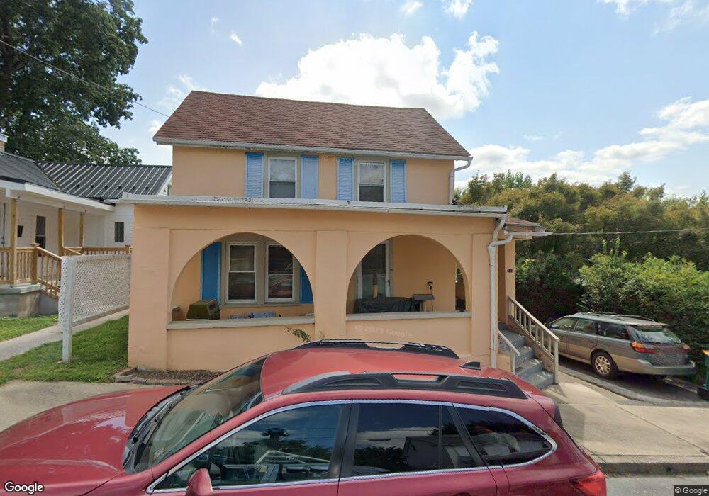
213 Wayne Ave Waynesboro, PA 17268
Estimated Value: $171,000 - $249,000
--
Bed
--
Bath
1,344
Sq Ft
$149/Sq Ft
Est. Value
About This Home
This home is located at 213 Wayne Ave, Waynesboro, PA 17268 and is currently estimated at $199,785, approximately $148 per square foot. 213 Wayne Ave is a home located in Franklin County with nearby schools including Waynesboro Area Senior High School, St. Andrew Catholic School, and Noah's Ark Christian Child Care Center.
Ownership History
Date
Name
Owned For
Owner Type
Purchase Details
Closed on
May 6, 2019
Sold by
Phillipson Sarah E and Phillipson Daniel S
Bought by
Smith Nancy
Current Estimated Value
Home Financials for this Owner
Home Financials are based on the most recent Mortgage that was taken out on this home.
Original Mortgage
$111,550
Outstanding Balance
$97,675
Interest Rate
4%
Mortgage Type
New Conventional
Estimated Equity
$102,110
Purchase Details
Closed on
Feb 13, 2008
Sold by
Phillipson Daniel S and Phillipson Daniel
Bought by
Phillipson Sarah E and Phillipson Daniel S
Create a Home Valuation Report for This Property
The Home Valuation Report is an in-depth analysis detailing your home's value as well as a comparison with similar homes in the area
Home Values in the Area
Average Home Value in this Area
Purchase History
| Date | Buyer | Sale Price | Title Company |
|---|---|---|---|
| Smith Nancy | -- | Amrock | |
| Phillipson Sarah E | -- | None Available |
Source: Public Records
Mortgage History
| Date | Status | Borrower | Loan Amount |
|---|---|---|---|
| Open | Smith Nancy | $111,550 |
Source: Public Records
Tax History Compared to Growth
Tax History
| Year | Tax Paid | Tax Assessment Tax Assessment Total Assessment is a certain percentage of the fair market value that is determined by local assessors to be the total taxable value of land and additions on the property. | Land | Improvement |
|---|---|---|---|---|
| 2025 | $1,238 | $6,830 | $850 | $5,980 |
| 2024 | $1,207 | $6,830 | $850 | $5,980 |
| 2023 | $1,181 | $6,830 | $850 | $5,980 |
| 2022 | $1,143 | $6,830 | $850 | $5,980 |
| 2021 | $1,085 | $6,830 | $850 | $5,980 |
| 2020 | $1,076 | $6,830 | $850 | $5,980 |
| 2019 | $1,056 | $6,830 | $850 | $5,980 |
| 2018 | $996 | $6,830 | $850 | $5,980 |
| 2017 | $977 | $6,830 | $850 | $5,980 |
| 2016 | $196 | $6,830 | $850 | $5,980 |
| 2015 | $182 | $6,830 | $850 | $5,980 |
| 2014 | $182 | $6,830 | $850 | $5,980 |
Source: Public Records
Map
Nearby Homes
- 109 Garfield St
- 112 N Church St
- 107 Garfield St
- 520 N Potomac St
- 403 Sunny Dr
- 231 W North St
- Frankford Plan at Pheasant Run
- Hamilton Plan at Pheasant Run
- Roosevelt Plan at Pheasant Run
- Avondale Plan at Pheasant Run
- Bristol II Plan at Pheasant Run
- Hanover Plan at Pheasant Run
- Sussex Plan at Pheasant Run
- Bradford Plan at Pheasant Run
- Pearl Plan at Pheasant Run
- Opal Plan at Pheasant Run
- Topaz Plan at Pheasant Run
- Emerald Plan at Pheasant Run
- Ruby Plan at Pheasant Run
- 125 N Broad St
- 215 Wayne Ave
- 15 W King St
- 212 Wayne Ave
- 210 Wayne Ave
- 216 Wayne Ave
- 217 Wayne Ave
- 202 Crown Ct
- 223 Wayne Ave
- 208 & 210 Wayne Ave
- 0 Wayne Ave Unit FL6228769
- 204 Crown Ct
- 38 Linden Ave
- 206 Wayne Ave
- 200 Crown Ct
- 218 Wayne Ave
- 220 Wayne Ave
- 27 W King St
- 206 Crown Ct
- 206 Crown Ct Unit 4
- 0 Crown Ct Unit 1004785259