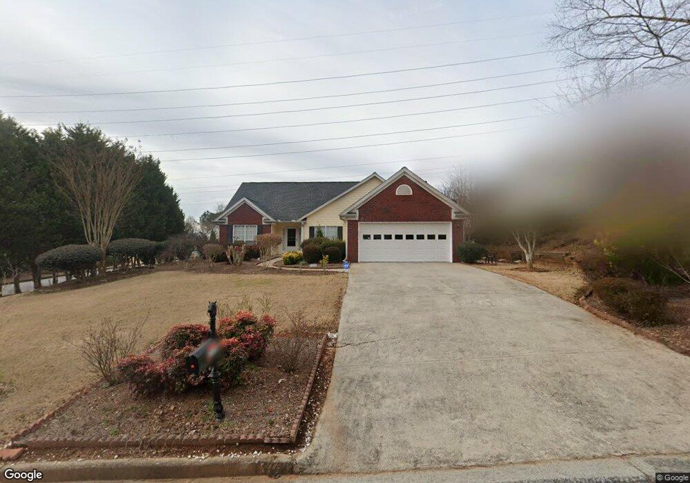
2130 Saint Thomas Way Suwanee, GA 30024
Estimated Value: $381,000 - $417,000
3
Beds
2
Baths
1,689
Sq Ft
$232/Sq Ft
Est. Value
About This Home
This home is located at 2130 Saint Thomas Way, Suwanee, GA 30024 and is currently estimated at $392,374, approximately $232 per square foot. 2130 Saint Thomas Way is a home located in Gwinnett County with nearby schools including Walnut Grove Elementary School, Creekland Middle School, and Collins Hill High School.
Ownership History
Date
Name
Owned For
Owner Type
Purchase Details
Closed on
Feb 14, 2002
Sold by
Ahmadian Shapour
Bought by
Nekouei Parahsima
Current Estimated Value
Purchase Details
Closed on
Nov 27, 2001
Sold by
Lee Donald
Bought by
Ahmadian Shapour
Purchase Details
Closed on
Feb 21, 1997
Sold by
West Palm Assoc Lp
Bought by
Lee Donald and Stout Robyn
Create a Home Valuation Report for This Property
The Home Valuation Report is an in-depth analysis detailing your home's value as well as a comparison with similar homes in the area
Home Values in the Area
Average Home Value in this Area
Purchase History
| Date | Buyer | Sale Price | Title Company |
|---|---|---|---|
| Nekouei Parahsima | -- | -- | |
| Ahmadian Shapour | $138,000 | -- | |
| Lee Donald | $119,000 | -- |
Source: Public Records
Mortgage History
| Date | Status | Borrower | Loan Amount |
|---|---|---|---|
| Closed | Lee Donald | $0 |
Source: Public Records
Tax History Compared to Growth
Tax History
| Year | Tax Paid | Tax Assessment Tax Assessment Total Assessment is a certain percentage of the fair market value that is determined by local assessors to be the total taxable value of land and additions on the property. | Land | Improvement |
|---|---|---|---|---|
| 2025 | $973 | $137,880 | $26,320 | $111,560 |
| 2024 | $3,763 | $139,640 | $33,600 | $106,040 |
| 2023 | $3,763 | $131,440 | $33,600 | $97,840 |
| 2022 | $3,136 | $111,000 | $29,200 | $81,800 |
| 2021 | $2,515 | $79,520 | $20,200 | $59,320 |
| 2020 | $2,532 | $79,520 | $20,200 | $59,320 |
| 2019 | $2,474 | $79,520 | $20,200 | $59,320 |
| 2018 | $2,443 | $78,080 | $17,200 | $60,880 |
| 2016 | $2,158 | $63,880 | $14,440 | $49,440 |
| 2015 | $1,990 | $55,560 | $12,400 | $43,160 |
| 2014 | $1,999 | $55,560 | $12,400 | $43,160 |
Source: Public Records
Map
Nearby Homes
- 2370 Cape Courage Way
- 2167 Merrymount Dr
- 2372 Merrymount Dr Unit 2
- 2140 Wildcat Cliffs Way
- 2265 Wildwood Lake Dr
- 2061 Wildcat Cliffs Ln
- 1924 Sidneys Cove
- 205 Camden Creek Ct
- 1839 Stonebrook Way
- 2205 Parliament Dr
- 1932 Riverton Dr
- 2067 York River Way
- 2155 Parliament Dr
- 2140 Deer Trail
- 525 Provence Gate Ln
- 2050 Fortuna St
- 1838 Prince Dr
- 2315 Prosperity Way Unit 2
- 83 Russell Rd
- 232 Clarion Rd
- 2140 Saint Thomas Way
- 161 Marston Dr
- 2125 Saint Thomas Way
- 2150 Saint Thomas Way Unit 1
- 2110 Saint Thomas Way
- 2145 Saint Thomas Way
- 2160 Saint Thomas Way
- 152 Marston Dr
- 2105 Saint Thomas Way
- 171 Marston Dr
- 144 Saint Georges Ct
- 2142 Little River Dr
- 122 Saint Aurics Dr
- 162 Marston Dr Unit 1
- 2172 Little River Dr
- 0 Saint Georges Ct
- 0 Saint Thomas Way Unit 9057365
- 0 Saint Thomas Way Unit 3289728
- 2175 Saint Thomas Way Unit 1
- 181 Marston Dr Unit 1