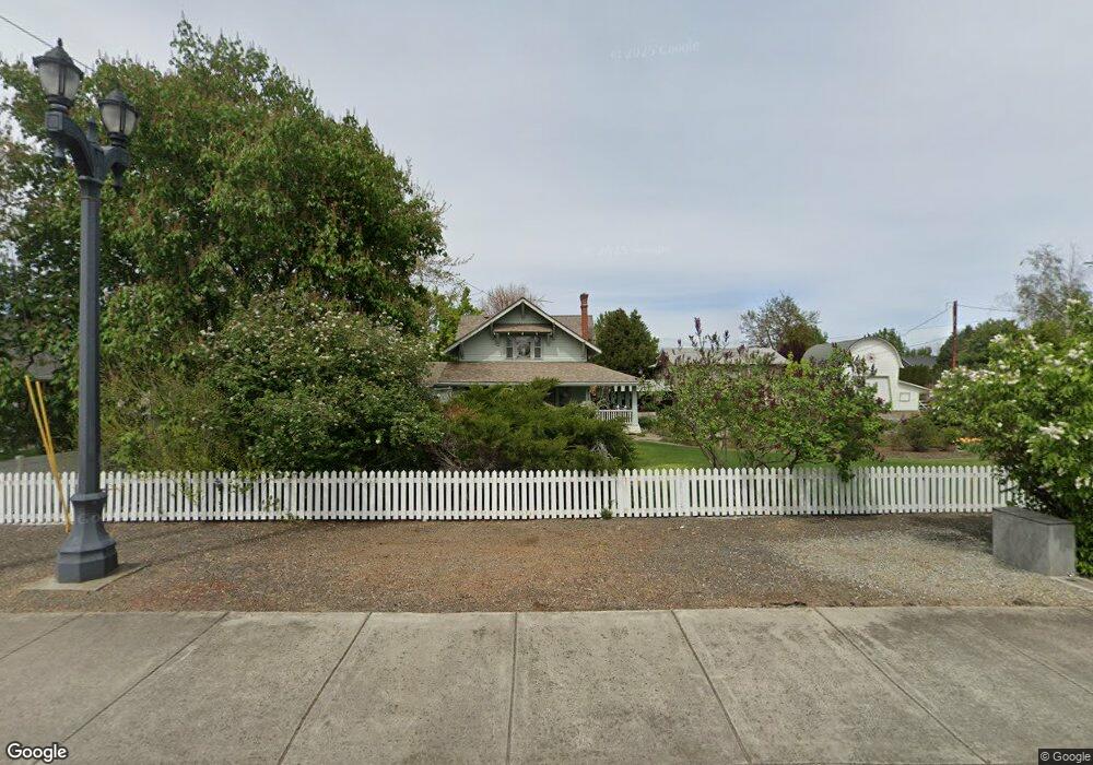
2130 Taylor Rd Central Point, OR 97502
Estimated Value: $520,000 - $620,000
5
Beds
3
Baths
2,020
Sq Ft
$282/Sq Ft
Est. Value
About This Home
This home is located at 2130 Taylor Rd, Central Point, OR 97502 and is currently estimated at $570,375, approximately $282 per square foot. 2130 Taylor Rd is a home located in Jackson County with nearby schools including Richardson Elementary School, Scenic Middle School, and Crater High School.
Ownership History
Date
Name
Owned For
Owner Type
Purchase Details
Closed on
Nov 21, 2023
Sold by
Brown Clayton and Brown Jessie
Bought by
Clayton Randolph Brown And Jessie Lee Brown R and Brown
Current Estimated Value
Purchase Details
Closed on
Mar 23, 2001
Sold by
Otto Bohnert Farms Llc
Bought by
Otto Bohnert Farms Llc
Create a Home Valuation Report for This Property
The Home Valuation Report is an in-depth analysis detailing your home's value as well as a comparison with similar homes in the area
Home Values in the Area
Average Home Value in this Area
Purchase History
| Date | Buyer | Sale Price | Title Company |
|---|---|---|---|
| Clayton Randolph Brown And Jessie Lee Brown R | -- | None Listed On Document | |
| Otto Bohnert Farms Llc | -- | Crater Title Insurance | |
| Brown Clayton | -- | Crater Title Insurance |
Source: Public Records
Tax History Compared to Growth
Tax History
| Year | Tax Paid | Tax Assessment Tax Assessment Total Assessment is a certain percentage of the fair market value that is determined by local assessors to be the total taxable value of land and additions on the property. | Land | Improvement |
|---|---|---|---|---|
| 2025 | $5,229 | $314,500 | $135,420 | $179,080 |
| 2024 | $5,229 | $305,340 | $131,470 | $173,870 |
| 2023 | $5,060 | $296,450 | $127,650 | $168,800 |
| 2022 | $4,942 | $296,450 | $127,650 | $168,800 |
| 2021 | $4,801 | $287,820 | $123,930 | $163,890 |
| 2020 | $4,661 | $279,440 | $120,320 | $159,120 |
| 2019 | $4,546 | $263,410 | $113,410 | $150,000 |
| 2018 | $4,408 | $255,740 | $110,100 | $145,640 |
| 2017 | $4,297 | $255,740 | $110,100 | $145,640 |
| 2016 | $4,172 | $241,070 | $103,780 | $137,290 |
| 2015 | $3,997 | $241,070 | $103,780 | $137,290 |
| 2014 | $3,895 | $227,240 | $97,810 | $129,430 |
Source: Public Records
Map
Nearby Homes
- 407 Silver Creek Dr
- 619 Palo Verde Way
- 626 Griffin Oaks Dr
- 1134 Steamboat Dr
- 349 W Pine St
- 1135 Shake Dr
- 420 Mayberry Ln
- 25 Donna Way
- 429 Mayberry Ln
- 21 Hickory Ln
- 342 Hazel St
- 1159 Rustler Peak St
- 570 Bachand Cir
- 1167 Boulder Ridge St
- 905 Comet Ave
- 55 Crater Ln
- 3642 Oak Pine Way
- 431 N 5th St
- 487 Creekside Cir
- 526 Stone Pointe Dr
- 410 Oakley St
- 402 Oakley St
- 418 Oakley St
- 631 Black Oak Dr
- 0 Taylor Rd Unit 15294733
- 0 Taylor Rd Unit 1802 16654553
- 0 Taylor Rd Unit 1801
- 399 Brad Way
- 525 Black Oak Dr
- 637 Black Oak Dr
- 2165 Taylor Rd
- 411 Oakley St
- 475 Valley Oak Blvd
- 519 Black Oak Dr
- 419 Oakley St
- 2167 Taylor Rd
- 391 Brad Way
- 427 Oakley St
- 410 Brad Way