Estimated Value: $149,000 - $169,000
3
Beds
3
Baths
1,144
Sq Ft
$137/Sq Ft
Est. Value
About This Home
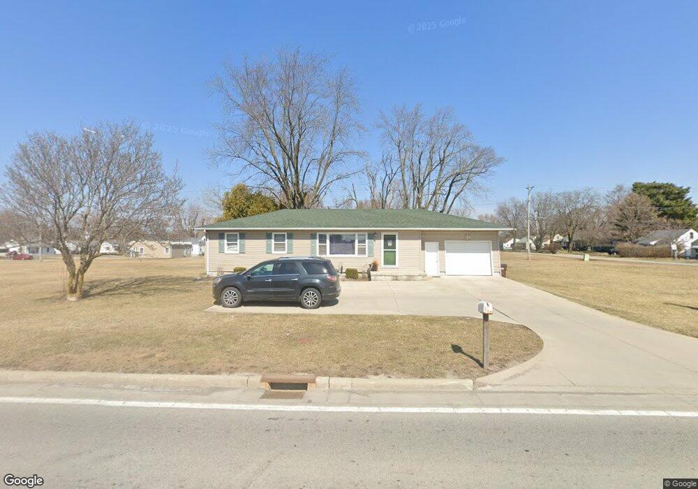
This home is located at 2131 Harding Hwy, Lima, OH 45804 and is currently estimated at $156,667, approximately $136 per square foot. 2131 Harding Hwy is a home located in Allen County with nearby schools including Bath Elementary School, Bath Middle School, and Bath High School.
Ownership History
Date
Name
Owned For
Owner Type
Purchase Details
Closed on
Mar 6, 2012
Sold by
Optimal Investments Llc
Bought by
State Of Ohio
Current Estimated Value
Purchase Details
Closed on
Jul 21, 2009
Sold by
Household Realty Corporation
Bought by
Optimal Investments Llc
Purchase Details
Closed on
Jun 29, 2009
Sold by
Fisher Thomas J
Bought by
Household Realty Corporation
Purchase Details
Closed on
Jan 9, 1998
Sold by
Downhower Samuel
Bought by
Leonard Ovid and Leonard Jetta
Home Financials for this Owner
Home Financials are based on the most recent Mortgage that was taken out on this home.
Original Mortgage
$37,000
Interest Rate
7.26%
Mortgage Type
New Conventional
Purchase Details
Closed on
Sep 1, 1978
Bought by
Downhower Samuel L
Create a Home Valuation Report for This Property
The Home Valuation Report is an in-depth analysis detailing your home's value as well as a comparison with similar homes in the area
Home Values in the Area
Average Home Value in this Area
Purchase History
| Date | Buyer | Sale Price | Title Company |
|---|---|---|---|
| State Of Ohio | $9,670 | None Available | |
| Optimal Investments Llc | $41,000 | Attorney | |
| Household Realty Corporation | $40,000 | None Available | |
| Leonard Ovid | $62,000 | -- | |
| Downhower Samuel L | $40,000 | -- |
Source: Public Records
Mortgage History
| Date | Status | Borrower | Loan Amount |
|---|---|---|---|
| Previous Owner | Leonard Ovid | $37,000 |
Source: Public Records
Tax History Compared to Growth
Tax History
| Year | Tax Paid | Tax Assessment Tax Assessment Total Assessment is a certain percentage of the fair market value that is determined by local assessors to be the total taxable value of land and additions on the property. | Land | Improvement |
|---|---|---|---|---|
| 2024 | $1,776 | $39,340 | $8,680 | $30,660 |
| 2023 | $1,451 | $30,980 | $6,830 | $24,150 |
| 2022 | $1,469 | $30,980 | $6,830 | $24,150 |
| 2021 | $1,469 | $30,980 | $6,830 | $24,150 |
| 2020 | $1,320 | $25,490 | $6,550 | $18,940 |
| 2019 | $1,320 | $25,490 | $6,550 | $18,940 |
| 2018 | $1,292 | $25,490 | $6,550 | $18,940 |
| 2017 | $1,158 | $23,000 | $6,550 | $16,450 |
| 2016 | $1,159 | $23,000 | $6,550 | $16,450 |
| 2015 | $1,235 | $23,000 | $6,550 | $16,450 |
| 2014 | $1,235 | $23,950 | $6,550 | $17,400 |
| 2013 | $1,245 | $23,950 | $6,550 | $17,400 |
Source: Public Records
Map
Nearby Homes
- 696 Mount Holyoke Ave
- 2223 Makin Dr
- 620 Willard Ave
- 120 Barnsbury Dr
- 800 Heritage Dr
- 710 Kingswood Dr
- 263 Barnsbury Dr
- 287 Barnsbury Dr
- 524 S Collins Ave
- 00 Bellefontaine Ave
- 1093 S Sugar St
- 1820 Bowman Rd
- 573 Waterview Cir
- 1008 Fairview Ave
- 520 Orena Ave
- 706 E Kibby St
- 806 Bellefontaine Ave
- 3 House Package
- 304 Pinewood Cir
- 861 E 4th St