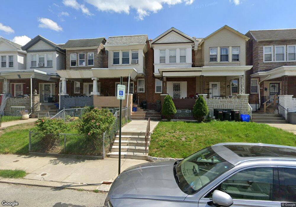
2132 Eastburn Ave Philadelphia, PA 19138
West Oak Lane NeighborhoodEstimated Value: $163,000 - $186,000
3
Beds
1
Bath
972
Sq Ft
$180/Sq Ft
Est. Value
About This Home
This home is located at 2132 Eastburn Ave, Philadelphia, PA 19138 and is currently estimated at $174,580, approximately $179 per square foot. 2132 Eastburn Ave is a home located in Philadelphia County with nearby schools including William Rowen School, Gen. Louis Wagner Middle School, and Martin Luther King High School.
Ownership History
Date
Name
Owned For
Owner Type
Purchase Details
Closed on
May 9, 2005
Sold by
Vorn Sharen and Lloyd Sharen
Bought by
Vorn Sharen
Current Estimated Value
Home Financials for this Owner
Home Financials are based on the most recent Mortgage that was taken out on this home.
Original Mortgage
$68,800
Interest Rate
10.5%
Mortgage Type
New Conventional
Create a Home Valuation Report for This Property
The Home Valuation Report is an in-depth analysis detailing your home's value as well as a comparison with similar homes in the area
Home Values in the Area
Average Home Value in this Area
Purchase History
| Date | Buyer | Sale Price | Title Company |
|---|---|---|---|
| Vorn Sharen | -- | Security Search & Abstract C |
Source: Public Records
Mortgage History
| Date | Status | Borrower | Loan Amount |
|---|---|---|---|
| Closed | Vorn Sharen | $68,800 |
Source: Public Records
Tax History Compared to Growth
Tax History
| Year | Tax Paid | Tax Assessment Tax Assessment Total Assessment is a certain percentage of the fair market value that is determined by local assessors to be the total taxable value of land and additions on the property. | Land | Improvement |
|---|---|---|---|---|
| 2025 | $1,862 | $159,100 | $31,820 | $127,280 |
| 2024 | $1,862 | $159,100 | $31,820 | $127,280 |
| 2023 | $1,862 | $133,000 | $26,600 | $106,400 |
| 2022 | $781 | $88,000 | $26,600 | $61,400 |
| 2021 | $1,411 | $0 | $0 | $0 |
| 2020 | $1,411 | $0 | $0 | $0 |
| 2019 | $1,474 | $0 | $0 | $0 |
| 2018 | $1,307 | $0 | $0 | $0 |
| 2017 | $1,307 | $0 | $0 | $0 |
| 2016 | $887 | $0 | $0 | $0 |
| 2015 | $753 | $0 | $0 | $0 |
| 2014 | -- | $90,400 | $8,775 | $81,625 |
| 2012 | -- | $13,632 | $3,018 | $10,614 |
Source: Public Records
Map
Nearby Homes
- 6824 Rodney St
- 2061 Independence St
- 6603 N 21st St
- 2120 66th Ave
- 2125 Stenton Ave
- 6332 E Wister St
- 2115 Stenton Ave
- 2105 Stenton Ave
- 2070 E Haines St
- 2152 Stenton Ave
- 6733 N Woodstock St
- 6731 N Woodstock St
- 6534 N Lambert St
- 6531 N Beechwood St
- 2056 Eastburn Ave
- 6558 Limekiln Pike
- 6620 Cornelius St
- 6600 N Opal St
- 1344 Narragansett St
- 2022 66th Ave
- 2134 Eastburn Ave
- 2130 Eastburn Ave
- 2136 Eastburn Ave
- 2128 Eastburn Ave
- 2126 Eastburn Ave
- 2138 Eastburn Ave
- 2140 Eastburn Ave
- 6616 Gerry St
- 6614 Gerry St
- 2142 Eastburn Ave
- 6612 Gerry St
- 2144 Eastburn Ave
- 2146 Eastburn Ave
- 2148 Eastburn Ave
- 6637 Gerry St
- 2139 66th Ave
- 6633 Gerry St
- 2141 66th Ave
- 2137 66th Ave
- 2135 66th Ave