Estimated Value: $911,437 - $1,366,000
4
Beds
5
Baths
3,774
Sq Ft
$307/Sq Ft
Est. Value
About This Home
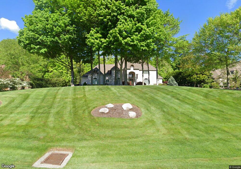
This home is located at 2132 Firestone Trace, Akron, OH 44333 and is currently estimated at $1,158,109, approximately $306 per square foot. 2132 Firestone Trace is a home located in Summit County with nearby schools including Richfield Elementary School, Bath Elementary School, and Revere Middle School.
Ownership History
Date
Name
Owned For
Owner Type
Purchase Details
Closed on
Nov 23, 2004
Sold by
Baun Douglas B and Baun Susan L
Bought by
Welsh Thomas Michael and Welsh Kathleen
Current Estimated Value
Home Financials for this Owner
Home Financials are based on the most recent Mortgage that was taken out on this home.
Original Mortgage
$552,000
Outstanding Balance
$256,389
Interest Rate
4.75%
Mortgage Type
Purchase Money Mortgage
Estimated Equity
$901,720
Purchase Details
Closed on
Apr 23, 2001
Sold by
North Fork Development Company Ltd
Bought by
Baun Douglas B and Baun Susan L
Create a Home Valuation Report for This Property
The Home Valuation Report is an in-depth analysis detailing your home's value as well as a comparison with similar homes in the area
Home Values in the Area
Average Home Value in this Area
Purchase History
| Date | Buyer | Sale Price | Title Company |
|---|---|---|---|
| Welsh Thomas Michael | $767,500 | Approved Statewide Title Age | |
| Baun Douglas B | $160,000 | Chicago Title Insurance Comp |
Source: Public Records
Mortgage History
| Date | Status | Borrower | Loan Amount |
|---|---|---|---|
| Open | Welsh Thomas Michael | $552,000 |
Source: Public Records
Tax History
| Year | Tax Paid | Tax Assessment Tax Assessment Total Assessment is a certain percentage of the fair market value that is determined by local assessors to be the total taxable value of land and additions on the property. | Land | Improvement |
|---|---|---|---|---|
| 2025 | $15,838 | $293,924 | $63,571 | $230,353 |
| 2024 | $15,838 | $293,924 | $63,571 | $230,353 |
| 2023 | $15,838 | $293,924 | $63,571 | $230,353 |
| 2022 | $15,239 | $243,044 | $52,539 | $190,505 |
| 2021 | $14,958 | $243,044 | $52,539 | $190,505 |
| 2020 | $14,768 | $243,050 | $52,540 | $190,510 |
| 2019 | $14,576 | $224,960 | $51,020 | $173,940 |
| 2018 | $14,415 | $224,960 | $51,020 | $173,940 |
| 2017 | $12,771 | $224,960 | $51,020 | $173,940 |
| 2016 | $13,139 | $198,400 | $51,020 | $147,380 |
| 2015 | $12,771 | $198,400 | $51,020 | $147,380 |
| 2014 | $12,439 | $198,400 | $51,020 | $147,380 |
| 2013 | $13,383 | $216,360 | $51,020 | $165,340 |
Source: Public Records
Map
Nearby Homes
- 2370 N Cleveland Massillon Rd
- 3906 Everett Rd
- 2941 Southern Rd
- 1282 Ledgewood Dr
- 4699 W Bath Rd
- 2250 Candlewood Ln
- 967 Robinwood Hills Dr
- 3863 Granger Rd
- 3582 W Glencoe Rd
- 1000 Woodhaven Blvd
- 3454 Skye Ridge Dr
- 3521 Hamilton Dr
- 3339 Yellow Creek Rd
- 3526 Crawford Dr
- 534 Ghentwood Dr
- 3166 Yellow Creek Rd
- 3797 Stewart Ct
- 3814 Faith Ln Unit 1
- 1500 N Revere Rd
- 3949 N Shore Dr
- 2150 Firestone Trace
- 2114 Firestone Trace
- 2141 Firestone Trace
- 2164 V/L Firestone Trace Blvd
- 2100 Firestone Trace
- 2164 Firestone Trace
- 3940 Meadowvale Dr
- 2161 Firestone Trace
- 2178 Firestone Trace
- 2084 Firestone Trace
- 2087 Firestone Trace
- 2069 Firestone Trace
- 0 Firestone
- 0 Firestone Trace Lot #22 Blvd
- 2068 Firestone Trace
- 2196 Firestone Trace
- 3908 Meadowvale Dr
- 3969 Meadowvale Dr
- 2189 Firestone Trace
- 3991 Meadowvale Dr
Your Personal Tour Guide
Ask me questions while you tour the home.