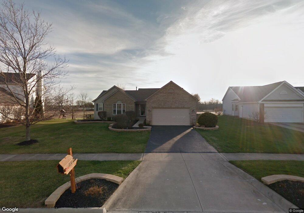
2132 Maxwell Ave Lewis Center, OH 43035
Orange NeighborhoodEstimated Value: $469,682 - $517,000
3
Beds
2
Baths
1,868
Sq Ft
$259/Sq Ft
Est. Value
About This Home
This home is located at 2132 Maxwell Ave, Lewis Center, OH 43035 and is currently estimated at $484,671, approximately $259 per square foot. 2132 Maxwell Ave is a home located in Delaware County with nearby schools including Freedom Trail Elementary School, Olentangy Orange Middle School, and Orange High School.
Ownership History
Date
Name
Owned For
Owner Type
Purchase Details
Closed on
Aug 9, 2020
Sold by
Fackler Henry and Fackler Cynthia
Bought by
Collins Brian G
Current Estimated Value
Purchase Details
Closed on
Aug 16, 2010
Sold by
Mccoy Martin R and Mccoy Denise
Bought by
Fackler Henry and Fackler Cynthia
Home Financials for this Owner
Home Financials are based on the most recent Mortgage that was taken out on this home.
Original Mortgage
$188,000
Interest Rate
4.58%
Mortgage Type
New Conventional
Purchase Details
Closed on
Nov 20, 2001
Sold by
Rockford Homes Inc
Bought by
Mccoy Martin R and Mccoy Denise E
Home Financials for this Owner
Home Financials are based on the most recent Mortgage that was taken out on this home.
Original Mortgage
$197,068
Interest Rate
5.37%
Mortgage Type
New Conventional
Create a Home Valuation Report for This Property
The Home Valuation Report is an in-depth analysis detailing your home's value as well as a comparison with similar homes in the area
Home Values in the Area
Average Home Value in this Area
Purchase History
| Date | Buyer | Sale Price | Title Company |
|---|---|---|---|
| Collins Brian G | $81,333 | None Available | |
| Fackler Henry | $235,000 | Title First | |
| Mccoy Martin R | $207,440 | -- |
Source: Public Records
Mortgage History
| Date | Status | Borrower | Loan Amount |
|---|---|---|---|
| Previous Owner | Fackler Henry | $188,000 | |
| Previous Owner | Mccoy Martin R | $197,068 |
Source: Public Records
Tax History Compared to Growth
Tax History
| Year | Tax Paid | Tax Assessment Tax Assessment Total Assessment is a certain percentage of the fair market value that is determined by local assessors to be the total taxable value of land and additions on the property. | Land | Improvement |
|---|---|---|---|---|
| 2024 | $7,591 | $134,230 | $36,020 | $98,210 |
| 2023 | $7,619 | $134,230 | $36,020 | $98,210 |
| 2022 | $6,725 | $96,290 | $25,380 | $70,910 |
| 2021 | $6,764 | $96,290 | $25,380 | $70,910 |
| 2020 | $6,045 | $96,290 | $25,380 | $70,910 |
| 2019 | $5,101 | $85,370 | $22,050 | $63,320 |
| 2018 | $5,120 | $85,370 | $22,050 | $63,320 |
| 2017 | $4,788 | $78,230 | $16,940 | $61,290 |
| 2016 | $4,943 | $78,230 | $16,940 | $61,290 |
| 2015 | $4,511 | $78,230 | $16,940 | $61,290 |
| 2014 | $4,690 | $78,230 | $16,940 | $61,290 |
| 2013 | $4,523 | $75,880 | $16,940 | $58,940 |
Source: Public Records
Map
Nearby Homes
- 2216 Reeves Ave
- 1923 Myrtle St
- 2165 Ben Brush Place
- 8322 Aurora Ct
- 1955 Royal Oak Dr
- 1746 E Powell Rd
- 7631 Pleasant Colony Ct
- 975 Adara Dr Unit 6975
- 2383 Bold Venture Dr
- 1520 Aniko Ave
- 1143 Little Bear Place
- 2715 Tucker Trail
- 1245 Little Bear Loop
- 7633 Storrington Place
- 8749 Paulden Ct
- 8910 Sedona Ct
- 0 E Orange Rd Unit lot 1
- 0 E Orange Rd
- 1326 Westwood Dr
- 1627 Bristol Commons Place
- 2148 Maxwell Ave
- 2122 Maxwell Ave
- 2110 Maxwell Ave
- 2166 Maxwell Ave
- 2121 Maxwell Ave
- 2145 Maxwell Ave
- 2100 Maxwell Ave
- 2163 Maxwell Ave
- 2182 Maxwell Ave
- 2101 Maxwell Ave
- 2181 Maxwell Ave
- 2166 Barnet Ct
- 2094 Maxwell Ave
- 2198 Maxwell Ave
- 2093 Maxwell Ave
- 2182 Barnet Ct
- 2199 Maxwell Ave
- 2200 Barnet Ct
- 2161 Barnet Ct
- 2088 Maxwell Ave