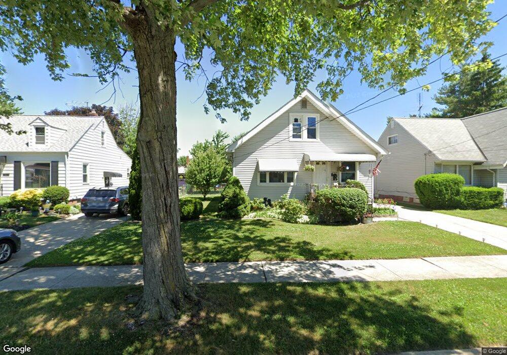
21327 Westport Ave Euclid, OH 44123
Estimated Value: $113,431 - $153,000
3
Beds
1
Bath
1,278
Sq Ft
$108/Sq Ft
Est. Value
About This Home
This home is located at 21327 Westport Ave, Euclid, OH 44123 and is currently estimated at $138,358, approximately $108 per square foot. 21327 Westport Ave is a home located in Cuyahoga County with nearby schools including Arbor Elementary School, Euclid Middle School, and Euclid High School.
Ownership History
Date
Name
Owned For
Owner Type
Purchase Details
Closed on
Jan 1, 1975
Bought by
Mikolic Linda
Current Estimated Value
Create a Home Valuation Report for This Property
The Home Valuation Report is an in-depth analysis detailing your home's value as well as a comparison with similar homes in the area
Home Values in the Area
Average Home Value in this Area
Purchase History
| Date | Buyer | Sale Price | Title Company |
|---|---|---|---|
| Mikolic Linda | -- | -- |
Source: Public Records
Tax History Compared to Growth
Tax History
| Year | Tax Paid | Tax Assessment Tax Assessment Total Assessment is a certain percentage of the fair market value that is determined by local assessors to be the total taxable value of land and additions on the property. | Land | Improvement |
|---|---|---|---|---|
| 2024 | $2,411 | $33,845 | $9,380 | $24,465 |
| 2023 | $2,356 | $26,430 | $7,390 | $19,040 |
| 2022 | $2,262 | $26,430 | $7,390 | $19,040 |
| 2021 | $2,513 | $26,430 | $7,390 | $19,040 |
| 2020 | $2,114 | $20,020 | $5,600 | $14,420 |
| 2019 | $1,898 | $57,200 | $16,000 | $41,200 |
| 2018 | $1,248 | $20,020 | $5,600 | $14,420 |
| 2017 | $1,886 | $16,420 | $3,710 | $12,710 |
| 2016 | $1,891 | $16,420 | $3,710 | $12,710 |
| 2015 | $1,724 | $16,420 | $3,710 | $12,710 |
| 2014 | $1,724 | $16,420 | $3,710 | $12,710 |
Source: Public Records
Map
Nearby Homes
- 21481 Ball Ave
- 21440 Fuller Ave
- 21181 Ball Ave
- 21170 Wilmore Ave
- 21051 Westport Ave
- 21030 Priday Ave
- 20760 Westport Ave
- 20801 Morris Ave
- 20671 Wilmore Ave
- 20830 Tracy Ave
- 21251 S Lake Shore Blvd
- 21051 S Lake Shore Blvd
- 20450 Wilmore Ave
- 21130 Arbor Ave
- 362 E 214th St
- 20400 Tracy Ave
- 20330 S Lake Shore Blvd
- 273 E 208th St
- 21561 Maydale Ave
- 20231 Nicholas Ave
- 21361 Westport Ave
- 21321 Westport Ave
- 21391 Westport Ave
- 21271 Westport Ave
- 21340 Ball Ave
- 21300 Ball Ave
- 21421 Westport Ave
- 21260 Ball Ave
- 21251 Westport Ave
- 21390 Ball Ave
- 21390 Ball Ave Unit 2/UP
- 21390 Ball Ave Unit 1/DN
- 21340 Westport Ave
- 21320 Westport Ave
- 21290 Westport Ave
- 21370 Westport Ave
- 21420 Ball Ave
- 21270 Westport Ave
- 21250 Ball Ave
- 21390 Westport Ave