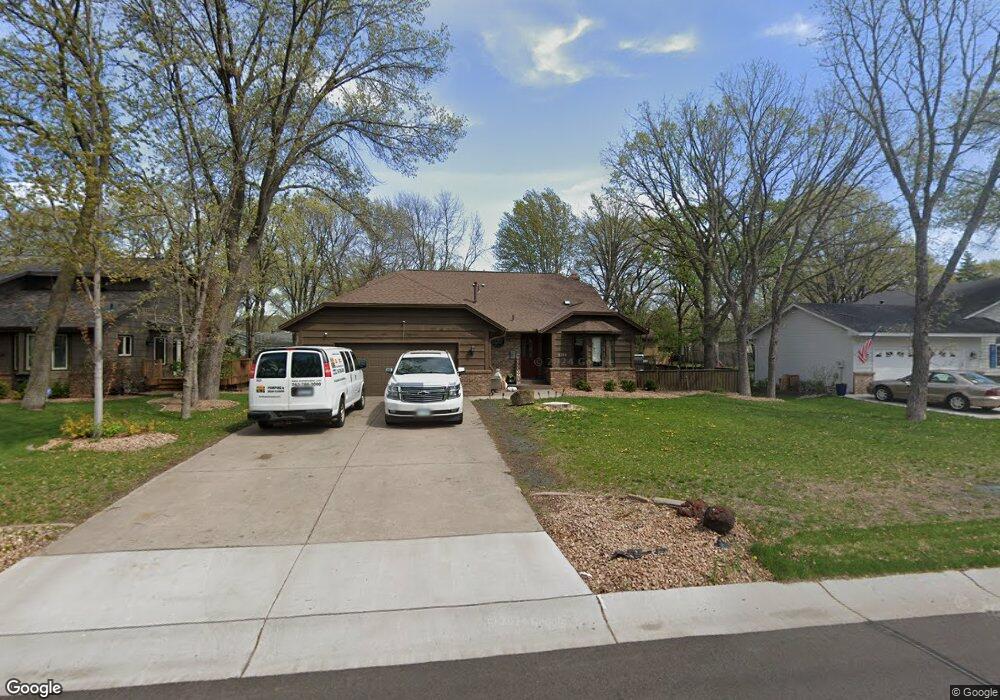
2133 129th Ave NW Coon Rapids, MN 55448
Estimated Value: $396,000 - $444,000
4
Beds
3
Baths
1,478
Sq Ft
$283/Sq Ft
Est. Value
About This Home
This home is located at 2133 129th Ave NW, Coon Rapids, MN 55448 and is currently estimated at $418,164, approximately $282 per square foot. 2133 129th Ave NW is a home located in Anoka County with nearby schools including Morris Bye Elementary School, Coon Rapids Middle School, and Coon Rapids Senior High School.
Ownership History
Date
Name
Owned For
Owner Type
Purchase Details
Closed on
Oct 27, 2020
Sold by
Commaford Stephen N and Commaford Marilyn F
Bought by
Vue Mao
Current Estimated Value
Home Financials for this Owner
Home Financials are based on the most recent Mortgage that was taken out on this home.
Original Mortgage
$325,375
Outstanding Balance
$289,538
Interest Rate
2.8%
Mortgage Type
New Conventional
Estimated Equity
$128,626
Create a Home Valuation Report for This Property
The Home Valuation Report is an in-depth analysis detailing your home's value as well as a comparison with similar homes in the area
Home Values in the Area
Average Home Value in this Area
Purchase History
| Date | Buyer | Sale Price | Title Company |
|---|---|---|---|
| Vue Mao | $342,500 | Legacy Title | |
| Vue Mao Mao | $342,500 | -- |
Source: Public Records
Mortgage History
| Date | Status | Borrower | Loan Amount |
|---|---|---|---|
| Open | Vue Mao | $325,375 | |
| Closed | Vue Mao Mao | $342,500 |
Source: Public Records
Tax History
| Year | Tax Paid | Tax Assessment Tax Assessment Total Assessment is a certain percentage of the fair market value that is determined by local assessors to be the total taxable value of land and additions on the property. | Land | Improvement |
|---|---|---|---|---|
| 2025 | $4,358 | $386,200 | $90,000 | $296,200 |
| 2024 | $4,358 | $382,100 | $87,000 | $295,100 |
| 2023 | $3,757 | $380,300 | $72,000 | $308,300 |
| 2022 | $3,484 | $380,800 | $72,000 | $308,800 |
| 2021 | $3,422 | $316,000 | $56,000 | $260,000 |
| 2020 | $3,482 | $303,800 | $56,000 | $247,800 |
| 2019 | $3,299 | $296,400 | $56,000 | $240,400 |
| 2018 | $3,138 | $274,100 | $0 | $0 |
| 2017 | $2,823 | $254,100 | $0 | $0 |
| 2016 | $2,891 | $227,200 | $0 | $0 |
| 2015 | $2,809 | $227,200 | $50,000 | $177,200 |
| 2014 | -- | $190,300 | $35,400 | $154,900 |
Source: Public Records
Map
Nearby Homes
- 1914 128th Ave NW
- 13034 Verdin St NW
- 2060 125th Ln NW
- 2246 125th Ln NW
- 1681 128th Ave NW
- 1680 129th Cir NW
- 13207 Yukon St NW
- 2536 131st Ave NW
- 13416 Swallow St NW
- 13208 Zion St NW
- 13232 Grouse St NW
- 2699 128th Ave NW
- 13518 Thrush St NW
- 12739 Drake Cir NW
- 12219 Quinn St NW
- 13519 Partridge Cir NW
- 12203 Quinn St NW
- 13525 Partridge Cir NW
- 12240 Killdeer St NW Unit 1203
- 13145 Avocet St NW
- 2147 129th Ave NW
- 2119 129th Ave NW
- 2130 129th Ln NW
- 2161 129th Ave NW
- 2105 129th Ave NW
- 2144 129th Ln NW
- 2116 129th Ln NW
- 2136 129th Ave NW
- 2122 129th Ave NW
- 2150 129th Ave NW
- 2158 129th Ln NW
- 2102 129th Ln NW
- 2175 129th Ave NW
- 2091 129th Ave NW
- 2164 129th Ave NW
- 2106 129th Ave NW
- 12936 Quinn St NW
- 2088 129th Ln NW
- 2178 129th Ave NW
- 2092 129th Ave NW
Your Personal Tour Guide
Ask me questions while you tour the home.