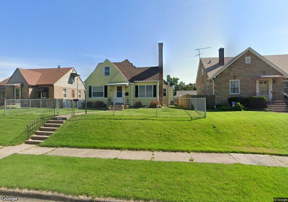
2133 Frisco Dr Davenport, IA 52804
Northwest Davenport NeighborhoodEstimated Value: $190,000 - $217,000
3
Beds
3
Baths
2,748
Sq Ft
$74/Sq Ft
Est. Value
About This Home
This home is located at 2133 Frisco Dr, Davenport, IA 52804 and is currently estimated at $202,637, approximately $73 per square foot. 2133 Frisco Dr is a home located in Scott County with nearby schools including South Christian Elementary School, Wilson Elementary School, and Williams Intermediate School.
Ownership History
Date
Name
Owned For
Owner Type
Purchase Details
Closed on
Nov 19, 2013
Sold by
Benton Reginald A
Bought by
First Financial Group Llc
Current Estimated Value
Purchase Details
Closed on
Nov 30, 2007
Sold by
Bert Angela K and Bert Armon
Bought by
Benton Regiland A and Stambaugh Michelle R
Home Financials for this Owner
Home Financials are based on the most recent Mortgage that was taken out on this home.
Original Mortgage
$157,753
Interest Rate
6.33%
Mortgage Type
FHA
Create a Home Valuation Report for This Property
The Home Valuation Report is an in-depth analysis detailing your home's value as well as a comparison with similar homes in the area
Home Values in the Area
Average Home Value in this Area
Purchase History
| Date | Buyer | Sale Price | Title Company |
|---|---|---|---|
| First Financial Group Llc | $57,754 | None Available | |
| Benton Regiland A | $159,000 | None Available |
Source: Public Records
Mortgage History
| Date | Status | Borrower | Loan Amount |
|---|---|---|---|
| Previous Owner | Benton Regiland A | $157,753 |
Source: Public Records
Tax History Compared to Growth
Tax History
| Year | Tax Paid | Tax Assessment Tax Assessment Total Assessment is a certain percentage of the fair market value that is determined by local assessors to be the total taxable value of land and additions on the property. | Land | Improvement |
|---|---|---|---|---|
| 2025 | $3,030 | $188,490 | $18,400 | $170,090 |
| 2024 | $2,958 | $169,590 | $18,400 | $151,190 |
| 2023 | $2,833 | $169,590 | $18,400 | $151,190 |
| 2022 | $2,850 | $124,690 | $16,100 | $108,590 |
| 2021 | $2,850 | $132,780 | $16,100 | $116,680 |
| 2020 | $2,796 | $128,730 | $16,100 | $112,630 |
| 2019 | $2,818 | $125,600 | $16,100 | $109,500 |
| 2018 | $2,566 | $125,600 | $16,100 | $109,500 |
| 2017 | $650 | $116,810 | $16,100 | $100,710 |
| 2016 | $2,564 | $117,110 | $0 | $0 |
| 2015 | $2,564 | $118,440 | $0 | $0 |
| 2014 | $2,630 | $143,040 | $0 | $0 |
| 2013 | $3,122 | $0 | $0 | $0 |
| 2012 | -- | $140,590 | $19,160 | $121,430 |
Source: Public Records
Map
Nearby Homes
- 2103 W High St
- 2308 Wilkes Ave
- 2223 W Lombard St
- 1723 W Locust St
- 1658 W Lombard St
- 1922 N Pine St
- 1637 W Pleasant St
- 2424 Davie St
- 2221 Madison St
- 1525 W High St
- 2640 Wilkes Ave
- 1517 W Lombard St
- 2508 N Sturdevant St
- 1419 N Division St
- 2417 W 18th St
- 2015 Washington St
- 1636 W Columbia Ave
- 2236 W Columbia Ave
- 1548 W Central Park Ave
- 2738 Kelling St
- 2139 Frisco Dr
- 2143 Frisco Dr
- 2142 Frisco Dr
- 2148 Frisco Dr
- 2123 Frisco Dr
- 2138 Frisco Dr
- 2149 Frisco Dr
- 2152 Frisco Dr
- 2132 Frisco Dr
- 2117 Frisco Dr
- 2128 Frisco Dr
- 2153 Frisco Dr
- 2122 Frisco Dr
- 2118 Hickory Grove Rd
- 2124 Hickory Grove Rd
- 2114 Hickory Grove Rd
- 2128 Hickory Grove Rd
- 2113 Frisco Dr
- 2108 Hickory Grove Rd
- 2156 Frisco Dr