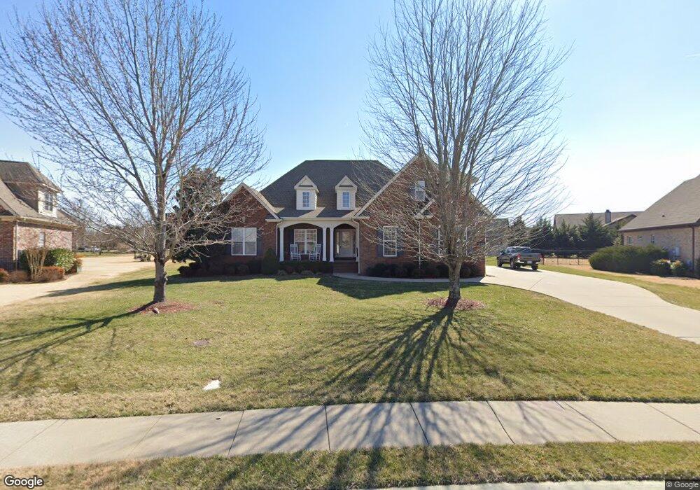
2133 Slater Drive - Lot 45 Murfreesboro, TN 37128
Estimated Value: $568,000 - $658,000
--
Bed
2
Baths
2,565
Sq Ft
$234/Sq Ft
Est. Value
About This Home
This home is located at 2133 Slater Drive - Lot 45, Murfreesboro, TN 37128 and is currently estimated at $600,401, approximately $234 per square foot. 2133 Slater Drive - Lot 45 is a home located in Rutherford County with nearby schools including Salem Elementary School, Barfield Elementary School, and Rockvale Middle School.
Ownership History
Date
Name
Owned For
Owner Type
Purchase Details
Closed on
Aug 6, 2014
Sold by
Tate Jeffery N
Bought by
Waggoner John A Pamela J
Current Estimated Value
Home Financials for this Owner
Home Financials are based on the most recent Mortgage that was taken out on this home.
Original Mortgage
$100,000
Outstanding Balance
$76,256
Interest Rate
4.19%
Mortgage Type
New Conventional
Estimated Equity
$524,145
Purchase Details
Closed on
Aug 9, 2007
Sold by
M & B Developers Llc
Bought by
Tate Jefffery N and Tate Janice J
Create a Home Valuation Report for This Property
The Home Valuation Report is an in-depth analysis detailing your home's value as well as a comparison with similar homes in the area
Home Values in the Area
Average Home Value in this Area
Purchase History
| Date | Buyer | Sale Price | Title Company |
|---|---|---|---|
| Waggoner John A Pamela J | $264,900 | -- | |
| Tate Jefffery N | $50,000 | -- | |
| Tate Jefffery N | $50,000 | -- |
Source: Public Records
Mortgage History
| Date | Status | Borrower | Loan Amount |
|---|---|---|---|
| Open | Waggoner John A Pamela J | $100,000 |
Source: Public Records
Tax History Compared to Growth
Tax History
| Year | Tax Paid | Tax Assessment Tax Assessment Total Assessment is a certain percentage of the fair market value that is determined by local assessors to be the total taxable value of land and additions on the property. | Land | Improvement |
|---|---|---|---|---|
| 2025 | $3,308 | $116,925 | $16,250 | $100,675 |
| 2024 | $3,308 | $116,925 | $16,250 | $100,675 |
| 2023 | $2,194 | $116,925 | $16,250 | $100,675 |
| 2022 | $1,890 | $116,925 | $16,250 | $100,675 |
| 2021 | $1,934 | $87,125 | $16,250 | $70,875 |
| 2020 | $1,934 | $87,125 | $16,250 | $70,875 |
| 2019 | $1,934 | $87,125 | $16,250 | $70,875 |
Source: Public Records
Map
Nearby Homes
- 3245 Genoa Dr
- 2737 Beaulah Dr
- 2338 Stonecenter Ln
- 3411 Geneva Dr
- 3606 Geneva Dr
- 2542 Stonecenter Ln
- 2338 Thad Ct
- 2605 Colleen Dr
- 2365 Stonecenter Ln
- 2621 Colleen Dr
- 2608 Stonecenter Ln
- 2949 Goose Creek Ln
- 3013 Shady Forest Dr
- 2462 Bridgeway St
- 2211 Bridgeway St
- 2228 Cason Ln
- 2819 Silver Springs Ct
- 2818 Silver Springs Ct
- 2807 Cason Ln
- 1421 Proprietors Place
- 2133 Slater Dr
- 2129 Slater Dr
- 3524 Mathewson Way
- 3520 Mathewson Way
- 3528 Mathewson Way
- 2137 Slater Dr
- 3212 Robinwood Dr
- 98 Robinwwod
- 3216 Robinwood Dr
- 3208 Robinwood Dr
- 2824 Beaulah Dr
- 2828 Beaulah Dr
- 2132 Slater Dr
- 2125 Slater Dr
- 2141 Slater Dr
- 2820 Beaulah Dr
- 2832 Beaulah Dr
- 2140 Slater Dr
- 2816 Beaulah Dr
- 2121 Slater Dr