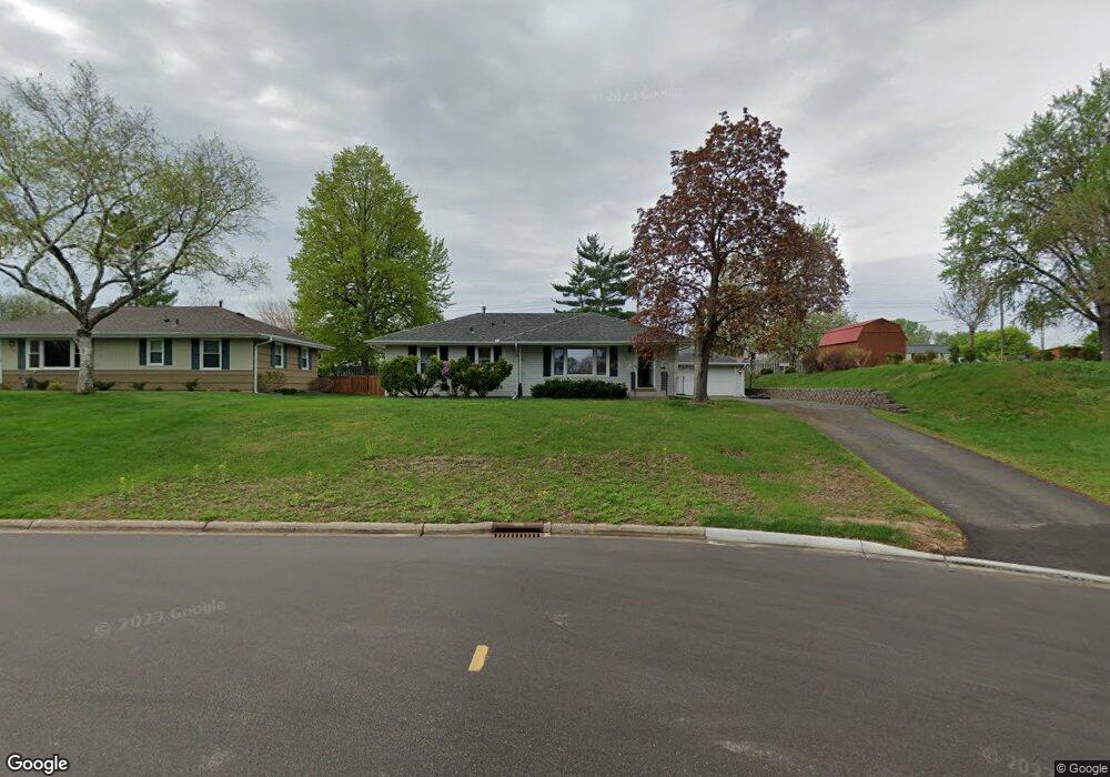
2133 W 92nd St Minneapolis, MN 55431
West Bloomington NeighborhoodEstimated Value: $363,000 - $382,000
3
Beds
2
Baths
1,280
Sq Ft
$291/Sq Ft
Est. Value
About This Home
This home is located at 2133 W 92nd St, Minneapolis, MN 55431 and is currently estimated at $372,076, approximately $290 per square foot. 2133 W 92nd St is a home located in Hennepin County with nearby schools including Washburn Elementary School, Valley View Middle School, and Kennedy Senior High School.
Ownership History
Date
Name
Owned For
Owner Type
Purchase Details
Closed on
Oct 9, 2022
Sold by
Winslow Brian Paul
Bought by
Winslow Heidi Lyn
Current Estimated Value
Purchase Details
Closed on
Jun 25, 2021
Sold by
Winslow Heidi L and Winslow Brian Paul
Bought by
Winslow Heidi L and Winslow Brian Paul
Home Financials for this Owner
Home Financials are based on the most recent Mortgage that was taken out on this home.
Original Mortgage
$158,000
Interest Rate
2.9%
Mortgage Type
New Conventional
Purchase Details
Closed on
Jul 11, 2014
Sold by
Vanalstine Jason Troy
Bought by
Bjerke Heidi Lyn
Purchase Details
Closed on
Sep 21, 2006
Sold by
Gladys M Sorensen Trust Agreement
Bought by
Vanalstine Jason T and Van Alstine Heidi L
Create a Home Valuation Report for This Property
The Home Valuation Report is an in-depth analysis detailing your home's value as well as a comparison with similar homes in the area
Home Values in the Area
Average Home Value in this Area
Purchase History
| Date | Buyer | Sale Price | Title Company |
|---|---|---|---|
| Winslow Heidi Lyn | $500 | -- | |
| Winslow Heidi L | -- | Watermark Title Agency | |
| Bjerke Heidi Lyn | -- | None Available | |
| Vanalstine Jason T | $239,000 | -- |
Source: Public Records
Mortgage History
| Date | Status | Borrower | Loan Amount |
|---|---|---|---|
| Previous Owner | Winslow Heidi L | $158,000 |
Source: Public Records
Tax History Compared to Growth
Tax History
| Year | Tax Paid | Tax Assessment Tax Assessment Total Assessment is a certain percentage of the fair market value that is determined by local assessors to be the total taxable value of land and additions on the property. | Land | Improvement |
|---|---|---|---|---|
| 2024 | $4,234 | $339,300 | $109,000 | $230,300 |
| 2023 | $3,900 | $329,800 | $99,500 | $230,300 |
| 2022 | $3,603 | $329,600 | $104,000 | $225,600 |
| 2021 | $3,178 | $290,000 | $105,700 | $184,300 |
| 2020 | $3,398 | $261,400 | $94,900 | $166,500 |
| 2019 | $2,843 | $270,400 | $111,600 | $158,800 |
| 2018 | $2,785 | $227,100 | $105,100 | $122,000 |
| 2017 | $2,341 | $189,100 | $83,800 | $105,300 |
| 2016 | $2,351 | $181,500 | $78,000 | $103,500 |
| 2015 | $2,358 | $175,900 | $76,600 | $99,300 |
| 2014 | -- | $155,200 | $74,200 | $81,000 |
Source: Public Records
Map
Nearby Homes
- 9149 Queen Ave S
- 2101 W 89th St
- 2300 W 95th St
- 8831 Queen Ave S
- 8836 James Ave S
- 9609 Vincent Ave S
- 8545 Penn Ave S
- 8525 Penn Ave S
- 1706 W 86th St
- 9824 Fremont Ave S
- 8706 Aldrich Ave S
- 9522 Pleasant Ave S
- 2113 Village Terrace
- 3801 W 98th St Unit 402
- 8264 York Ave S
- 8212 Fremont Ave S Unit D
- 2225 Village Terrace
- 9020 Blaisdell Ave S
- 8549 Irwin Rd Unit 239
- 8256 Beard Rd
- 2125 W 92nd St
- 9140 Oliver Ave S
- 2117 W 92nd St
- 9141 Oliver Ave S
- 9159 Penn Ave S
- 9165 Penn Ave S
- 2109 W 92nd St
- 2201 W 91 1/2 St
- 9133 Oliver Ave S
- 9140 Newton Ave S
- 2209 W 91 1/2 St
- 2101 W 92nd St
- 9132 Newton Ave S
- 2217 W 91 1/2 St
- 9125 Oliver Ave S
- 9124 Newton Ave S
- 2025 W 92nd St
- 9124 Oliver Ave S
- 9150 Penn Ave S
- 9117 Oliver Ave S