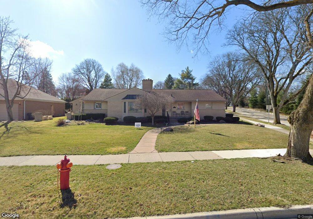
2135 Vinsetta Blvd Royal Oak, MI 48073
Estimated Value: $666,000 - $800,000
3
Beds
5
Baths
3,081
Sq Ft
$237/Sq Ft
Est. Value
About This Home
This home is located at 2135 Vinsetta Blvd, Royal Oak, MI 48073 and is currently estimated at $730,479, approximately $237 per square foot. 2135 Vinsetta Blvd is a home located in Oakland County with nearby schools including Northwood Elementary School, Royal Oak Middle School, and Royal Oak High School.
Ownership History
Date
Name
Owned For
Owner Type
Purchase Details
Closed on
Oct 23, 2018
Sold by
Christman Therese M
Bought by
Christman Therese M and Therese M Christman Revocable
Current Estimated Value
Purchase Details
Closed on
Dec 13, 2017
Sold by
Christman James Ronald and Christman Thenese M
Bought by
Christman Thenese M
Purchase Details
Closed on
Dec 8, 2008
Sold by
Christman James and Christman Therese
Bought by
Christman James R D and Christman Therese M
Purchase Details
Closed on
Jan 2, 1998
Sold by
Christma Therese Michell
Bought by
Christman James
Create a Home Valuation Report for This Property
The Home Valuation Report is an in-depth analysis detailing your home's value as well as a comparison with similar homes in the area
Home Values in the Area
Average Home Value in this Area
Purchase History
| Date | Buyer | Sale Price | Title Company |
|---|---|---|---|
| Christman Therese M | -- | None Available | |
| Christman Thenese M | -- | None Available | |
| Christman James R D | -- | None Available | |
| Christman James | -- | -- |
Source: Public Records
Tax History Compared to Growth
Tax History
| Year | Tax Paid | Tax Assessment Tax Assessment Total Assessment is a certain percentage of the fair market value that is determined by local assessors to be the total taxable value of land and additions on the property. | Land | Improvement |
|---|---|---|---|---|
| 2025 | $8,492 | $312,670 | $0 | $0 |
| 2024 | $6,464 | $288,820 | $0 | $0 |
| 2022 | $7,638 | $252,600 | $0 | $0 |
| 2020 | $6,281 | $227,700 | $0 | $0 |
| 2018 | $7,638 | $211,030 | $0 | $0 |
| 2017 | $7,340 | $211,030 | $0 | $0 |
| 2015 | -- | $201,300 | $0 | $0 |
| 2014 | -- | $190,460 | $0 | $0 |
| 2011 | -- | $170,670 | $0 | $0 |
Source: Public Records
Map
Nearby Homes
- 1012 W 12 Mile Rd
- 2403 Crooks Rd
- 1721 Forestdale Ct
- 817 Magnolia Ave
- 2438 Evergreen Dr
- 1027 Orchard Grove Dr
- 1630 W 12 Mile Rd
- 1203 Woodsboro Dr
- 1718 W 12 Mile Rd
- 1825 Northwood Blvd
- 1319 Woodsboro Dr
- 2115 Marywood Dr
- 422 Walnut Ave
- 1915 Northwood Blvd
- 1506 N Pleasant St
- 419 W 12 Mile Rd
- 1634 Crooks Rd
- 2728 Galpin Ave
- 1828 N Lafayette Ave
- 1837 N Washington Ave
- 2115 Vinsetta Blvd
- 2140 Laurome Dr
- 2130 Laurome Dr
- 2209 Vinsetta Blvd
- 2105 Vinsetta Blvd
- 2110 Laurome Dr
- 2126 Vinsetta Blvd
- 2204 Vinsetta Blvd
- 2046 Laurome Dr
- 2120 Vinsetta Blvd
- 2023 Vinsetta Blvd
- 2210 Vinsetta Blvd
- 2108 Vinsetta Blvd
- 2114 Vinsetta Blvd
- 2036 Laurome Dr
- 1202 Murdock Ave
- 1136 Murdock Ave
- 1217 Lloyd Ave
- 2131 Laurome Dr
- 0 Sycamore Ave