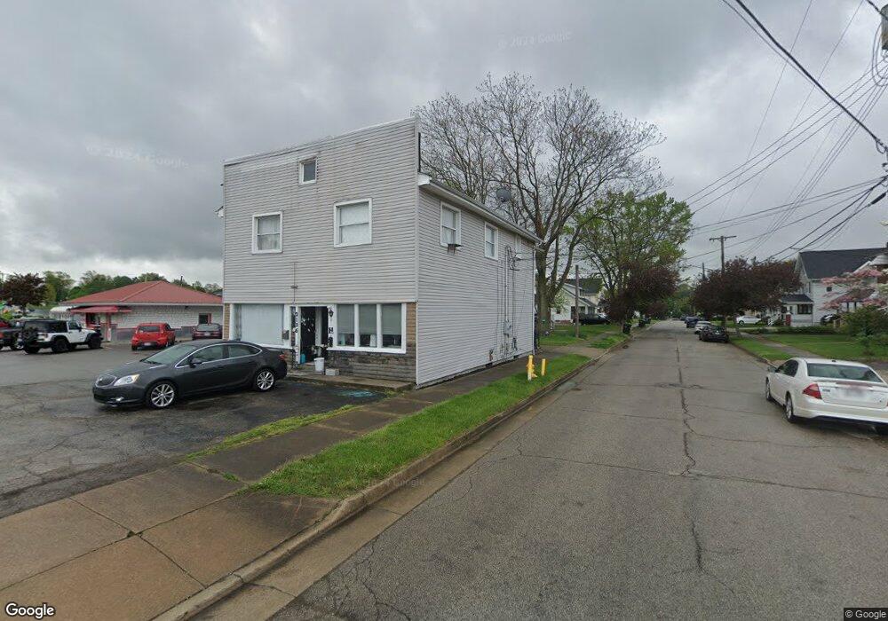
2136 E Market St Akron, OH 44312
Ellet NeighborhoodEstimated Value: $282,465
Studio
--
Bath
1,120
Sq Ft
$252/Sq Ft
Est. Value
About This Home
This home is located at 2136 E Market St, Akron, OH 44312 and is currently estimated at $282,465, approximately $252 per square foot. 2136 E Market St is a home located in Summit County with nearby schools including Ellet High School.
Ownership History
Date
Name
Owned For
Owner Type
Purchase Details
Closed on
Oct 20, 2023
Sold by
Jaber Tony
Bought by
Tj Land Management One Llc
Current Estimated Value
Purchase Details
Closed on
Apr 4, 2016
Sold by
Roose Billie N
Bought by
Jaber Tony
Purchase Details
Closed on
Sep 22, 2010
Sold by
Jaber Tony and Jaber Lori
Bought by
Roose Billie N
Home Financials for this Owner
Home Financials are based on the most recent Mortgage that was taken out on this home.
Original Mortgage
$117,500
Interest Rate
4.45%
Mortgage Type
Seller Take Back
Create a Home Valuation Report for This Property
The Home Valuation Report is an in-depth analysis detailing your home's value as well as a comparison with similar homes in the area
Home Values in the Area
Average Home Value in this Area
Purchase History
| Date | Buyer | Sale Price | Title Company |
|---|---|---|---|
| Tj Land Management One Llc | -- | None Listed On Document | |
| Jaber Tony | -- | None Available | |
| Roose Billie N | $135,000 | Attorney |
Source: Public Records
Mortgage History
| Date | Status | Borrower | Loan Amount |
|---|---|---|---|
| Previous Owner | Roose Billie N | $117,500 |
Source: Public Records
Tax History
| Year | Tax Paid | Tax Assessment Tax Assessment Total Assessment is a certain percentage of the fair market value that is determined by local assessors to be the total taxable value of land and additions on the property. | Land | Improvement |
|---|---|---|---|---|
| 2025 | $4,271 | $44,394 | $15,463 | $28,931 |
| 2024 | $4,271 | $44,394 | $15,463 | $28,931 |
| 2023 | $4,271 | $44,394 | $15,463 | $28,931 |
| 2022 | $4,353 | $44,394 | $15,463 | $28,931 |
| 2021 | $4,272 | $44,394 | $15,463 | $28,931 |
| 2020 | $4,224 | $44,390 | $15,460 | $28,930 |
| 2019 | $4,606 | $44,470 | $13,530 | $30,940 |
| 2018 | $4,579 | $44,470 | $13,530 | $30,940 |
| 2017 | $4,697 | $44,470 | $13,530 | $30,940 |
| 2016 | $4,661 | $46,770 | $14,250 | $32,520 |
| 2015 | $4,697 | $46,770 | $14,250 | $32,520 |
| 2014 | $4,643 | $46,770 | $14,250 | $32,520 |
| 2013 | $4,948 | $47,130 | $12,110 | $35,020 |
Source: Public Records
Map
Nearby Homes
- 111 Akers Ave
- 20 Verdun Dr
- 110 Eastholm Ave
- 2269 Emerald Dr
- 2258 Mogadore Rd
- 187 Highpoint Ave
- 274 Fulmer Ave
- 2382 Mogadore Rd
- 228 Hawk Ave
- 1874 Adelaide Blvd
- 248 Malacca St
- 1837 Marks Ave
- 487 Hilbish Ave
- 1991-1993 Congo St
- 404 Newell Ave
- 295 Goodview Ave
- 37 Ansel Ave
- 439 Larkin Ave
- 472 Stephens Rd
- 2541 Edgebrook Ave
- 2146 E Market St
- 143 Gleason Ave
- 145 Gleason Ave
- 2139 E Market St
- 2135 E Market St
- 2131 E Market St
- 146 Gleason Ave
- 152 Gleason Ave
- 2121 E Market St
- 124 Devonshire Dr
- 155 Gleason Ave
- 105 Carlton Dr
- 2155 E Market St
- 2117 E Market St
- 156 Gleason Ave
- 161 Gleason Ave
- 101 Carlton Dr
- 2113 E Market St
- 122 Devonshire Dr
- 172 Prairie Dr
Your Personal Tour Guide
Ask me questions while you tour the home.