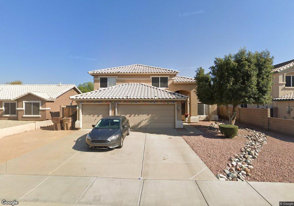
21365 N 108th Ave Sun City, AZ 85373
Estimated Value: $530,263 - $570,000
5
Beds
3
Baths
2,397
Sq Ft
$231/Sq Ft
Est. Value
About This Home
This home is located at 21365 N 108th Ave, Sun City, AZ 85373 and is currently estimated at $553,566, approximately $230 per square foot. 21365 N 108th Ave is a home located in Maricopa County with nearby schools including Parkridge Elementary School, Sunrise Mountain High School, and Candeo Peoria.
Ownership History
Date
Name
Owned For
Owner Type
Purchase Details
Closed on
Apr 14, 2009
Sold by
Federal Home Loan Mortgage Corporation
Bought by
White Brenda J
Current Estimated Value
Home Financials for this Owner
Home Financials are based on the most recent Mortgage that was taken out on this home.
Original Mortgage
$181,550
Outstanding Balance
$115,076
Interest Rate
4.99%
Mortgage Type
FHA
Estimated Equity
$438,490
Purchase Details
Closed on
Dec 1, 2008
Sold by
York Christopher
Bought by
Mortgage Electronic Registration Systems
Purchase Details
Closed on
Oct 8, 2008
Sold by
Aurora Loan Services Llc
Bought by
Federal Home Loan Mortgage Corp
Purchase Details
Closed on
Apr 4, 2007
Sold by
York Felicia
Bought by
York Christopher
Home Financials for this Owner
Home Financials are based on the most recent Mortgage that was taken out on this home.
Original Mortgage
$345,000
Interest Rate
7.85%
Mortgage Type
Purchase Money Mortgage
Purchase Details
Closed on
Oct 21, 2004
Sold by
Grasis Egils M and Grasis Patricia A
Bought by
Thompson Jeffrey L and Thompson Jennifer J
Home Financials for this Owner
Home Financials are based on the most recent Mortgage that was taken out on this home.
Original Mortgage
$158,200
Interest Rate
5.79%
Mortgage Type
New Conventional
Purchase Details
Closed on
Mar 10, 1998
Sold by
Marlor Land Company Inc
Bought by
Grasis Egils M and Grasis Patricia A
Home Financials for this Owner
Home Financials are based on the most recent Mortgage that was taken out on this home.
Original Mortgage
$125,200
Interest Rate
7.06%
Mortgage Type
New Conventional
Purchase Details
Closed on
Nov 14, 1997
Sold by
Security Title Agency
Bought by
Marlor Land Company Inc
Home Financials for this Owner
Home Financials are based on the most recent Mortgage that was taken out on this home.
Original Mortgage
$110,000
Interest Rate
7.33%
Mortgage Type
New Conventional
Create a Home Valuation Report for This Property
The Home Valuation Report is an in-depth analysis detailing your home's value as well as a comparison with similar homes in the area
Home Values in the Area
Average Home Value in this Area
Purchase History
| Date | Buyer | Sale Price | Title Company |
|---|---|---|---|
| White Brenda J | $184,900 | First American Title Ins Co | |
| Mortgage Electronic Registration Systems | $230,100 | None Available | |
| Federal Home Loan Mortgage Corp | -- | Accommodation | |
| York Christopher | -- | First American Title Ins Co | |
| York Christopher | $345,000 | First American Title Ins Co | |
| Thompson Jeffrey L | $226,000 | Fidelity National Title | |
| Grasis Egils M | $139,905 | Security Title Agency | |
| Marlor Land Company Inc | $23,650 | Security Title Agency |
Source: Public Records
Mortgage History
| Date | Status | Borrower | Loan Amount |
|---|---|---|---|
| Open | White Brenda J | $181,550 | |
| Previous Owner | York Christopher | $345,000 | |
| Previous Owner | Thompson Jeffrey L | $158,200 | |
| Previous Owner | Grasis Egils M | $125,200 | |
| Previous Owner | Marlor Land Company Inc | $110,000 | |
| Closed | Thompson Jeffrey L | $67,800 |
Source: Public Records
Tax History Compared to Growth
Tax History
| Year | Tax Paid | Tax Assessment Tax Assessment Total Assessment is a certain percentage of the fair market value that is determined by local assessors to be the total taxable value of land and additions on the property. | Land | Improvement |
|---|---|---|---|---|
| 2025 | $1,857 | $23,517 | -- | -- |
| 2024 | $1,826 | $22,398 | -- | -- |
| 2023 | $1,826 | $37,060 | $7,410 | $29,650 |
| 2022 | $1,788 | $28,710 | $5,740 | $22,970 |
| 2021 | $1,912 | $26,870 | $5,370 | $21,500 |
| 2020 | $1,930 | $25,220 | $5,040 | $20,180 |
| 2019 | $1,869 | $23,080 | $4,610 | $18,470 |
| 2018 | $1,799 | $21,520 | $4,300 | $17,220 |
| 2017 | $1,801 | $20,020 | $4,000 | $16,020 |
| 2016 | $1,757 | $18,910 | $3,780 | $15,130 |
| 2015 | $1,663 | $17,200 | $3,440 | $13,760 |
Source: Public Records
Map
Nearby Homes
- 10806 W Adam Ave
- 10816 W Quail Ave
- 10816 W Deanna Dr
- 10549 W Albert Ln
- 10672 W Ross Ave
- 20957 N 107th Dr
- 20769 N 106th Ln
- 10528 W Potter Dr
- 10728 W Irma Ln
- 10722 W Irma Ln
- 10446 W Lone Cactus Dr
- 20670 N 105th Dr
- 10368 W Ross Ave
- 10824 W Sands Dr
- 10630 W Mohawk Ln
- 21479 N 104th Dr
- 20615 N 105th Ave
- 20641 N 110th Ave
- 20360 N 106th Ln
- 10344 W Burnett Rd
- 21375 N 108th Ave
- 21355 N 108th Ave
- 21380 N 107th Dr
- 21320 N 107th Dr
- 21360 N 107th Dr
- 21385 N 108th Ave
- 21410 N 107th Dr
- 21410 N 107th Dr
- 10805 W Lone Cactus Dr
- 21430 N 107th Dr
- 10747 W Adam Ave
- 10753 W Adam Ave
- 10812 W Adam Ave
- 10811 W Lone Cactus Dr
- 21405 N 108th Ave
- 10741 W Adam Ave
- 10805 W Adam Ave
- 10806 W Lone Cactus Dr
- 10735 W Adam Ave
- 10811 W Adam Ave