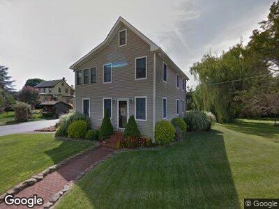
2139 E Buckshutem Rd Mauricetown, NJ 08329
Estimated Value: $266,000 - $326,000
--
Bed
--
Bath
2,352
Sq Ft
$126/Sq Ft
Est. Value
About This Home
This home is located at 2139 E Buckshutem Rd, Mauricetown, NJ 08329 and is currently estimated at $295,975, approximately $125 per square foot. 2139 E Buckshutem Rd is a home with nearby schools including Commercial Township School and Port Norris Elementary School.
Ownership History
Date
Name
Owned For
Owner Type
Purchase Details
Closed on
Jan 11, 2007
Sold by
Perrelli Jamie and Perrelli Ronald Sutton
Bought by
Sutton Jamie P and Sutton Ronald
Current Estimated Value
Purchase Details
Closed on
Mar 5, 2001
Sold by
Risimini Robert
Bought by
Sutton Ronald and Perrelli Jaime
Create a Home Valuation Report for This Property
The Home Valuation Report is an in-depth analysis detailing your home's value as well as a comparison with similar homes in the area
Home Values in the Area
Average Home Value in this Area
Purchase History
| Date | Buyer | Sale Price | Title Company |
|---|---|---|---|
| Sutton Jamie P | -- | -- | |
| Sutton Ronald | $55,000 | -- |
Source: Public Records
Mortgage History
| Date | Status | Borrower | Loan Amount |
|---|---|---|---|
| Open | Sutton Jaime P | $223,850 | |
| Closed | Sutton Jaime | $181,900 |
Source: Public Records
Tax History Compared to Growth
Tax History
| Year | Tax Paid | Tax Assessment Tax Assessment Total Assessment is a certain percentage of the fair market value that is determined by local assessors to be the total taxable value of land and additions on the property. | Land | Improvement |
|---|---|---|---|---|
| 2024 | $6,617 | $221,000 | $27,900 | $193,100 |
| 2023 | $6,526 | $221,000 | $27,900 | $193,100 |
| 2022 | $6,462 | $221,000 | $27,900 | $193,100 |
| 2021 | $6,219 | $221,000 | $27,900 | $193,100 |
| 2020 | $6,219 | $221,000 | $27,900 | $193,100 |
| 2019 | $5,815 | $221,000 | $27,900 | $193,100 |
| 2018 | $5,859 | $221,000 | $27,900 | $193,100 |
| 2017 | $5,662 | $221,000 | $27,900 | $193,100 |
| 2016 | $5,479 | $221,000 | $27,900 | $193,100 |
| 2015 | $5,514 | $221,000 | $27,900 | $193,100 |
| 2014 | $5,916 | $246,700 | $27,900 | $218,800 |
Source: Public Records
Map
Nearby Homes
- 1224 Front St
- 9087 Highland St
- 2029 E Buckshutem Rd
- 8773 Highland St
- 19 Market St
- 423 Main St
- 414 Main St
- 1832 E Buckshutem Rd
- 530 Main St
- 502 E Main St
- 9059 Highland St
- 8896 Highland St
- 0 North Ave Unit 590347
- 0 Ward Ave Unit NJCB2023148
- 4 Quaker St
- 643 Main St
- 7079 James Moore Rd
- 12 Doughty Ln
- 1511 North Ave
- 3444 New Jersey 47
- 2139 E Buckshutem Rd
- 9576 Highland St
- 2133 E Buckshutem Rd
- 2138 E Buckshutem Rd
- 2134 E Buckshutem Rd
- 9568 Highland St
- 9582 Highland St
- 9566 Highland St
- 9566 Highland St
- 9567 Highland St
- 1201 Front St
- 9564 Highland St
- 9562 Highland St
- 9588 Highland St
- 1205 Front St
- 1200 Front St
- 1207 Front St
- 1202 Front St
- 1209 Front St
- 2126 E Buckshutem Rd