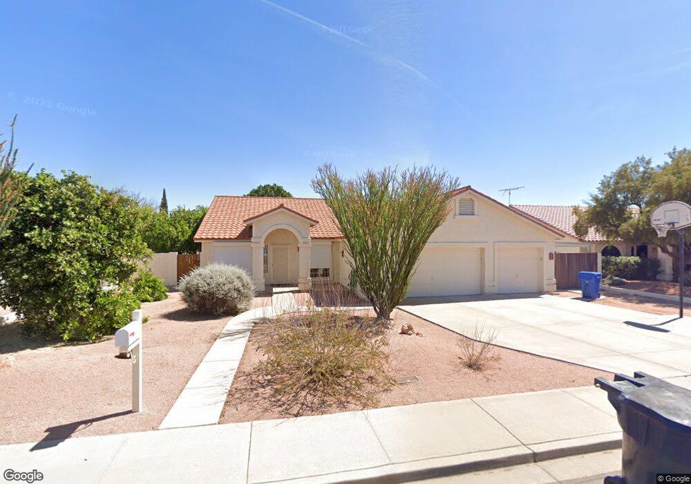
2139 N Almond Mesa, AZ 85213
Rancho de Arboleda NeighborhoodEstimated Value: $501,647 - $577,000
Studio
3
Baths
1,953
Sq Ft
$279/Sq Ft
Est. Value
About This Home
This home is located at 2139 N Almond, Mesa, AZ 85213 and is currently estimated at $544,162, approximately $278 per square foot. 2139 N Almond is a home located in Maricopa County with nearby schools including Hermosa Vista Elementary School, Franklin at Brimhall Elementary School, and Franklin West Elementary School.
Ownership History
Date
Name
Owned For
Owner Type
Purchase Details
Closed on
Dec 9, 2016
Sold by
Gory Robert E and Gory Connie B
Bought by
Gory Robert E and Gory Connie B
Current Estimated Value
Purchase Details
Closed on
Dec 31, 2009
Sold by
Gory Robert E and Gory Connie B
Bought by
Gory Robert E and Gory Connie B
Purchase Details
Closed on
Jul 30, 2007
Sold by
Gory Connie B
Bought by
Gory Robert E and Gory Connie B
Purchase Details
Closed on
Dec 17, 2004
Sold by
Gory Robert E
Bought by
Gory Connie B
Purchase Details
Closed on
Sep 18, 1995
Sold by
Gory Theresa A
Bought by
Gory Robert E
Create a Home Valuation Report for This Property
The Home Valuation Report is an in-depth analysis detailing your home's value as well as a comparison with similar homes in the area
Home Values in the Area
Average Home Value in this Area
Purchase History
| Date | Buyer | Sale Price | Title Company |
|---|---|---|---|
| Gory Robert E | -- | None Available | |
| Gory Robert E | -- | None Available | |
| Gory Robert E | -- | None Available | |
| Gory Connie B | -- | -- | |
| Gory Robert E | -- | -- |
Source: Public Records
Tax History
| Year | Tax Paid | Tax Assessment Tax Assessment Total Assessment is a certain percentage of the fair market value that is determined by local assessors to be the total taxable value of land and additions on the property. | Land | Improvement |
|---|---|---|---|---|
| 2025 | $2,358 | $27,882 | -- | -- |
| 2024 | $2,383 | $26,554 | -- | -- |
| 2023 | $2,383 | $40,770 | $8,150 | $32,620 |
| 2022 | $2,332 | $31,930 | $6,380 | $25,550 |
| 2021 | $2,387 | $30,750 | $6,150 | $24,600 |
| 2020 | $2,354 | $27,680 | $5,530 | $22,150 |
| 2019 | $2,184 | $25,830 | $5,160 | $20,670 |
| 2018 | $2,083 | $24,320 | $4,860 | $19,460 |
| 2017 | $2,019 | $23,610 | $4,720 | $18,890 |
| 2016 | $1,973 | $23,520 | $4,700 | $18,820 |
| 2015 | $1,869 | $21,670 | $4,330 | $17,340 |
Source: Public Records
Map
Nearby Homes
- 2435 E Kenwood Cir
- 2240 E Kenwood St
- 2160 E Kenwood St
- 2528 E Mckellips Rd Unit 116
- 2528 E Mckellips Rd Unit 146
- 2528 E Mckellips Rd Unit 15
- 2566 E Lynwood St
- 2334 N Rose
- 2064 E Kenwood Cir
- 2161 E Menlo Cir
- 2255 E Jacaranda St
- 2029 E Lockwood St
- 2112 E Laurel St
- 2057 N Ashbrook
- 2722 E Lawndale St
- 2360 N Yale
- 2129 E Jensen St
- 2558 E Inglewood St
- 2728 E Minton St
- 1844 E Leland Cir
- 2147 N Almond
- 2131 N Almond
- 2406 E Kael Cir
- 2405 E Kael Cir
- 2358 E Kael Cir
- 2123 N Almond
- 2155 N Almond
- 2407 E Leonora St
- 2414 E Kael Cir
- 2357 E Kael Cir
- 2345 E Leonora St
- 2413 E Kael Cir
- 2415 E Leonora St
- 2115 N Almond
- 2404 E Kenwood St
- 2350 E Kael Cir
- 2422 E Kael Cir
- 2349 E Kael Cir
- 2356 E Kenwood St
- 2337 E Leonora St
Your Personal Tour Guide
Ask me questions while you tour the home.