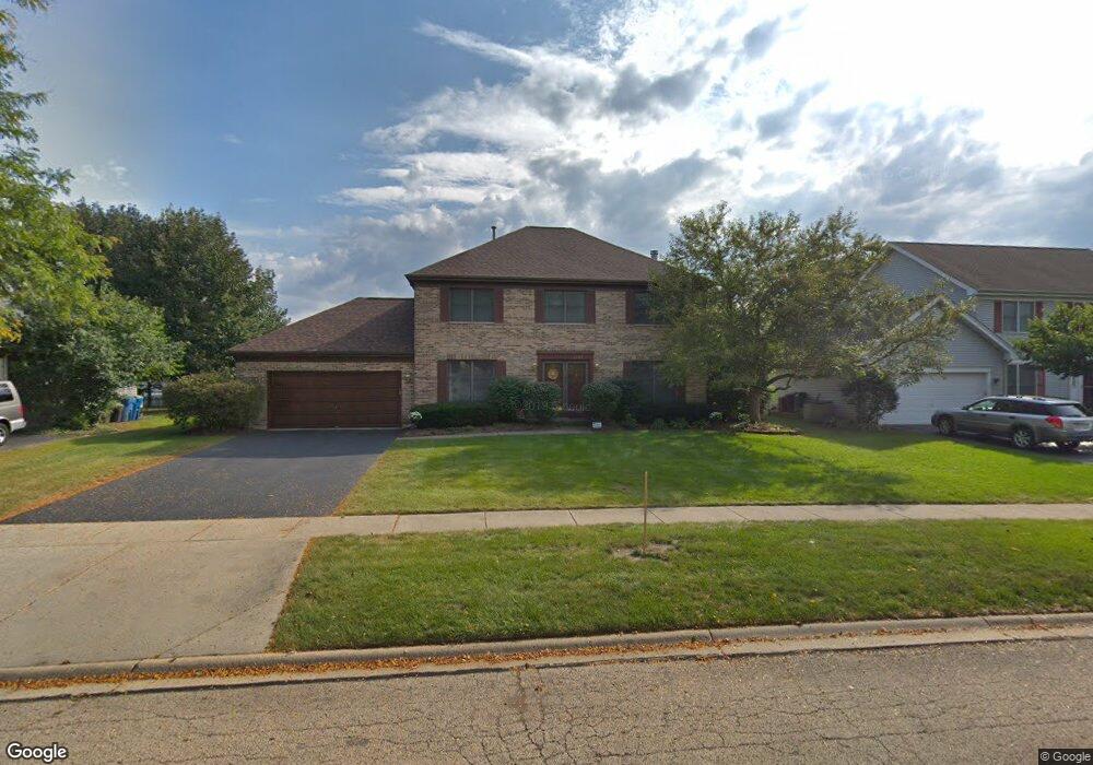
2139 Spaulding Ave West Dundee, IL 60118
Estimated Value: $417,430 - $457,000
4
Beds
--
Bath
2,346
Sq Ft
$190/Sq Ft
Est. Value
About This Home
This home is located at 2139 Spaulding Ave, West Dundee, IL 60118 and is currently estimated at $445,858, approximately $190 per square foot. 2139 Spaulding Ave is a home located in Kane County with nearby schools including Dundee Highlands Elementary School, Dundee Middle School, and Harry D Jacobs High School.
Ownership History
Date
Name
Owned For
Owner Type
Purchase Details
Closed on
May 2, 2012
Sold by
Lapinski Mark G and Lapinski Rebecca E
Bought by
Lapinski Mark G and Lapinski Rebecca E
Current Estimated Value
Home Financials for this Owner
Home Financials are based on the most recent Mortgage that was taken out on this home.
Original Mortgage
$225,698
Outstanding Balance
$157,033
Interest Rate
3.99%
Mortgage Type
New Conventional
Estimated Equity
$288,825
Purchase Details
Closed on
Aug 12, 2004
Sold by
Sakiewicz Bruce E and Sakiewicz Jill M
Bought by
Lapinski Mark G and Lapinski Rebecca E
Home Financials for this Owner
Home Financials are based on the most recent Mortgage that was taken out on this home.
Original Mortgage
$250,000
Interest Rate
6.08%
Mortgage Type
Purchase Money Mortgage
Create a Home Valuation Report for This Property
The Home Valuation Report is an in-depth analysis detailing your home's value as well as a comparison with similar homes in the area
Home Values in the Area
Average Home Value in this Area
Purchase History
| Date | Buyer | Sale Price | Title Company |
|---|---|---|---|
| Lapinski Mark G | -- | Mortgage Information Service | |
| Lapinski Mark G | $325,000 | Professional National Title |
Source: Public Records
Mortgage History
| Date | Status | Borrower | Loan Amount |
|---|---|---|---|
| Open | Lapinski Mark G | $225,698 | |
| Closed | Lapinski Mark G | $250,000 |
Source: Public Records
Tax History
| Year | Tax Paid | Tax Assessment Tax Assessment Total Assessment is a certain percentage of the fair market value that is determined by local assessors to be the total taxable value of land and additions on the property. | Land | Improvement |
|---|---|---|---|---|
| 2024 | $9,619 | $126,010 | $24,968 | $101,042 |
| 2023 | $9,018 | $113,379 | $22,465 | $90,914 |
| 2022 | $9,214 | $110,586 | $22,465 | $88,121 |
| 2021 | $8,893 | $104,415 | $21,211 | $83,204 |
| 2020 | $8,729 | $102,067 | $20,734 | $81,333 |
| 2019 | $8,449 | $96,893 | $19,683 | $77,210 |
| 2018 | $8,799 | $98,254 | $19,293 | $78,961 |
| 2017 | $8,381 | $91,912 | $18,048 | $73,864 |
| 2016 | $8,105 | $84,729 | $23,811 | $60,918 |
| 2015 | -- | $79,394 | $22,312 | $57,082 |
| 2014 | -- | $77,202 | $21,696 | $55,506 |
| 2013 | -- | $79,565 | $22,360 | $57,205 |
Source: Public Records
Map
Nearby Homes
- 817 Lindsay Ln
- 809 Lindsay Ln
- 815 Lindsay Ln
- 850 Tartans Dr
- 1107 Pember Cir Unit 2
- 1811 W Main St
- 1715 W Main St
- 822 Lindsay Ln
- 816 Lindsay Ln
- 818 Lindsay Ln
- 1601 Higgins Rd
- 801 Lindsay Ln
- 804 Lindsay Ln
- 820 Lindsay Ln
- 808 Lindsay Ln
- 821 Lindsay Ln
- 1023 Shagbark Ln
- 1031 Shagbark Ln
- 2660 Chesire Ct
- 176 Tay River Dr
- 2127 Spaulding Ave
- 2145 Spaulding Ave
- 722 Macgregor Ct
- 734 Macgregor Ct
- 2113 Spaulding Ave
- 2153 Spaulding Ave
- 706 Macgregor Ct
- 2134 Spaulding Ave
- 2128 Spaulding Ave Unit 2
- 2112 Glenmoor Dr
- 2146 Spaulding Ave
- 2109 Spaulding Ave Unit 2
- 2114 Spaulding Ave
- 2157 Spaulding Ave
- 730 Macgregor Ct
- 2118 Glenmoor Dr
- 2152 Spaulding Ave
- 2110 Spaulding Ave
- 964 Pember Cir
- 2065 Spaulding Ave
Your Personal Tour Guide
Ask me questions while you tour the home.