
Seller's Agent in 2025
William Thomas
Red 1 Realty
(937) 689-6134
3 in this area
25 Total Sales
Estimated Value: $222,000 - $258,000
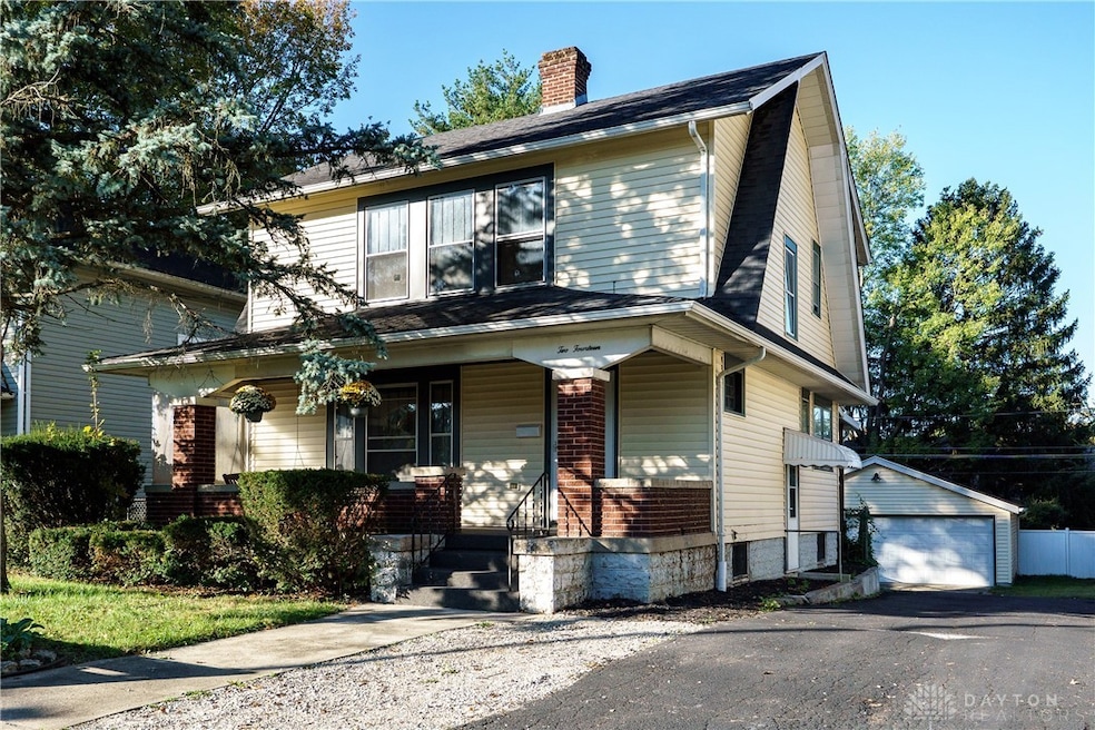
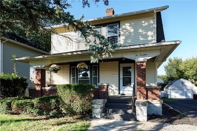
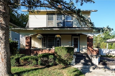
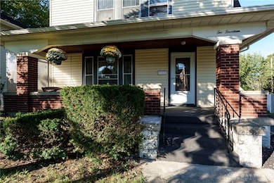
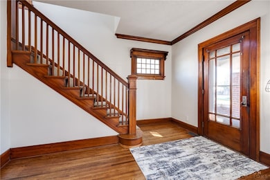
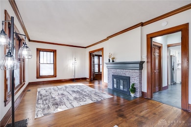
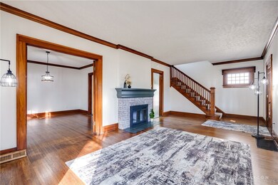
Welcome to 214 Corwin Avenue, a beautifully maintained residence located in the heart of Xenia. This charming 1923 home blends timeless character with thoughtful updates, offering 3 spacious bedrooms, 2 bathrooms, and over 1,500 square feet of inviting living space. Step inside to discover stunning wood flooring and rich trim work that highlight the craftsmanship of a bygone era. The updated kitchen is designed with both style and function in mind, featuring modern finishes that complement the home's vintage appeal. A gas fireplace anchors the cozy living room, creating a warm and welcoming atmosphere perfect for gatherings. Classic features like French doors, crown molding, and built-in cabinetry add personality and functionality throughout the home. The large dining room is ideal for entertaining, while a window seat provides a perfect nook for quiet moments. Upstairs, the spacious bedrooms offer natural light and comfort, while the semi-finished basement provides additional flexibility for recreation, work, or storage. A recently added back deck expands your outdoor living space, ideal for relaxing or entertaining in the fenced backyard. Situated on a manageable lot with a detached garage, this home combines charm, space, and updates in a convenient location near local parks, schools, and downtown Xenia amenities. Whether you're drawn to its historic character or the thoughtful upgrades, 214 Corwin Avenue invites you to enjoy all it has to offer.
Last Agent to Sell the Property
Red 1 Realty Brokerage Phone: (937) 689-6134 License #2007002894 Listed on: 10/15/2025
| Date | Buyer | Sale Price | Title Company |
|---|---|---|---|
| Reich Jerri | $235,000 | None Listed On Document | |
| Ced Properties Llc | $120,000 | None Listed On Document | |
| Floyd Monique D | $118,500 | Hallmark Title | |
| Peterson Ryan S | $130,000 | Attorney | |
| Pendry David L | -- | -- |
| Date | Status | Borrower | Loan Amount |
|---|---|---|---|
| Open | Reich Jerri | $188,000 | |
| Previous Owner | Floyd Monique D | $112,575 | |
| Previous Owner | Peterson Ryan S | $123,500 |
| Date | Event | Price | List to Sale | Price per Sq Ft |
|---|---|---|---|---|
| 11/20/2025 11/20/25 | Sold | $235,000 | -1.7% | $152 / Sq Ft |
| 10/26/2025 10/26/25 | Pending | -- | -- | -- |
| 10/15/2025 10/15/25 | For Sale | $239,000 | -- | $155 / Sq Ft |
| Year | Tax Paid | Tax Assessment Tax Assessment Total Assessment is a certain percentage of the fair market value that is determined by local assessors to be the total taxable value of land and additions on the property. | Land | Improvement |
|---|---|---|---|---|
| 2025 | $2,888 | $66,300 | $7,500 | $58,800 |
| 2024 | $2,888 | $66,300 | $7,500 | $58,800 |
| 2023 | $2,837 | $66,300 | $7,500 | $58,800 |
| 2022 | $2,483 | $49,490 | $4,690 | $44,800 |
| 2021 | $2,516 | $49,490 | $4,690 | $44,800 |
| 2020 | $2,411 | $49,490 | $4,690 | $44,800 |
| 2019 | $2,300 | $44,440 | $4,820 | $39,620 |
| 2018 | $2,309 | $44,440 | $4,820 | $39,620 |
| 2017 | $2,242 | $44,440 | $4,820 | $39,620 |
| 2016 | $2,140 | $40,430 | $4,820 | $35,610 |
| 2015 | $2,146 | $40,430 | $4,820 | $35,610 |
| 2014 | $2,055 | $40,430 | $4,820 | $35,610 |
Seller's Agent in 2025
William Thomas
Red 1 Realty
(937) 689-6134
3 in this area
25 Total Sales
Buyer's Agent in 2025
Lesli Norris
Coldwell Banker Realty
(513) 479-2411
1 in this area
283 Total Sales
Source: Dayton REALTORS®
MLS Number: 945592
APN: M40-0002-0005-0-0044-00
Disclaimer: Certain information contained herein is derived from information provided by parties other than Homes.com. All information provided is deemed reliable, but is not guaranteed to be accurate and should be independently verified.
![]() The information is being provided by Dayton Area Board of Realtors MLS. Information deemed reliable but not guaranteed. Information is provided for the consumer's personal, non-commercial use, and may not be used for any purpose other than the identification of potential properties for purchase. Copyright 2026 Dayton Area Board of Realtors MLS. All Rights Reserved.
The information is being provided by Dayton Area Board of Realtors MLS. Information deemed reliable but not guaranteed. Information is provided for the consumer's personal, non-commercial use, and may not be used for any purpose other than the identification of potential properties for purchase. Copyright 2026 Dayton Area Board of Realtors MLS. All Rights Reserved.
Ask me questions while you tour the home.