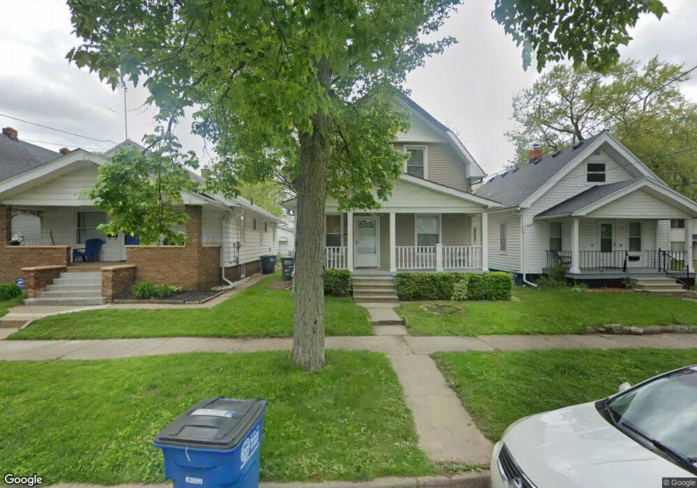
214 Hanover St Toledo, OH 43609
Southside NeighborhoodEstimated Value: $76,000 - $109,134
3
Beds
1
Bath
1,561
Sq Ft
$60/Sq Ft
Est. Value
About This Home
This home is located at 214 Hanover St, Toledo, OH 43609 and is currently estimated at $93,534, approximately $59 per square foot. 214 Hanover St is a home located in Lucas County with nearby schools including Burroughs Elementary School, Bowsher High School, and Explorers Academy of Science and Technology.
Ownership History
Date
Name
Owned For
Owner Type
Purchase Details
Closed on
Feb 28, 2022
Sold by
Switlick Randal L
Bought by
Norton Eliza
Current Estimated Value
Home Financials for this Owner
Home Financials are based on the most recent Mortgage that was taken out on this home.
Original Mortgage
$83,354
Outstanding Balance
$77,675
Interest Rate
3.69%
Mortgage Type
New Conventional
Estimated Equity
$15,859
Purchase Details
Closed on
Sep 7, 2001
Sold by
Nash Robert E
Bought by
Switlick Randal
Home Financials for this Owner
Home Financials are based on the most recent Mortgage that was taken out on this home.
Original Mortgage
$64,600
Interest Rate
7.03%
Purchase Details
Closed on
Jan 7, 1994
Sold by
Ramirez M R
Create a Home Valuation Report for This Property
The Home Valuation Report is an in-depth analysis detailing your home's value as well as a comparison with similar homes in the area
Home Values in the Area
Average Home Value in this Area
Purchase History
| Date | Buyer | Sale Price | Title Company |
|---|---|---|---|
| Norton Eliza | $85,200 | Louisville Title | |
| Switlick Randal | $69,666 | Chelsea Title Agency | |
| -- | $5,300 | -- |
Source: Public Records
Mortgage History
| Date | Status | Borrower | Loan Amount |
|---|---|---|---|
| Open | Norton Eliza | $83,354 | |
| Previous Owner | Switlick Randal | $64,600 |
Source: Public Records
Tax History Compared to Growth
Tax History
| Year | Tax Paid | Tax Assessment Tax Assessment Total Assessment is a certain percentage of the fair market value that is determined by local assessors to be the total taxable value of land and additions on the property. | Land | Improvement |
|---|---|---|---|---|
| 2024 | $894 | $28,350 | $5,285 | $23,065 |
| 2023 | $1,259 | $18,410 | $4,200 | $14,210 |
| 2022 | $1,283 | $18,410 | $4,200 | $14,210 |
| 2021 | $1,288 | $18,410 | $4,200 | $14,210 |
| 2020 | $1,327 | $16,590 | $3,885 | $12,705 |
| 2019 | $1,286 | $16,590 | $3,885 | $12,705 |
| 2018 | $1,233 | $16,590 | $3,885 | $12,705 |
| 2017 | $1,242 | $14,875 | $3,185 | $11,690 |
| 2016 | $1,217 | $42,500 | $9,100 | $33,400 |
| 2015 | $1,179 | $42,500 | $9,100 | $33,400 |
| 2014 | $1,443 | $14,880 | $3,190 | $11,690 |
| 2013 | $962 | $14,880 | $3,190 | $11,690 |
Source: Public Records
Map
Nearby Homes
- 221 Somerset St
- 224 S Fearing Blvd
- 226 Somerset St
- 142 S Detroit Ave
- 321 Mayberry St
- 304 Mayberry St
- 440 Somerset St
- 140 Whiting Ave
- 2126 Airport Hwy
- 1754 Finch St
- 531 Shasta Dr
- 512 Woodsdale Ave
- 1777 South Ave
- 323 Champion St
- 649 Wright Ave
- 556 Apple Ave
- 705 Wright Ave
- 1587 Colton St
- 1574 Colton St
- 1579 Colton St
- 216 Hanover St
- 210 Hanover St
- 220 Hanover St
- 222 Hanover St
- 224 Hanover St
- 215 Somerset St
- 217 Somerset St
- 228 Hanover St
- 211 Hanover St
- 2012 Airline Ave
- 2014 Airline Ave
- 2000 Airline Ave
- 232 Hanover St
- 209 Hanover St
- 2018 Airline Ave
- 215 Hanover St
- 225 Somerset St
- 1998 Airline Ave
- 217 Hanover St
- 2020 Airline Ave