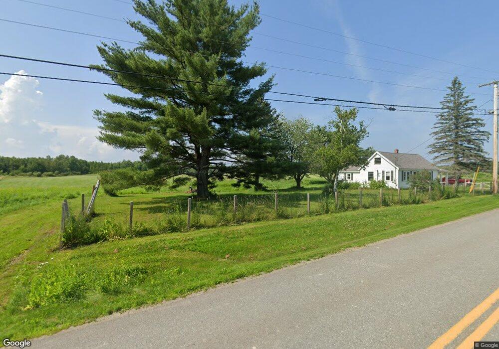
214 Lancaster Brook Rd Glenburn, ME 04401
Estimated Value: $239,695 - $313,000
--
Bed
--
Bath
--
Sq Ft
1.03
Acres
About This Home
This home is located at 214 Lancaster Brook Rd, Glenburn, ME 04401 and is currently estimated at $285,924. 214 Lancaster Brook Rd is a home located in Penobscot County with nearby schools including Glenburn Elementary School, Orono Middle School, and Orono High School.
Ownership History
Date
Name
Owned For
Owner Type
Purchase Details
Closed on
Aug 14, 2008
Sold by
Mudgett Beverly A
Bought by
Mudgett Beverly
Current Estimated Value
Home Financials for this Owner
Home Financials are based on the most recent Mortgage that was taken out on this home.
Original Mortgage
$76,000
Outstanding Balance
$50,052
Interest Rate
6.4%
Mortgage Type
Unknown
Estimated Equity
$235,872
Create a Home Valuation Report for This Property
The Home Valuation Report is an in-depth analysis detailing your home's value as well as a comparison with similar homes in the area
Home Values in the Area
Average Home Value in this Area
Purchase History
| Date | Buyer | Sale Price | Title Company |
|---|---|---|---|
| Mudgett Beverly | -- | -- |
Source: Public Records
Mortgage History
| Date | Status | Borrower | Loan Amount |
|---|---|---|---|
| Open | Mudgett Beverly | $76,000 |
Source: Public Records
Tax History Compared to Growth
Tax History
| Year | Tax Paid | Tax Assessment Tax Assessment Total Assessment is a certain percentage of the fair market value that is determined by local assessors to be the total taxable value of land and additions on the property. | Land | Improvement |
|---|---|---|---|---|
| 2024 | $2,358 | $170,850 | $45,650 | $125,200 |
| 2023 | $2,375 | $170,850 | $45,650 | $125,200 |
| 2022 | $2,385 | $142,380 | $38,050 | $104,330 |
| 2021 | $2,563 | $142,380 | $38,050 | $104,330 |
| 2020 | $2,344 | $142,380 | $38,050 | $104,330 |
| 2019 | $2,598 | $142,380 | $38,050 | $104,330 |
| 2018 | $2,634 | $142,380 | $38,050 | $104,330 |
| 2017 | $3,227 | $152,240 | $21,740 | $130,500 |
| 2016 | $3,074 | $152,200 | $21,700 | $130,500 |
| 2015 | $2,991 | $152,200 | $21,700 | $130,500 |
| 2014 | $2,831 | $152,200 | $21,700 | $130,500 |
| 2012 | $2,976 | $155,400 | $24,900 | $130,500 |
Source: Public Records
Map
Nearby Homes
- 56 Lancaster Brook Rd
- 879 Hudson Rd
- 348 Lakeview Rd
- 549 Hudson Rd
- 1075 Sunset Ave
- 41 Roundstone Dr
- 474 Hudson Rd
- 52 Vista Ridge
- 20 Sandy Dr
- 67 Stacey Ln
- 2740 Ohio St
- 1247 Pushaw Rd
- 1330 Pushaw Rd
- 1441 Pushaw Rd
- 953 Pushaw Rd
- 30 Moonbeam Way
- 45 (#16) Moonbeam Way
- 357 Kelley Rd
- 137 Aa Landing Rd
- 134 Pine Ledge Rd
- 200 Lancaster Brook Rd
- 197 Lancaster Brook Rd
- 207 Lancaster Brook Rd
- 189 Lancaster Brook Rd
- 213 Lancaster Brook Rd
- 188 Lancaster Brook Rd
- 177 Lancaster Brook Rd
- 18 Lancaster Ln
- 223 Lancaster Brook Rd
- 229 Lancaster Brook Rd
- 160 Lancaster Brook Rd
- 28 Lancaster Ln
- 5 Lancaster Ln
- 17 Lancaster Ln
- 235 Lancaster Brook Rd
- 23 Lancaster Ln
- Lot #55 Lancaster Ln
- 22 Mongoose Ln
- 25 Lancaster Ln
- 244 Lancaster Brook Rd