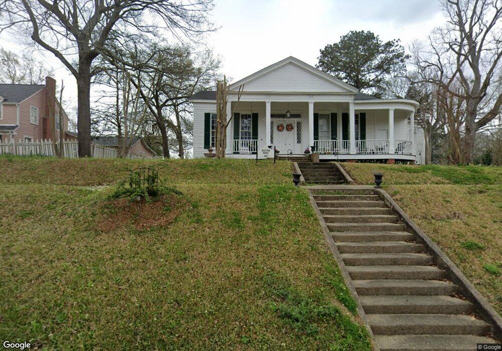
214 Port Gibson St Raymond, MS 39154
Estimated Value: $139,131 - $326,000
Studio
--
Bath
2,764
Sq Ft
$92/Sq Ft
Est. Value
About This Home
This home is located at 214 Port Gibson St, Raymond, MS 39154 and is currently estimated at $255,044, approximately $92 per square foot. 214 Port Gibson St is a home with nearby schools including Raymond High School and Central Hinds Academy.
Ownership History
Date
Name
Owned For
Owner Type
Purchase Details
Closed on
Apr 8, 2016
Sold by
Garrison Richard H
Bought by
Garrison Barbara B
Current Estimated Value
Home Financials for this Owner
Home Financials are based on the most recent Mortgage that was taken out on this home.
Original Mortgage
$85,000
Outstanding Balance
$5,862
Interest Rate
3.68%
Mortgage Type
Commercial
Estimated Equity
$249,182
Purchase Details
Closed on
Feb 22, 2016
Sold by
Boteler William L
Bought by
Garrison Barbara B
Home Financials for this Owner
Home Financials are based on the most recent Mortgage that was taken out on this home.
Original Mortgage
$85,000
Outstanding Balance
$5,862
Interest Rate
3.68%
Mortgage Type
Commercial
Estimated Equity
$249,182
Create a Home Valuation Report for This Property
The Home Valuation Report is an in-depth analysis detailing your home's value as well as a comparison with similar homes in the area
Purchase History
| Date | Buyer | Sale Price | Title Company |
|---|---|---|---|
| Garrison Barbara B | -- | Attorney | |
| Garrison Barbara B | -- | None Available |
Source: Public Records
Mortgage History
| Date | Status | Borrower | Loan Amount |
|---|---|---|---|
| Open | Garrison Barbara B | $85,000 |
Source: Public Records
Tax History
| Year | Tax Paid | Tax Assessment Tax Assessment Total Assessment is a certain percentage of the fair market value that is determined by local assessors to be the total taxable value of land and additions on the property. | Land | Improvement |
|---|---|---|---|---|
| 2025 | $1,870 | $8,498 | $1,500 | $6,998 |
| 2024 | $1,870 | $12,621 | $2,250 | $10,371 |
| 2023 | $1,870 | $8,414 | $1,500 | $6,914 |
| 2022 | $1,199 | $8,414 | $1,500 | $6,914 |
| 2021 | $899 | $8,414 | $1,500 | $6,914 |
| 2020 | $880 | $8,351 | $1,500 | $6,851 |
| 2019 | $875 | $8,351 | $1,500 | $6,851 |
| 2018 | $854 | $8,351 | $1,500 | $6,851 |
| 2017 | $1,664 | $8,351 | $1,500 | $6,851 |
| 2016 | $1,664 | $12,527 | $2,250 | $10,277 |
| 2015 | $1,664 | $12,597 | $2,250 | $10,347 |
| 2014 | $1,638 | $12,597 | $2,250 | $10,347 |
Source: Public Records
Map
Nearby Homes
- 501 Palestine St
- 00 Main St
- 1052 Johnson Dr
- 00 Ratliff Rd
- 131 Valley Dr
- 000 SE Meets and Bounds
- 14999 Dry Grove Rd
- 00 Drake Landing
- 0 Wood Duck Cove Unit 4116304
- 140 Cedar Ridge Rd
- 1039 Hall Ln
- 131 Chapel Cliff Dr
- 7994 Midway Rd
- 121 Fox Run Dr
- 1700 Dunn Pease Rd
- 1600 Wright Rd
- 0 Mcfarland Rd Unit 21460112
- 0 Emily Way Dr Unit 4025182
- 0 Ms-18 Unit 4120558
- 0 Ms-18 Unit 4120556
- 206 Port Gibson St
- 204 Port Gibson St
- 221 Port Gibson St
- 124 Palestine St
- 213 Port Gibson St
- 230 Port Gibson St
- 150 Palestine St
- 125 Palestine St
- 241 Old Port Gibson St
- 202 Palestine St
- 249 Port Gibson St
- 204 Gillespie Cir
- 252 Port Gibson St
- 110 Main St
- 212 Palestine St
- 114 E Main St
- 104 Main St
- 123 Main St
- 118 S Oak
- 118 S Oak
Your Personal Tour Guide
Ask me questions while you tour the home.