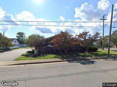
214 S Crutchfield St Dobson, NC 27017
Estimated Value: $1,106,588
--
Bed
6
Baths
3,089
Sq Ft
$358/Sq Ft
Est. Value
About This Home
This home is located at 214 S Crutchfield St, Dobson, NC 27017 and is currently estimated at $1,106,588, approximately $358 per square foot. 214 S Crutchfield St is a home located in Surry County with nearby schools including Dobson Elementary School, Central Middle School, and Surry Central High School.
Ownership History
Date
Name
Owned For
Owner Type
Purchase Details
Closed on
Oct 11, 2021
Sold by
Dod Re Llc
Bought by
Store Mstr Fund 22 Llc
Current Estimated Value
Home Financials for this Owner
Home Financials are based on the most recent Mortgage that was taken out on this home.
Original Mortgage
$10,000
Outstanding Balance
$9,355
Interest Rate
3.01%
Mortgage Type
Purchase Money Mortgage
Purchase Details
Closed on
Jun 13, 2018
Sold by
Tumbarello Michael R and Tumbarello Robyn L
Bought by
Dod Re Llc
Home Financials for this Owner
Home Financials are based on the most recent Mortgage that was taken out on this home.
Original Mortgage
$238,500
Interest Rate
4.6%
Mortgage Type
Credit Line Revolving
Create a Home Valuation Report for This Property
The Home Valuation Report is an in-depth analysis detailing your home's value as well as a comparison with similar homes in the area
Home Values in the Area
Average Home Value in this Area
Purchase History
| Date | Buyer | Sale Price | Title Company |
|---|---|---|---|
| Store Mstr Fund 22 Llc | $920,000 | None Available | |
| Dod Re Llc | $265,000 | -- |
Source: Public Records
Mortgage History
| Date | Status | Borrower | Loan Amount |
|---|---|---|---|
| Open | Store Mstr Fund 22 Llc | $10,000 | |
| Previous Owner | Dod Re Llc | $604,610 | |
| Previous Owner | Dod Re Llc | $238,500 | |
| Previous Owner | Tumbarello Michael R | $201,000 |
Source: Public Records
Tax History Compared to Growth
Tax History
| Year | Tax Paid | Tax Assessment Tax Assessment Total Assessment is a certain percentage of the fair market value that is determined by local assessors to be the total taxable value of land and additions on the property. | Land | Improvement |
|---|---|---|---|---|
| 2024 | $5,980 | $608,950 | $86,250 | $522,700 |
| 2023 | $5,860 | $608,950 | $86,250 | $522,700 |
| 2022 | $5,860 | $608,950 | $86,250 | $522,700 |
| 2021 | $2,668 | $271,690 | $86,250 | $185,440 |
| 2020 | $2,791 | $275,780 | $86,250 | $189,530 |
| 2019 | $2,791 | $275,780 | $0 | $0 |
| 2018 | $2,604 | $275,780 | $0 | $0 |
| 2017 | $2,657 | $276,190 | $0 | $0 |
| 2016 | $2,657 | $276,190 | $0 | $0 |
| 2013 | -- | $277,170 | $0 | $0 |
Source: Public Records
Map
Nearby Homes
- 0 Main St Unit 1127207
- 0000 N Main St
- 215 Fowler Cir
- 394 Forest Oaks Dr
- 1 Arthur Haney Rd
- 165 Snowberry Ln
- 0 Abner Ln
- 125 Edwards Farm Ln
- 2988 Old Highway 601
- 2853 Old Highway 601
- 648 Union Cross Rd
- 00 Rockford Rd
- 125 Whistle Stop Ln
- 195 Piney Grove Rd
- 7513 U S 601
- 189 Village Main Trail
- 00 Money Rd
- 1275 White Dirt Rd
- 209 Serenity Way
- 261 Helaman Way
- 214 S Crutchfield St
- 218 S Crutchfield St
- 213 S Crutchfield St
- 220 S Crutchfield St
- 217 S Crutchfield St
- 224 S Crutchfield St
- 219 S Crutchfield St
- 232 Mike St
- 230 Mike St
- 223 S Crutchfield St
- 220 S Main St
- 226 Mike St
- 228 Crutchfield Rd
- 208 Mike St
- 214 Mike St
- 229 S Crutchfield St
- 233 Mike St
- 229 Mike St
- 207 Mike St
- 302 S Crutchfield St
