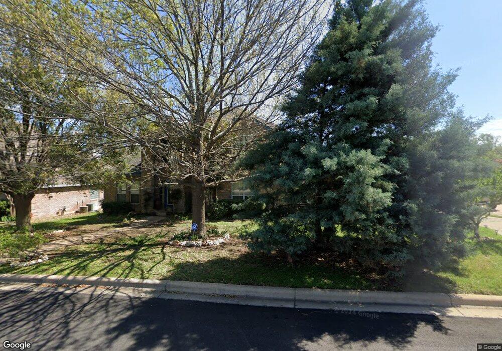
214 S Ridge Cir Georgetown, TX 78628
Estimated Value: $455,574 - $562,000
3
Beds
3
Baths
2,422
Sq Ft
$215/Sq Ft
Est. Value
About This Home
This home is located at 214 S Ridge Cir, Georgetown, TX 78628 and is currently estimated at $520,394, approximately $214 per square foot. 214 S Ridge Cir is a home located in Williamson County with nearby schools including Dell Pickett Elementary School, James Tippit Middle School, and East View High School.
Ownership History
Date
Name
Owned For
Owner Type
Purchase Details
Closed on
Feb 23, 2010
Sold by
Greenfield Chester C and Greenfield Janet L
Bought by
Gambone Lawrence C and Gambone Marilyn A
Current Estimated Value
Home Financials for this Owner
Home Financials are based on the most recent Mortgage that was taken out on this home.
Original Mortgage
$173,200
Outstanding Balance
$114,744
Interest Rate
5.05%
Mortgage Type
New Conventional
Estimated Equity
$405,650
Create a Home Valuation Report for This Property
The Home Valuation Report is an in-depth analysis detailing your home's value as well as a comparison with similar homes in the area
Home Values in the Area
Average Home Value in this Area
Purchase History
| Date | Buyer | Sale Price | Title Company |
|---|---|---|---|
| Gambone Lawrence C | -- | Longhorn Title Co Inc |
Source: Public Records
Mortgage History
| Date | Status | Borrower | Loan Amount |
|---|---|---|---|
| Open | Gambone Lawrence C | $173,200 |
Source: Public Records
Tax History Compared to Growth
Tax History
| Year | Tax Paid | Tax Assessment Tax Assessment Total Assessment is a certain percentage of the fair market value that is determined by local assessors to be the total taxable value of land and additions on the property. | Land | Improvement |
|---|---|---|---|---|
| 2025 | $3,355 | $500,199 | $105,000 | $395,199 |
| 2024 | $3,355 | $447,174 | -- | -- |
| 2023 | $3,181 | $406,522 | $0 | $0 |
| 2022 | $7,255 | $369,565 | $0 | $0 |
| 2021 | $7,337 | $335,968 | $77,000 | $309,215 |
| 2020 | $6,773 | $305,425 | $71,437 | $233,988 |
| 2019 | $7,507 | $328,097 | $66,019 | $262,078 |
| 2018 | $5,304 | $319,381 | $66,019 | $253,362 |
| 2017 | $7,300 | $316,094 | $61,700 | $254,394 |
| 2016 | $6,733 | $291,541 | $61,700 | $229,841 |
| 2015 | $5,444 | $271,606 | $50,200 | $221,406 |
| 2014 | $5,444 | $261,437 | $0 | $0 |
Source: Public Records
Map
Nearby Homes
- 303 S Ridge Cir
- 213 Oakwood Dr
- 100 S Ridge Cir
- 305 River Ridge Dr
- 105 Tallwood Dr
- 318 Ridge Run Dr
- 205 Ridge Run Ct
- 221 Running Fawn
- Whitney Plan at West Bend - Wolf Ranch South Fork
- Bristol Plan at West Bend - Wolf Ranch South Fork
- Thomas Plan at West Bend - Wolf Ranch South Fork
- Tristan Plan at West Bend - Wolf Ranch South Fork
- Thatcher Plan at West Bend - Wolf Ranch South Fork
- Brady Plan at West Bend - Wolf Ranch South Fork
- Huntley II Plan at West Bend - Wolf Ranch South Fork
- 1213 River Trace
- 300 Innwood Dr
- 304 Innwood Dr
- 1232 River Trace
- 101 Ashmore Ln
- 216 S Ridge Cir
- 212 S Ridge Cir
- 305 Norwood St W
- 401 Norwood St W
- 303 Norwood St W
- 215 S Ridge Cir
- 218 South Ridge
- 218 S Ridge Cir
- 403 Norwood St W
- 217 S Ridge Cir
- 301 Norwood St W
- 211 S Ridge Cir
- 208 S Ridge Cir
- 211 River Bow Dr
- 405 Norwood St W
- 305 S Ridge Cir
- 307 S Ridge Cir
- 214 River Bow Dr
- 209 Norwood St W