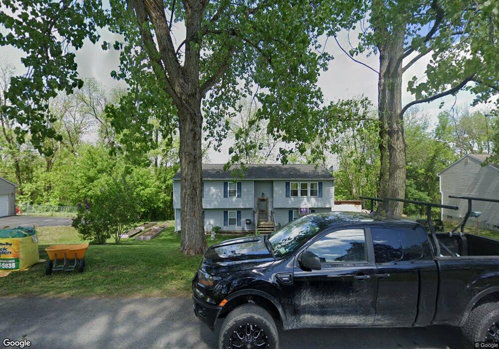
214 Samantha Dr Fort Edward, NY 12828
Estimated Value: $270,000 - $331,000
4
Beds
2
Baths
2,216
Sq Ft
$134/Sq Ft
Est. Value
About This Home
This home is located at 214 Samantha Dr, Fort Edward, NY 12828 and is currently estimated at $297,511, approximately $134 per square foot. 214 Samantha Dr is a home located in Washington County with nearby schools including Fort Edward School.
Ownership History
Date
Name
Owned For
Owner Type
Purchase Details
Closed on
Jul 17, 2003
Sold by
Home Exterior Industries Inc
Bought by
Constantineau Jeffrey
Current Estimated Value
Purchase Details
Closed on
Jun 10, 2003
Sold by
Leonbruno Peter
Bought by
Home Exterior Industries Inc
Purchase Details
Closed on
Jun 6, 2003
Sold by
Shelter Homes
Bought by
Leonbruno Peter
Purchase Details
Closed on
Nov 4, 1998
Sold by
County Washington
Bought by
Leobruno Peter
Create a Home Valuation Report for This Property
The Home Valuation Report is an in-depth analysis detailing your home's value as well as a comparison with similar homes in the area
Home Values in the Area
Average Home Value in this Area
Purchase History
| Date | Buyer | Sale Price | Title Company |
|---|---|---|---|
| Constantineau Jeffrey | $100,000 | Christopher Nenninger | |
| Home Exterior Industries Inc | $11,000 | Wililam Nikas | |
| Leonbruno Peter | -- | -- | |
| Leobruno Peter | $3,750 | -- |
Source: Public Records
Tax History Compared to Growth
Tax History
| Year | Tax Paid | Tax Assessment Tax Assessment Total Assessment is a certain percentage of the fair market value that is determined by local assessors to be the total taxable value of land and additions on the property. | Land | Improvement |
|---|---|---|---|---|
| 2024 | $7,902 | $225,000 | $30,800 | $194,200 |
| 2023 | $7,931 | $225,000 | $30,800 | $194,200 |
| 2022 | $7,950 | $225,000 | $30,800 | $194,200 |
| 2021 | $7,783 | $136,000 | $15,500 | $120,500 |
| 2020 | $7,334 | $136,000 | $15,500 | $120,500 |
| 2019 | $6,904 | $136,000 | $15,500 | $120,500 |
| 2018 | $6,904 | $136,000 | $15,500 | $120,500 |
| 2017 | $8,516 | $136,000 | $15,500 | $120,500 |
| 2016 | $5,586 | $136,000 | $15,500 | $120,500 |
| 2015 | -- | $136,000 | $15,500 | $120,500 |
| 2014 | -- | $136,000 | $15,500 | $120,500 |
Source: Public Records
Map
Nearby Homes
- L 75 Frederick Dr
- L1.1 Drifting Ridge Rd
- 418 Tori Trace
- 420 Tori Trace
- 415 Tori Trace
- 411 Tori Trace
- 410 Tori Trace
- 44-46 Notre Dame St
- 3040 County Route 46
- 99 State Route 197
- 11 Bridge St Unit 13
- 109-111 Broadway
- 8 Bridge St
- 82 East St
- 2434 State Route 4
- 27-29 Taylor St
- 12 Laurel Rd
- 24 Wing St
- 4 Keating Ave
- 2 Birch Dr
- 216 Samantha Dr
- 216 Samantha Dr
- 218 Samantha Dr
- 215 Samantha Dr
- 212 Samantha Dr
- 302 Andrew Ln
- 2 Samantha Dr
- 220 Samantha Dr
- 220 Samantha Dr
- 219 Samantha Dr
- 304 Andrew Ln
- 210 Samantha Dr
- 207 Samantha Dr
- 301 Andrew Ln
- 306 Andrew Ln
- 303 Andrew Ln
- 226 Samantha Dr
- 228 Samantha Dr
- 222 Samantha St
- 206 Samantha Dr