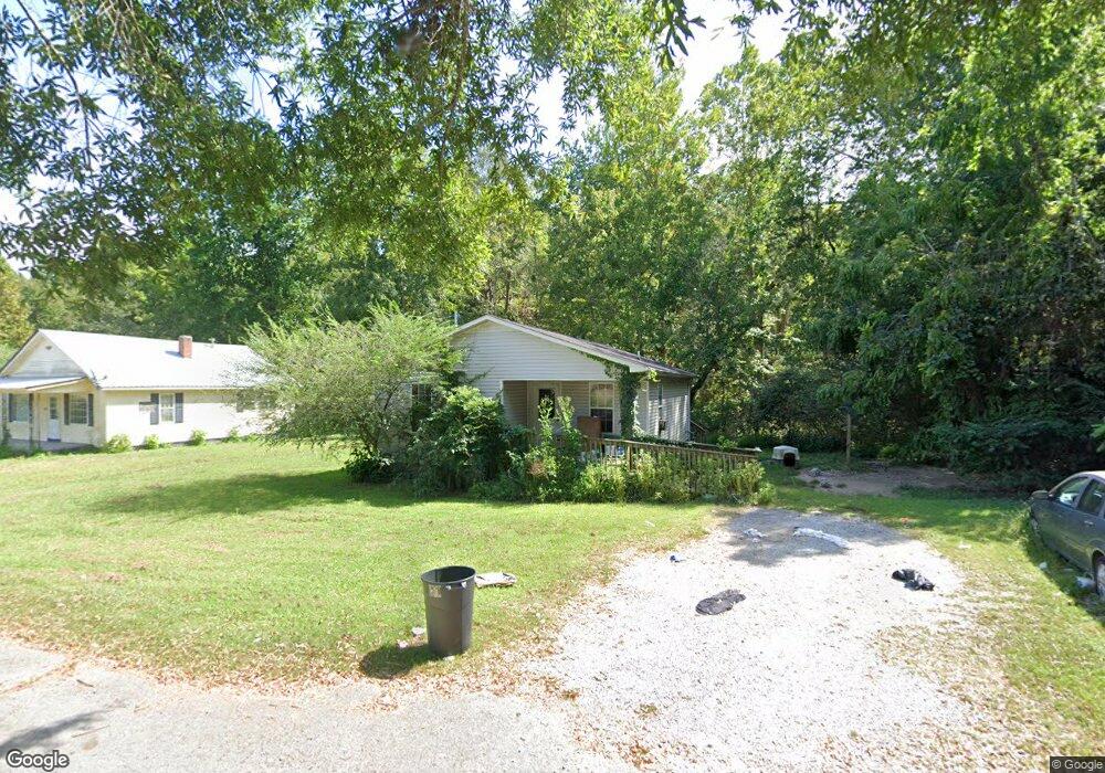
214 Shelton St Linden, TN 37096
Estimated Value: $103,704 - $281,000
--
Bed
2
Baths
858
Sq Ft
$211/Sq Ft
Est. Value
About This Home
This home is located at 214 Shelton St, Linden, TN 37096 and is currently estimated at $181,176, approximately $211 per square foot. 214 Shelton St is a home located in Perry County.
Ownership History
Date
Name
Owned For
Owner Type
Purchase Details
Closed on
Oct 30, 2024
Sold by
Coble Norma Lee
Bought by
Coble Nicholas Lee
Current Estimated Value
Purchase Details
Closed on
Feb 18, 1989
Bought by
Pevahouse Tommy W and Pevahouse Helen M
Purchase Details
Closed on
May 19, 1988
Bought by
Szuliman Sandor and Szuliman Margarette
Purchase Details
Closed on
Jan 2, 1977
Purchase Details
Closed on
Jan 1, 1977
Create a Home Valuation Report for This Property
The Home Valuation Report is an in-depth analysis detailing your home's value as well as a comparison with similar homes in the area
Home Values in the Area
Average Home Value in this Area
Purchase History
| Date | Buyer | Sale Price | Title Company |
|---|---|---|---|
| Coble Nicholas Lee | -- | None Listed On Document | |
| Pevahouse Tommy W | $21,000 | -- | |
| Szuliman Sandor | -- | -- | |
| -- | $5,000 | -- | |
| -- | $5,000 | -- |
Source: Public Records
Tax History Compared to Growth
Tax History
| Year | Tax Paid | Tax Assessment Tax Assessment Total Assessment is a certain percentage of the fair market value that is determined by local assessors to be the total taxable value of land and additions on the property. | Land | Improvement |
|---|---|---|---|---|
| 2025 | $457 | $16,325 | $0 | $0 |
| 2024 | $457 | $16,325 | $1,625 | $14,700 |
| 2023 | $457 | $16,325 | $1,625 | $14,700 |
| 2022 | $457 | $16,325 | $1,625 | $14,700 |
| 2021 | $457 | $16,325 | $1,625 | $14,700 |
| 2020 | $375 | $16,325 | $1,625 | $14,700 |
| 2019 | $505 | $16,925 | $1,625 | $15,300 |
| 2018 | $505 | $16,925 | $1,625 | $15,300 |
| 2017 | $500 | $16,925 | $1,625 | $15,300 |
| 2016 | $500 | $16,925 | $1,625 | $15,300 |
| 2015 | $492 | $16,925 | $1,625 | $15,300 |
| 2014 | $492 | $16,925 | $1,625 | $15,300 |
| 2013 | $468 | $16,115 | $0 | $0 |
Source: Public Records
Map
Nearby Homes
- 218 Cedar Ave
- 122 Shelton St
- 141 Maple St
- 245 S Mill St
- 0 Church St
- 0 Treadwell Prong Unit RTC2707562
- 628 Starlight Dr
- 8884 U S Highway 412
- 130 Elm Ln
- 2017 Airport Ridge Rd
- 0 U S Highway 412
- 107 Possum Trot Ln
- Lot 5 Campers Ln
- Lot 7 Campers Ln
- Lot 9 Campers Ln
- 2082 Airport Ridge Rd
- Lot 15 Campers Ln
- Lot 11 Campers Ln
- Lot 4 Campers Ln
- Lot 8 Campers Ln
- 210 Shelton St
- 243 Meadow Brook Dr
- 206 Shelton St
- 246 Meadow Brook Dr
- 204 Shelton St
- 239 Meadow Brook Dr
- 240 Meadow Brook Dr
- 247 Brooklyn Ave
- 242 Graham St
- 200 Shelton St
- 235 Meadow Brook Dr
- 167 W Brooklyn St
- 238 Meadow Brook Dr
- 243 Brooklyn Ave
- 238 Graham St
- 231 Meadow Brook Dr
- 236 Meadow Brook Dr
- 236 Graham St
- 152 Shelton St
- 239 Brooklyn Ave