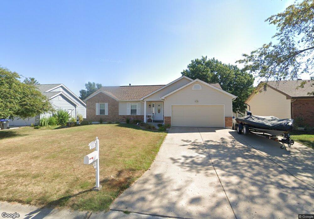
214 Surrey Ct O Fallon, MO 63366
Estimated Value: $313,000 - $392,000
3
Beds
2
Baths
1,468
Sq Ft
$239/Sq Ft
Est. Value
About This Home
This home is located at 214 Surrey Ct, O Fallon, MO 63366 and is currently estimated at $350,590, approximately $238 per square foot. 214 Surrey Ct is a home located in St. Charles County with nearby schools including Joseph L. Mudd Elementary School, Forest Park Elementary School, and Fort Zumwalt North Middle School.
Ownership History
Date
Name
Owned For
Owner Type
Purchase Details
Closed on
Jul 24, 1998
Sold by
Paul Wiley A and Paul Ernestine L
Bought by
Holloway Scott A and Holloway Candy A
Current Estimated Value
Home Financials for this Owner
Home Financials are based on the most recent Mortgage that was taken out on this home.
Original Mortgage
$91,600
Outstanding Balance
$18,150
Interest Rate
6.94%
Estimated Equity
$332,440
Create a Home Valuation Report for This Property
The Home Valuation Report is an in-depth analysis detailing your home's value as well as a comparison with similar homes in the area
Home Values in the Area
Average Home Value in this Area
Purchase History
| Date | Buyer | Sale Price | Title Company |
|---|---|---|---|
| Holloway Scott A | $114,500 | -- |
Source: Public Records
Mortgage History
| Date | Status | Borrower | Loan Amount |
|---|---|---|---|
| Open | Holloway Scott A | $91,600 |
Source: Public Records
Tax History
| Year | Tax Paid | Tax Assessment Tax Assessment Total Assessment is a certain percentage of the fair market value that is determined by local assessors to be the total taxable value of land and additions on the property. | Land | Improvement |
|---|---|---|---|---|
| 2025 | $3,276 | $54,010 | -- | -- |
| 2024 | $3,276 | $49,413 | -- | -- |
| 2023 | $3,277 | $49,413 | -- | -- |
| 2022 | $3,070 | $43,055 | $0 | $0 |
| 2021 | $3,072 | $43,055 | $0 | $0 |
| 2020 | $2,863 | $38,880 | $0 | $0 |
| 2019 | $2,870 | $38,880 | $0 | $0 |
| 2018 | $2,578 | $33,322 | $0 | $0 |
| 2017 | $2,542 | $33,322 | $0 | $0 |
| 2016 | $2,392 | $31,235 | $0 | $0 |
| 2015 | $2,224 | $31,235 | $0 | $0 |
| 2014 | $2,200 | $30,383 | $0 | $0 |
Source: Public Records
Map
Nearby Homes
- 731 Cordes St
- 0 Montbrook Dr
- 423 Woodlawn Ave
- 734 Sunset Ln
- 503 Imperial Ct
- 24 Hawthorne Ct
- 38 Downing St
- 205 E Elm St
- 151 N Wellington St
- 309 E Pitman St
- 6 Emerson Ct
- 4 Shinnecock Hills
- 203 Saint Margaret Ln
- 201 Allen Dr
- 6 S Boxwood Ln
- 962 Midpoint Dr
- 11 Southern Hills Ct
- 10 Southern Hills Ct
- 409 Saint Joseph Ave
- 508 Saint Christopher Dr
- 218 Surrey Ct
- 210 Surrey Ct
- 215 Birmingham Dr
- 219 Birmingham Dr
- 206 Surrey Ct
- 211 Birmingham Dr
- 222 Surrey Ct
- 301 Bristol Place
- 223 Birmingham Dr
- 207 Birmingham Dr
- 0TBB Bristol II
- 0TBB Bristol
- 207 Surrey Ct
- 226 Surrey Ct
- 210 Westridge Dr
- 227 Birmingham Dr
- 302 Bristol Place
- 305 Bristol Place
- 203 Birmingham Dr
- 203 Surrey Ct
Your Personal Tour Guide
Ask me questions while you tour the home.