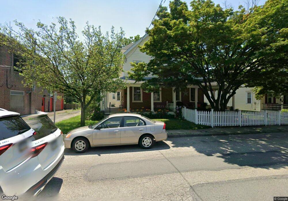
214 W Glenside Ave Glenside, PA 19038
Estimated Value: $334,000 - $435,218
5
Beds
2
Baths
1,964
Sq Ft
$195/Sq Ft
Est. Value
About This Home
This home is located at 214 W Glenside Ave, Glenside, PA 19038 and is currently estimated at $383,305, approximately $195 per square foot. 214 W Glenside Ave is a home located in Montgomery County with nearby schools including Elkins Park School, Cedarbrook Middle School, and Cheltenham High School.
Ownership History
Date
Name
Owned For
Owner Type
Purchase Details
Closed on
Jul 10, 2009
Sold by
Hensley Wei and Ambrose Michael
Bought by
Ambrose Wei L and Ambrose Michael J
Current Estimated Value
Purchase Details
Closed on
Jul 6, 2006
Sold by
Chawla Sameer N and Chawla Cynamon K
Bought by
Ambrose Michael and Hensley Wei
Home Financials for this Owner
Home Financials are based on the most recent Mortgage that was taken out on this home.
Original Mortgage
$100,000
Outstanding Balance
$59,433
Interest Rate
6.67%
Estimated Equity
$323,872
Purchase Details
Closed on
Jan 4, 2002
Sold by
Harrison Martin J and Harrison Karen M
Bought by
Chawla Sameer N and Chawla Cynamon K
Purchase Details
Closed on
May 20, 1994
Sold by
Bravo Stella
Bought by
Harrison Martin J and Harrison Karen M
Create a Home Valuation Report for This Property
The Home Valuation Report is an in-depth analysis detailing your home's value as well as a comparison with similar homes in the area
Home Values in the Area
Average Home Value in this Area
Purchase History
| Date | Buyer | Sale Price | Title Company |
|---|---|---|---|
| Ambrose Wei L | -- | None Available | |
| Ambrose Michael | $273,000 | None Available | |
| Chawla Sameer N | $166,000 | -- | |
| Harrison Martin J | $110,000 | T A Title Insurance Company |
Source: Public Records
Mortgage History
| Date | Status | Borrower | Loan Amount |
|---|---|---|---|
| Open | Ambrose Michael | $100,000 |
Source: Public Records
Tax History Compared to Growth
Tax History
| Year | Tax Paid | Tax Assessment Tax Assessment Total Assessment is a certain percentage of the fair market value that is determined by local assessors to be the total taxable value of land and additions on the property. | Land | Improvement |
|---|---|---|---|---|
| 2025 | $6,924 | $103,680 | $45,820 | $57,860 |
| 2024 | $6,924 | $103,680 | $45,820 | $57,860 |
| 2023 | $6,846 | $103,680 | $45,820 | $57,860 |
| 2022 | $6,729 | $103,680 | $45,820 | $57,860 |
| 2021 | $6,545 | $103,680 | $45,820 | $57,860 |
| 2020 | $6,356 | $103,680 | $45,820 | $57,860 |
| 2019 | $6,229 | $103,680 | $45,820 | $57,860 |
| 2018 | $2,065 | $103,680 | $45,820 | $57,860 |
| 2017 | $5,947 | $103,680 | $45,820 | $57,860 |
| 2016 | $5,907 | $103,680 | $45,820 | $57,860 |
| 2015 | $5,632 | $103,680 | $45,820 | $57,860 |
| 2014 | $5,632 | $103,680 | $45,820 | $57,860 |
Source: Public Records
Map
Nearby Homes
- 119 S Easton Rd
- 400 W Glenside Ave
- 221 S Easton Rd
- 158 S Keswick Ave
- 231 Roberts Ave
- 229 Parkside Ln
- 504 Plymouth Rd
- 307 Roslyn Ave
- 65 Limekiln Pike
- 354 Roberts Ave
- 540 Beaver Rd
- 229 Edge Hill Rd
- 615 Mulford Rd
- 0 Tyson Ave Unit PAMC2112670
- 446 Twickenham Rd
- 340 Locust Rd
- 2541 Church Rd
- 1600 Church Rd Unit A107
- 1600 Church Rd Unit C-207
- 1600 Church Rd Unit A-306
- 216 W Glenside Ave
- 220 W Glenside Ave
- 108 Lismore Ave
- 110 Lismore Ave
- 114 Lismore Ave Unit 20
- 224 W Glenside Ave
- 228 W Glenside Ave Unit 37
- 111 S Lynwood Ave Unit 26
- 128 Lismore Ave
- 115 S Lynwood Ave
- 302 W Glenside Ave
- 119 S Lynwood Ave
- 306 W Glenside Ave
- 307 W Glenside Ave
- 22 Huber St
- 134 Lismore Ave
- 101 Lismore Ave
- 105 Lismore Ave
- 115 Lismore Ave
- 114 S Lynwood Ave