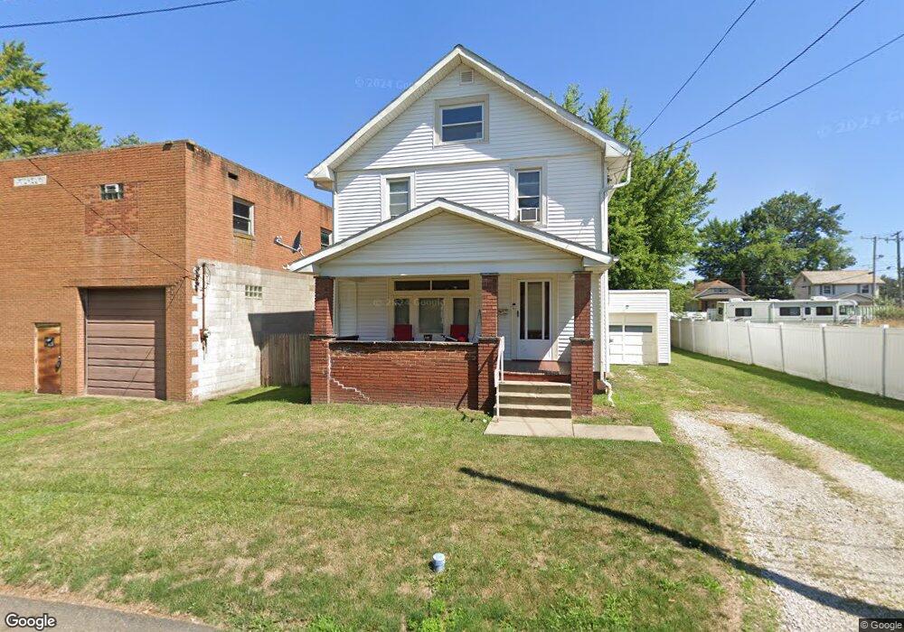
214 Williams Place Alliance, OH 44601
Estimated Value: $86,059 - $98,000
3
Beds
1
Bath
1,296
Sq Ft
$72/Sq Ft
Est. Value
About This Home
This home is located at 214 Williams Place, Alliance, OH 44601 and is currently estimated at $93,265, approximately $71 per square foot. 214 Williams Place is a home located in Stark County with nearby schools including Alliance Elementary School at Rockhill, Alliance Intermediate School at Northside, and Alliance Middle School.
Ownership History
Date
Name
Owned For
Owner Type
Purchase Details
Closed on
Sep 5, 2013
Sold by
Dossi Victor and Dossi Gloria M
Bought by
Carter Albert D
Current Estimated Value
Purchase Details
Closed on
Jan 16, 1992
Purchase Details
Closed on
Nov 4, 1991
Purchase Details
Closed on
Sep 4, 1991
Create a Home Valuation Report for This Property
The Home Valuation Report is an in-depth analysis detailing your home's value as well as a comparison with similar homes in the area
Home Values in the Area
Average Home Value in this Area
Purchase History
| Date | Buyer | Sale Price | Title Company |
|---|---|---|---|
| Carter Albert D | $20,000 | None Available | |
| -- | $15,000 | -- | |
| -- | $12,000 | -- | |
| -- | -- | -- |
Source: Public Records
Tax History Compared to Growth
Tax History
| Year | Tax Paid | Tax Assessment Tax Assessment Total Assessment is a certain percentage of the fair market value that is determined by local assessors to be the total taxable value of land and additions on the property. | Land | Improvement |
|---|---|---|---|---|
| 2025 | -- | $24,470 | $3,500 | $20,970 |
| 2024 | -- | $24,470 | $3,500 | $20,970 |
| 2023 | $621 | $15,090 | $1,930 | $13,160 |
| 2022 | $625 | $15,090 | $1,930 | $13,160 |
| 2021 | $627 | $15,090 | $1,930 | $13,160 |
| 2020 | $562 | $12,640 | $1,680 | $10,960 |
| 2019 | $555 | $12,640 | $1,680 | $10,960 |
| 2018 | $557 | $12,640 | $1,680 | $10,960 |
| 2017 | $506 | $11,270 | $1,400 | $9,870 |
| 2016 | $510 | $11,270 | $1,400 | $9,870 |
| 2015 | $540 | $11,270 | $1,400 | $9,870 |
| 2014 | $274 | $5,710 | $1,260 | $4,450 |
| 2013 | $91 | $3,820 | $1,260 | $2,560 |
Source: Public Records
Map
Nearby Homes
- 807 S Union Ave
- 452 E Summit St
- 1005 S Freedom Ave
- 1175 S Freedom Ave
- 432 S Linden Ave
- 140 W Summit St
- 427 S Union Ave
- 1044 S Liberty Ave
- 551 South St
- V/L S Fredeom Ave
- 356 E Broadway St
- 814 Milner St
- 1437 S Linden Ave
- 442 S Liberty Ave
- 1475 Chatauqua Ct
- 831 Wade Ave
- 1395 S Webb Ave
- 729 Waugh St
- 361 E Main St
- 815 Grace St
- 206 Williams Place
- 213 E Grant St
- 189 E Grant St
- 213 Williams Place
- 203 E Grant St
- 205 Williams Place
- 183 Williams Place
- 177 E Grant St
- 175 Williams Place
- 169 E Grant St
- 218 Rosenberry St
- 165 E Grant St
- 762 S Mechanic Ave
- 248 E Grant St
- 204 Rosenberry St
- 222 Rosenberry St
- 149 E Grant St
- 178 E Grant St
- 234 Rosenberry St
- 186 Rosenberry St