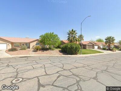
2141 E 390 N St. George, UT 84790
Estimated Value: $424,000 - $460,000
3
Beds
2
Baths
1,519
Sq Ft
$287/Sq Ft
Est. Value
About This Home
This home is located at 2141 E 390 N, St. George, UT 84790 and is currently estimated at $436,411, approximately $287 per square foot. 2141 E 390 N is a home located in Washington County with nearby schools including Panorama School, Pine View Middle School, and Fossil Ridge Intermediate School.
Ownership History
Date
Name
Owned For
Owner Type
Purchase Details
Closed on
Feb 25, 2016
Sold by
Berman Robert J
Bought by
B Girls Properties Llc
Current Estimated Value
Purchase Details
Closed on
May 10, 2010
Sold by
Hsbc Bank Usa National Association
Bought by
Berman Robert J
Purchase Details
Closed on
Apr 1, 2010
Sold by
Torreblanca Jose A and Torreblanca Maribel
Bought by
Hsbc Bank Usa National Association and Naac 2007-2
Purchase Details
Closed on
Jan 23, 2007
Sold by
Brady Donna R
Bought by
Torreblanca Jose A and Torreblanca Maribel
Home Financials for this Owner
Home Financials are based on the most recent Mortgage that was taken out on this home.
Original Mortgage
$269,900
Interest Rate
6.1%
Mortgage Type
Purchase Money Mortgage
Create a Home Valuation Report for This Property
The Home Valuation Report is an in-depth analysis detailing your home's value as well as a comparison with similar homes in the area
Home Values in the Area
Average Home Value in this Area
Purchase History
| Date | Buyer | Sale Price | Title Company |
|---|---|---|---|
| B Girls Properties Llc | -- | None Available | |
| Berman Robert J | -- | Backman Fptp | |
| Hsbc Bank Usa National Association | $136,000 | Etitle Insurance Agency | |
| Torreblanca Jose A | -- | Guardian Title Co |
Source: Public Records
Mortgage History
| Date | Status | Borrower | Loan Amount |
|---|---|---|---|
| Previous Owner | Torreblanca Jose A | $269,900 |
Source: Public Records
Tax History Compared to Growth
Tax History
| Year | Tax Paid | Tax Assessment Tax Assessment Total Assessment is a certain percentage of the fair market value that is determined by local assessors to be the total taxable value of land and additions on the property. | Land | Improvement |
|---|---|---|---|---|
| 2023 | $1,583 | $236,500 | $55,000 | $181,500 |
| 2022 | $1,685 | $236,720 | $54,890 | $181,830 |
| 2021 | $1,503 | $314,900 | $84,000 | $230,900 |
| 2020 | $1,337 | $263,800 | $63,000 | $200,800 |
| 2019 | $1,314 | $253,300 | $63,000 | $190,300 |
| 2018 | $1,275 | $123,200 | $0 | $0 |
| 2017 | $1,210 | $116,930 | $0 | $0 |
| 2016 | $1,255 | $112,200 | $0 | $0 |
| 2015 | $2,200 | $188,700 | $0 | $0 |
| 2014 | $2,057 | $177,500 | $0 | $0 |
Source: Public Records
Map
Nearby Homes
- 2170 E 575 N
- 2071 E 575 N
- 402 N 2370 E
- 345 N 2450 E Unit 236
- 345 N 2450 E Unit 142
- 345 N 2450 E Unit 239
- 345 N 2450 E Unit 193
- 616 N 2330 E
- 646 N 2000 E
- 2088 Panorama Pkwy N
- 675 N 2240 E
- 345 N 2450 E Unit 193
- 114 N 2000 E
- 2105 Panorama Pkwy N
- 210 N Mall Dr Unit 139
- 2577 E 430 N
- 280 N Sunflower Dr Unit 25
- 2379 E Crimson Cir
- 600 N 2450 E Unit 1903
- 2408 E 80 Cir N
- 2141 E 390 N
- 2141 E 390 North Cir
- 392 N 2110 Cir E
- 2138 E 390 North Cir
- 2155 E 390 N
- 392 N 2110 East Cir
- 2155 E 390 North Cir
- 404 N 2110 Cir E
- 404 N 2110 East Cir
- 380 N 2110 East Cir
- 380 N 2110 Cir E
- 2152 E 390 North Cir
- 2154 E 430 North Cir
- 2142 E 430 N
- 2142 E 430 North Cir
- 2142 E 430 North Cir
- 416 N 2110 East Cir
- 416 N 2110 E
- 368 N 2110 East Cir
- 368 N 2110 Cir E