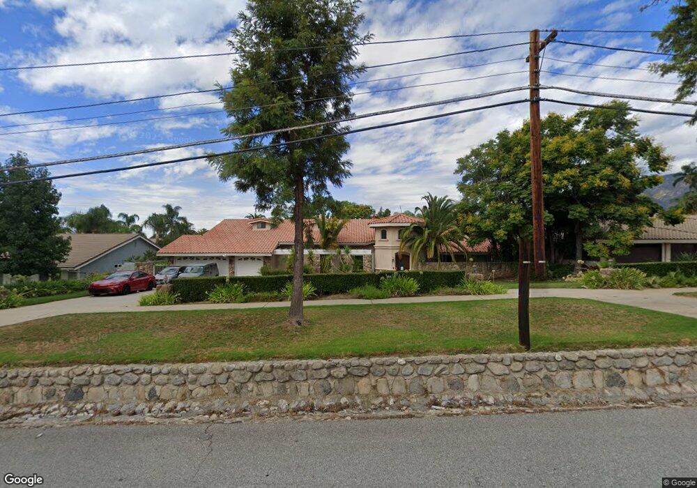
2141 N Euclid Ave Upland, CA 91784
Estimated Value: $1,451,356 - $1,628,000
4
Beds
3
Baths
4,059
Sq Ft
$381/Sq Ft
Est. Value
About This Home
This home is located at 2141 N Euclid Ave, Upland, CA 91784 and is currently estimated at $1,544,785, approximately $380 per square foot. 2141 N Euclid Ave is a home located in San Bernardino County with nearby schools including Valencia Elementary, Pioneer Junior High School, and Upland High School.
Ownership History
Date
Name
Owned For
Owner Type
Purchase Details
Closed on
Feb 10, 2011
Sold by
Kim Yung S and Kim James W
Bought by
Lai Chi Wen and Lai Katy Lih Huey
Current Estimated Value
Purchase Details
Closed on
Feb 16, 1995
Sold by
Liu Dih and Lin Yuh Lin
Bought by
Kim Yung S and Kim James W
Home Financials for this Owner
Home Financials are based on the most recent Mortgage that was taken out on this home.
Original Mortgage
$360,000
Interest Rate
9.27%
Create a Home Valuation Report for This Property
The Home Valuation Report is an in-depth analysis detailing your home's value as well as a comparison with similar homes in the area
Home Values in the Area
Average Home Value in this Area
Purchase History
| Date | Buyer | Sale Price | Title Company |
|---|---|---|---|
| Lai Chi Wen | $590,000 | North American Title Company | |
| Kim Yung S | $461,000 | Northern Counties Title |
Source: Public Records
Mortgage History
| Date | Status | Borrower | Loan Amount |
|---|---|---|---|
| Previous Owner | Kim Yung S | $360,000 |
Source: Public Records
Tax History Compared to Growth
Tax History
| Year | Tax Paid | Tax Assessment Tax Assessment Total Assessment is a certain percentage of the fair market value that is determined by local assessors to be the total taxable value of land and additions on the property. | Land | Improvement |
|---|---|---|---|---|
| 2025 | $8,054 | $755,893 | $264,563 | $491,330 |
| 2024 | $8,054 | $741,071 | $259,375 | $481,696 |
| 2023 | $7,934 | $726,540 | $254,289 | $472,251 |
| 2022 | $7,764 | $712,294 | $249,303 | $462,991 |
| 2021 | $7,758 | $698,328 | $244,415 | $453,913 |
| 2020 | $7,548 | $691,168 | $241,909 | $449,259 |
| 2019 | $7,522 | $677,616 | $237,166 | $440,450 |
| 2018 | $7,337 | $664,330 | $232,516 | $431,814 |
| 2017 | $7,126 | $651,304 | $227,957 | $423,347 |
| 2016 | $6,883 | $638,533 | $223,487 | $415,046 |
| 2015 | $6,726 | $628,942 | $220,130 | $408,812 |
| 2014 | $6,553 | $616,622 | $215,818 | $400,804 |
Source: Public Records
Map
Nearby Homes
- 2162 N Euclid Ave
- 211 Deborah Ct
- 2241 N 1st Ave
- 666 W 21st St
- 1931 N Redding Way
- 322 E 19th St
- 860 Emerson St
- 2335 N San Antonio Ave
- 275 E 24th St
- 1844 N 1st Ave
- 0 Vista Dr
- 937 Emerson St
- 701 W 24th St
- 256 W 18th St
- 2420 San Antonio Crescent E
- 1070 Emerson St
- 1817 N Vallejo Way
- 2419 San Antonio Crescent W
- 880 E 24th St
- 2464 Prospect Dr
- 2151 N Euclid Ave
- 2127 N Euclid Ave
- 2150 N Laurel Ave
- 2130 N Laurel Ave
- 2153 N Euclid Ave
- 2117 N Euclid Ave
- 72 Deborah Ct
- 2163 N Euclid Ave
- 2107 N Euclid Ave
- 2140 N Euclid Ave
- 2110 N Laurel Ave
- 104 Deborah Ct
- 2146 N Euclid Ave
- 2130 N Euclid Ave
- 145 W Westwood Place
- 2158 N Euclid Ave
- 2121 N Laurel Ave
- 2120 N Euclid Ave
- 124 Deborah Ct
- 2175 N Euclid Ave