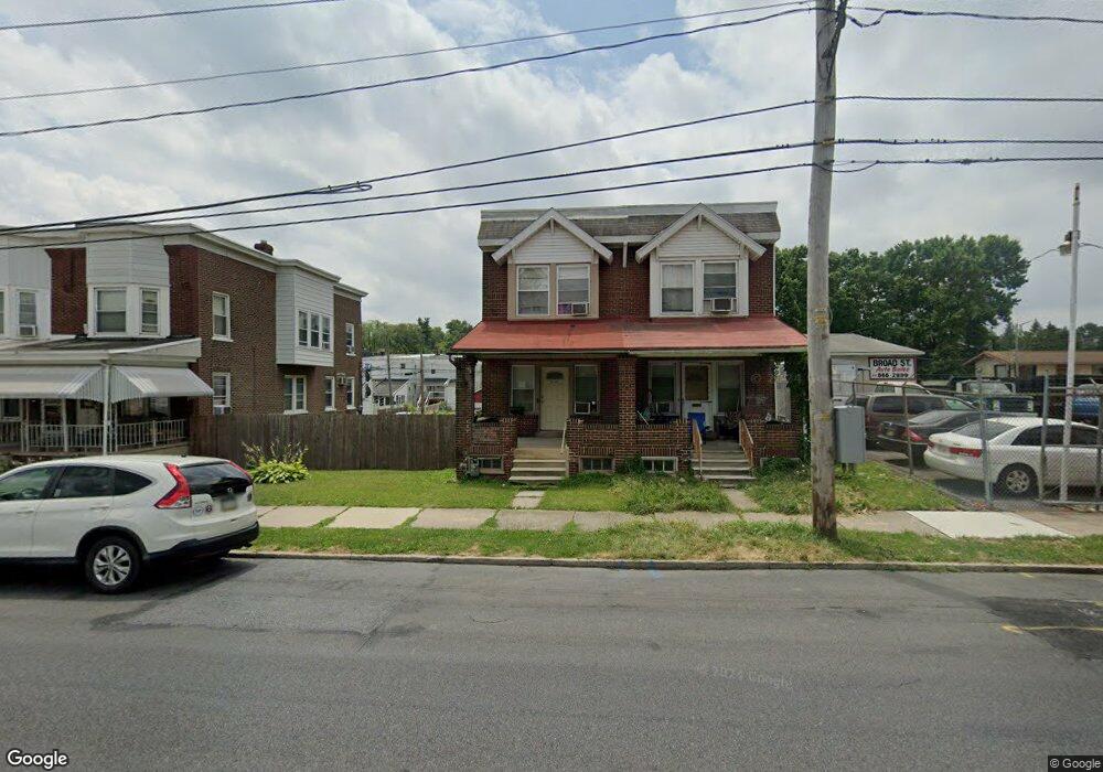
2141 W Broad St Bethlehem, PA 18018
West Bethlehem NeighborhoodEstimated Value: $212,837 - $237,000
3
Beds
1
Bath
1,306
Sq Ft
$172/Sq Ft
Est. Value
About This Home
This home is located at 2141 W Broad St, Bethlehem, PA 18018 and is currently estimated at $224,959, approximately $172 per square foot. 2141 W Broad St is a home located in Lehigh County with nearby schools including Clearview Elementary School, Nitschmann Middle School, and Liberty High School.
Ownership History
Date
Name
Owned For
Owner Type
Purchase Details
Closed on
Sep 9, 1993
Bought by
Houser Thomas W
Current Estimated Value
Purchase Details
Closed on
Jan 22, 1993
Sold by
Mcgrath Leslie C and Mcgrath Holly M
Bought by
Sec Of Housing & Urban Development
Purchase Details
Closed on
Nov 19, 1986
Sold by
Fenselau Frederick J and Fenselau Nancy J
Bought by
Mcgrath Leslie C and Mcgrath Holly M
Purchase Details
Closed on
Dec 22, 1977
Bought by
Fenselau Frederick J and Fenselau Nancy J
Create a Home Valuation Report for This Property
The Home Valuation Report is an in-depth analysis detailing your home's value as well as a comparison with similar homes in the area
Home Values in the Area
Average Home Value in this Area
Purchase History
| Date | Buyer | Sale Price | Title Company |
|---|---|---|---|
| Houser Thomas W | $32,700 | -- | |
| Sec Of Housing & Urban Development | -- | -- | |
| Mcgrath Leslie C | $46,000 | -- | |
| Fenselau Frederick J | $25,000 | -- |
Source: Public Records
Tax History
| Year | Tax Paid | Tax Assessment Tax Assessment Total Assessment is a certain percentage of the fair market value that is determined by local assessors to be the total taxable value of land and additions on the property. | Land | Improvement |
|---|---|---|---|---|
| 2025 | $2,844 | $99,000 | $9,100 | $89,900 |
| 2024 | $2,812 | $99,000 | $9,100 | $89,900 |
| 2023 | $2,787 | $99,000 | $9,100 | $89,900 |
| 2022 | $2,832 | $99,000 | $89,900 | $9,100 |
| 2021 | $2,820 | $99,000 | $9,100 | $89,900 |
| 2020 | $2,729 | $99,000 | $9,100 | $89,900 |
| 2019 | $2,749 | $99,000 | $9,100 | $89,900 |
| 2018 | $2,696 | $99,000 | $9,100 | $89,900 |
| 2017 | $2,576 | $99,000 | $9,100 | $89,900 |
| 2016 | -- | $99,000 | $9,100 | $89,900 |
| 2015 | -- | $99,000 | $9,100 | $89,900 |
| 2014 | -- | $99,000 | $9,100 | $89,900 |
Source: Public Records
Map
Nearby Homes
- 2010 Glendale Ave Unit A1
- 2045 Kenmore Ave
- 831 Wall St
- 1962 Glendale Ave
- 1953 Glendale Ave
- 1032 Club Ave
- 816 Shell St
- 1814 W Union Blvd
- 615 Sherman St
- 717 Mount Airy Ave
- 1104 Raymond Ave
- 615 N Randolph St
- 1705 E Cedar St
- 1827 Homestead Ave
- 1848 Ridgelawn Ave
- 1512 W Broad St
- 1714 Elliott Ave Unit 1718
- 1453 Stanford Rd
- 827 N Kiowa St
- 1146 E Livingston St
- 2143 W Broad St
- 2135 W Broad St
- 2133 W Broad St
- 2131 W Broad St
- 2129 W Broad St
- 2127 W Broad St
- 2125 W Broad St
- 2123 W Broad St
- 514 Grandview Blvd
- 2121 W Broad St
- 2136 Glendale Ave
- 2119 W Broad St
- 510 Grandview Blvd
- 512 Grandview Blvd
- 2140 Glendale Ave
- 2117 W Broad St
- 2138 Glendale Ave
- 2134 Glendale Ave
- 2126 Glendale Ave
- 508 Grandview Blvd
Your Personal Tour Guide
Ask me questions while you tour the home.