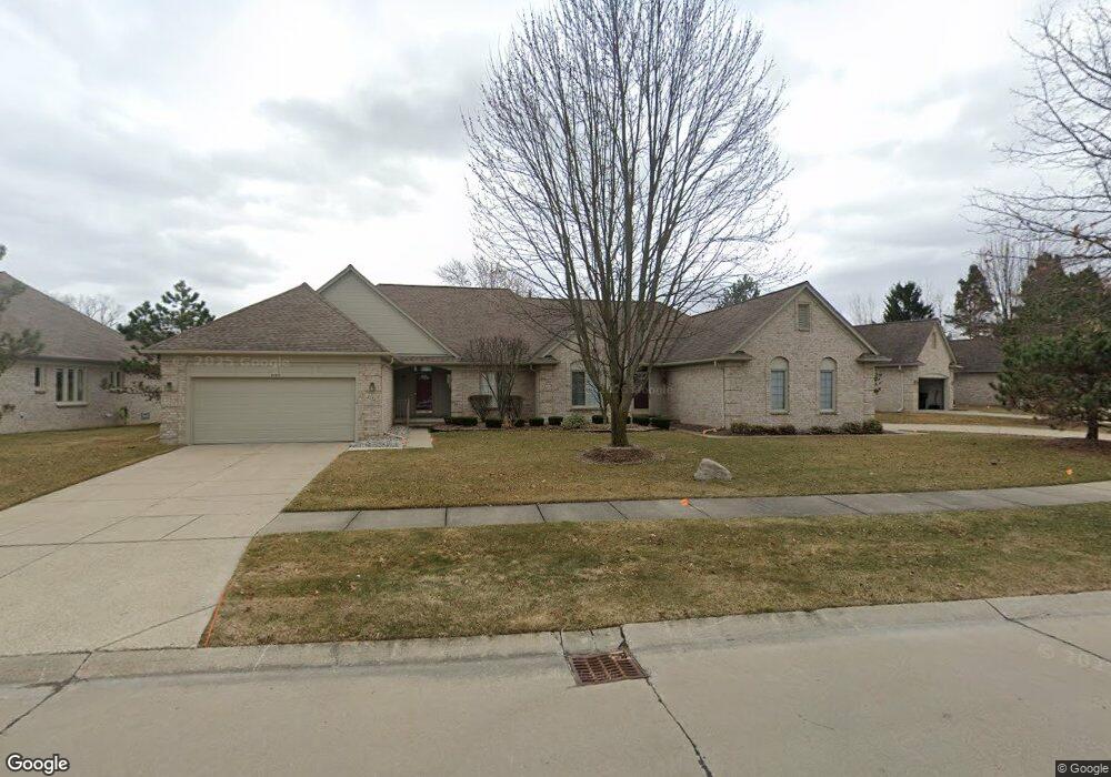
2142 Avalon Dr Sterling Heights, MI 48310
Estimated Value: $355,000 - $398,000
3
Beds
2
Baths
1,730
Sq Ft
$220/Sq Ft
Est. Value
About This Home
This home is located at 2142 Avalon Dr, Sterling Heights, MI 48310 and is currently estimated at $381,208, approximately $220 per square foot. 2142 Avalon Dr is a home located in Macomb County with nearby schools including Schuchard Elementary School, Frank Jeannette Junior High School, and Adlai Stevenson High School.
Ownership History
Date
Name
Owned For
Owner Type
Purchase Details
Closed on
Mar 12, 2025
Sold by
Redding Peter J and Ronan-Redding Patricia A
Bought by
Peter J Redding Trust and Patricia A Ronan-Redding Trust
Current Estimated Value
Purchase Details
Closed on
Feb 13, 2020
Sold by
Redding Peter J and Ronan Redding Patricia
Bought by
Redding Peter J and Ronan Redding Patricia
Purchase Details
Closed on
Sep 13, 2019
Sold by
Kang Young Ja and Kang Jun Ho
Bought by
Redding Peter J and Ronan Redding Patricia A
Purchase Details
Closed on
Mar 7, 2002
Sold by
Gill Timothy R
Bought by
Kang Jun H
Home Financials for this Owner
Home Financials are based on the most recent Mortgage that was taken out on this home.
Original Mortgage
$216,000
Interest Rate
7.18%
Create a Home Valuation Report for This Property
The Home Valuation Report is an in-depth analysis detailing your home's value as well as a comparison with similar homes in the area
Home Values in the Area
Average Home Value in this Area
Purchase History
| Date | Buyer | Sale Price | Title Company |
|---|---|---|---|
| Peter J Redding Trust | -- | None Listed On Document | |
| Peter J Redding Trust | -- | None Listed On Document | |
| Redding Peter J | -- | None Available | |
| Redding Peter J | -- | First American Title | |
| Kang Jun H | $270,000 | -- |
Source: Public Records
Mortgage History
| Date | Status | Borrower | Loan Amount |
|---|---|---|---|
| Previous Owner | Kang Jun H | $216,000 |
Source: Public Records
Tax History Compared to Growth
Tax History
| Year | Tax Paid | Tax Assessment Tax Assessment Total Assessment is a certain percentage of the fair market value that is determined by local assessors to be the total taxable value of land and additions on the property. | Land | Improvement |
|---|---|---|---|---|
| 2025 | $8,812 | $184,500 | $0 | $0 |
| 2024 | $6,885 | $170,400 | $0 | $0 |
| 2023 | $6,512 | $161,200 | $0 | $0 |
| 2022 | $7,772 | $148,700 | $0 | $0 |
| 2021 | $7,608 | $141,500 | $0 | $0 |
| 2020 | $5,854 | $134,800 | $0 | $0 |
| 2019 | $2,792 | $124,900 | $0 | $0 |
| 2018 | $2,823 | $114,900 | $0 | $0 |
| 2017 | $2,697 | $112,800 | $12,500 | $100,300 |
| 2016 | $2,606 | $112,800 | $0 | $0 |
| 2015 | -- | $108,200 | $0 | $0 |
| 2014 | -- | $76,700 | $0 | $0 |
Source: Public Records
Map
Nearby Homes
- 2648 Ormsby Dr
- 39588 Dequindre Rd
- 2700 Renshaw Dr
- 39560 Dequindre Rd
- 2833 Bywater Dr
- 2233 Mellowood Dr
- 2503 Westmont Cir
- 2664 Kenwyck Dr
- 2238 Nadine Dr
- 41395 Ambercrest Dr
- 4714 Butler Dr
- 2336 Heritage Pointe Dr Unit 17
- 5238 Windmill Dr
- 39327 Timberlane Dr
- 41466 Dequindre Rd
- 5092 Julian Dr
- 3514 Bates Dr
- 41599 Red Oak Dr
- 41659 Touchstone Dr
- 3550 Kirkton Dr
- 2142 Avalon Dr Unit 14
- 2134 Avalon Dr
- 2158 Avalon Dr Unit 16
- 2150 Avalon Dr Unit 8, 15
- 2150 Avalon Dr
- 2150 Avalon Dr Unit 15
- 2126 Avalon Dr
- 40091 Riverbend Dr
- 40079 Riverbend Dr
- 2141 Avalon Dr Unit 71
- 2118 Avalon Dr
- 2118 Avalon Dr Unit 6, 11
- 2118 Avalon Dr Unit 11
- 2174 Avalon Dr
- 2151 Avalon Dr Unit 70
- 40047 Riverbend Dr
- 40063 Riverbend Dr
- 2166 Avalon Dr
- 2087 Avalon Dr
- 40103 Riverbend Dr Unit 26