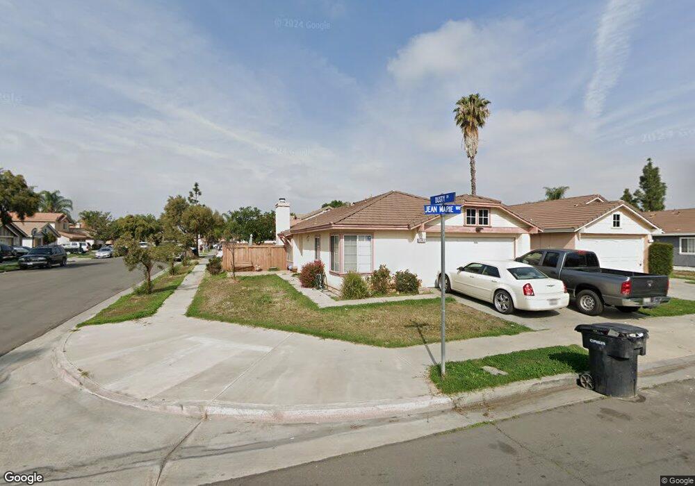
2142 Jean Marie Way Perris, CA 92571
Central Perris NeighborhoodEstimated Value: $465,722 - $479,000
3
Beds
2
Baths
1,317
Sq Ft
$359/Sq Ft
Est. Value
About This Home
This home is located at 2142 Jean Marie Way, Perris, CA 92571 and is currently estimated at $472,681, approximately $358 per square foot. 2142 Jean Marie Way is a home located in Riverside County with nearby schools including Triple Crown Elementary School, Lakeside Middle School, and Rancho Verde High School.
Ownership History
Date
Name
Owned For
Owner Type
Purchase Details
Closed on
Oct 30, 2024
Sold by
Lowe Leslie James and Lowe Sylvia A
Bought by
Lowe Family Trust and Lowe
Current Estimated Value
Purchase Details
Closed on
Sep 8, 2000
Sold by
Wilhite Joseph O
Bought by
Lowe Leslie James and Lowe Sylvia A
Home Financials for this Owner
Home Financials are based on the most recent Mortgage that was taken out on this home.
Original Mortgage
$87,181
Interest Rate
7.96%
Mortgage Type
FHA
Purchase Details
Closed on
Jul 11, 2000
Sold by
Wilhite Marta E
Bought by
Wilhite Joseph O
Home Financials for this Owner
Home Financials are based on the most recent Mortgage that was taken out on this home.
Original Mortgage
$87,181
Interest Rate
7.96%
Mortgage Type
FHA
Create a Home Valuation Report for This Property
The Home Valuation Report is an in-depth analysis detailing your home's value as well as a comparison with similar homes in the area
Home Values in the Area
Average Home Value in this Area
Purchase History
| Date | Buyer | Sale Price | Title Company |
|---|---|---|---|
| Lowe Family Trust | -- | None Listed On Document | |
| Lowe Family Trust | -- | None Listed On Document | |
| Lowe Leslie James | $88,000 | Orange Coast Title | |
| Wilhite Joseph O | -- | -- |
Source: Public Records
Mortgage History
| Date | Status | Borrower | Loan Amount |
|---|---|---|---|
| Previous Owner | Lowe Leslie James | $87,181 |
Source: Public Records
Tax History Compared to Growth
Tax History
| Year | Tax Paid | Tax Assessment Tax Assessment Total Assessment is a certain percentage of the fair market value that is determined by local assessors to be the total taxable value of land and additions on the property. | Land | Improvement |
|---|---|---|---|---|
| 2025 | $1,567 | $132,421 | $37,653 | $94,768 |
| 2023 | $1,567 | $127,281 | $36,192 | $91,089 |
| 2022 | $1,520 | $124,786 | $35,483 | $89,303 |
| 2021 | $1,509 | $122,340 | $34,788 | $87,552 |
| 2020 | $1,494 | $121,087 | $34,432 | $86,655 |
| 2019 | $1,412 | $118,713 | $33,757 | $84,956 |
| 2018 | $1,393 | $116,387 | $33,097 | $83,290 |
| 2017 | $1,362 | $114,106 | $32,449 | $81,657 |
| 2016 | $1,346 | $111,869 | $31,813 | $80,056 |
| 2015 | $1,326 | $110,190 | $31,336 | $78,854 |
| 2014 | $1,310 | $108,033 | $30,723 | $77,310 |
Source: Public Records
Map
Nearby Homes
- 487 Lassa Way
- 575 Prairie Way
- 507 Coudures Way
- 484 Harvest Rd
- 675 Camelia Dr
- 763 Anthirium Ave
- 2363 Cloverfield St
- 702 Camelia Dr
- 302 Daystar Dr
- 2175 Willowbrook Ln
- 702 Clearwater Dr
- 1864 Havasu St
- 2245 Liberty Ct
- 1753 Jade Ave
- 1033 Madera St
- 157 Ambrosia Ct
- 174 Linden Ct
- 159 Linden Ct
- 2 Lemon Ave
- 1 Lemon Ave
- 2146 Jean Marie Way
- 522 Dusty Ln
- 2150 Jean Marie Way
- 516 Dusty Ln
- 529 Dusty Ln
- 535 Dusty Ln
- 525 Lassa Way
- 2154 Jean Marie Way
- 510 Dusty Ln
- 523 Dusty Ln
- 2151 Jean Marie Way
- 519 Lassa Way
- 2153 Jean Marie Way
- 2149 Jean Marie Way
- 517 Dusty Ln
- 2155 Jean Marie Way
- 2147 Jean Marie Way
- 504 Dusty Ln
- 513 Lassa Way
- 511 Dusty Ln