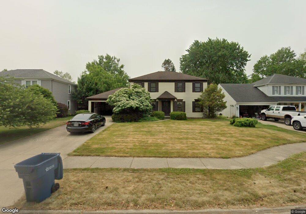
21435 Kings Hwy Cleveland, OH 44126
Estimated Value: $321,000 - $398,000
4
Beds
3
Baths
2,180
Sq Ft
$161/Sq Ft
Est. Value
About This Home
This home is located at 21435 Kings Hwy, Cleveland, OH 44126 and is currently estimated at $350,982, approximately $161 per square foot. 21435 Kings Hwy is a home located in Cuyahoga County with nearby schools including Gilles-Sweet Elementary School, Lewis F Mayer Middle School, and Fairview High School.
Ownership History
Date
Name
Owned For
Owner Type
Purchase Details
Closed on
Dec 20, 2023
Sold by
Burgett Fredrick M and Burgett Colleen M
Bought by
Burgett Fredrick M and Burgett Colleen M
Current Estimated Value
Purchase Details
Closed on
Jun 17, 1998
Sold by
Hoy Charles L and Hoy Cleo M
Bought by
Burgett Fredrick M and Burgett Colleen M
Home Financials for this Owner
Home Financials are based on the most recent Mortgage that was taken out on this home.
Original Mortgage
$110,000
Interest Rate
7.22%
Create a Home Valuation Report for This Property
The Home Valuation Report is an in-depth analysis detailing your home's value as well as a comparison with similar homes in the area
Home Values in the Area
Average Home Value in this Area
Purchase History
| Date | Buyer | Sale Price | Title Company |
|---|---|---|---|
| Burgett Fredrick M | -- | None Listed On Document | |
| Burgett Fredrick M | $192,000 | Chicago Title Insurance Comp |
Source: Public Records
Mortgage History
| Date | Status | Borrower | Loan Amount |
|---|---|---|---|
| Previous Owner | Burgett Fredrick M | $110,000 |
Source: Public Records
Tax History Compared to Growth
Tax History
| Year | Tax Paid | Tax Assessment Tax Assessment Total Assessment is a certain percentage of the fair market value that is determined by local assessors to be the total taxable value of land and additions on the property. | Land | Improvement |
|---|---|---|---|---|
| 2024 | $6,395 | $92,995 | $21,875 | $71,120 |
| 2023 | $7,183 | $89,960 | $17,610 | $72,350 |
| 2022 | $7,013 | $89,950 | $17,610 | $72,350 |
| 2021 | $7,176 | $89,950 | $17,610 | $72,350 |
| 2020 | $7,981 | $88,170 | $17,260 | $70,910 |
| 2019 | $7,087 | $251,900 | $49,300 | $202,600 |
| 2018 | $6,905 | $88,170 | $17,260 | $70,910 |
| 2017 | $7,044 | $81,030 | $16,420 | $64,610 |
| 2016 | $6,996 | $81,030 | $16,420 | $64,610 |
| 2015 | $6,042 | $81,030 | $16,420 | $64,610 |
| 2014 | $6,042 | $70,460 | $14,280 | $56,180 |
Source: Public Records
Map
Nearby Homes
- 20930 Mastick Rd
- 5951 Rockport Ln
- 22534 Bard Ave
- 22247 Mastick Rd
- 22506 Sharon Ln
- 22503 Sandy Ln
- 22045 Morton Ave
- 4627 W 223rd St
- 4464 W 224th St
- 21437 Hillsdale Ave
- 21763 Hillsdale Ave
- 4710 Grayton Rd
- 22934 Mastick Rd Unit 102
- 4720 Grayton Rd
- 4514 Orchard Rd
- 4309 W 222nd St
- 22895 Mastick Rd
- 4401 Fairview Park
- 22968 Maple Ridge Rd Unit 103
- 22976 Maple Ridge Rd Unit B 105
- 21445 Kings Hwy
- 21425 Kings Hwy
- 21455 Kings Hwy
- 5330 Kings Hwy
- 5320 Kings Hwy
- 21430 Kings Hwy
- 21440 Kings Hwy
- 21440 Mastick Rd
- 5310 Kings Hwy
- 21400 Mastick Rd
- 21450 Kings Hwy
- 5421 Sherwood Dr
- 5401 Sherwood Dr
- 5441 Sherwood Dr
- 5381 Sherwood Dr
- 21460 Mastick Rd
- 5461 Sherwood Dr
- 5300 Kings Hwy
- 5361 Sherwood Dr
- 21460 Kings Hwy