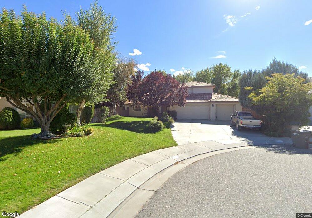
2144 Kiowa Cir Bishop, CA 93514
Estimated Value: $734,000 - $826,000
4
Beds
3
Baths
2,432
Sq Ft
$314/Sq Ft
Est. Value
About This Home
This home is located at 2144 Kiowa Cir, Bishop, CA 93514 and is currently estimated at $764,810, approximately $314 per square foot. 2144 Kiowa Cir is a home located in Inyo County with nearby schools including Bishop Elementary School, Home Street Middle School, and Bishop Union High School.
Ownership History
Date
Name
Owned For
Owner Type
Purchase Details
Closed on
Apr 19, 2018
Sold by
Plakos Christopher James and Plakos Lori L
Bought by
Calloway Brent R and Calloway Angela K
Current Estimated Value
Home Financials for this Owner
Home Financials are based on the most recent Mortgage that was taken out on this home.
Original Mortgage
$416,500
Interest Rate
4.5%
Mortgage Type
New Conventional
Purchase Details
Closed on
Jun 21, 2007
Sold by
Plakos Christopher J and Plakos Lori I
Bought by
Plakos Christopher James and Plakos Lori I
Create a Home Valuation Report for This Property
The Home Valuation Report is an in-depth analysis detailing your home's value as well as a comparison with similar homes in the area
Home Values in the Area
Average Home Value in this Area
Purchase History
| Date | Buyer | Sale Price | Title Company |
|---|---|---|---|
| Calloway Brent R | $490,000 | Inyo Mono Title Co | |
| Plakos Christopher James | -- | None Available |
Source: Public Records
Mortgage History
| Date | Status | Borrower | Loan Amount |
|---|---|---|---|
| Previous Owner | Calloway Brent R | $416,500 |
Source: Public Records
Tax History
| Year | Tax Paid | Tax Assessment Tax Assessment Total Assessment is a certain percentage of the fair market value that is determined by local assessors to be the total taxable value of land and additions on the property. | Land | Improvement |
|---|---|---|---|---|
| 2025 | $5,734 | $557,529 | $195,135 | $362,394 |
| 2024 | $5,734 | $546,598 | $191,309 | $355,289 |
| 2023 | $5,604 | $535,881 | $187,558 | $348,323 |
| 2022 | $5,581 | $525,375 | $183,881 | $341,494 |
| 2021 | $5,490 | $515,075 | $180,276 | $334,799 |
| 2020 | $5,309 | $509,795 | $178,428 | $331,367 |
| 2019 | $5,309 | $499,800 | $174,930 | $324,870 |
| 2018 | $3,416 | $323,338 | $88,566 | $234,772 |
| 2017 | $3,346 | $316,999 | $86,830 | $230,169 |
| 2016 | $3,308 | $310,784 | $85,128 | $225,656 |
| 2015 | $3,243 | $306,117 | $83,850 | $222,267 |
| 2014 | $3,177 | $300,122 | $82,208 | $217,914 |
Source: Public Records
Map
Nearby Homes
- 1631 Shoshone Dr
- 2428 Choctaw Dr
- 2361 Hopi Cir
- 2360 Brigadoon Ave
- 2222 Brigadoon Ave
- 2280 Baskerville Ave
- 1528 Argyle Ln
- 2268 Mcgalliard Ave
- 2229 Fiora Ave
- 2307 Galloway Ave
- 2322 Galloway Ave
- 2205 Edinburgh Ave
- 1443 Shelly Creek Rd
- 0 US Highway 6
- 718 Keough St
- 771 N Main St Unit 124
- 3028 Laurel Rd
- 310 Shepard Ln
- 112 Mclaren Ln
- 399 E Yaney St Unit 53
- 2138 Kiowa Cir Unit 11
- 2138 Kiowa Cir
- 2383 Cheyenne Dr
- 2150 Kiowa Cir Unit 13
- 2150 Kiowa Cir
- 2371 Cheyenne Dr
- 2395 Cheyenne Dr
- 2156 Kiowa Cir
- 2143 Kiowa Cir
- 2359 Cheyenne Dr Unit 14
- 2359 Cheyenne Dr
- 2407 Cheyenne Dr
- 1704 Shoshone Dr
- 1692 Shoshone Dr Unit 46
- 1692 Shoshone Dr
- 2149 Kiowa Cir Unit 9
- 2149 Kiowa Cir
- 2382 Cheyenne Dr
- 1716 Shoshone Dr
- 1680 Shoshone Dr Unit .250
Your Personal Tour Guide
Ask me questions while you tour the home.