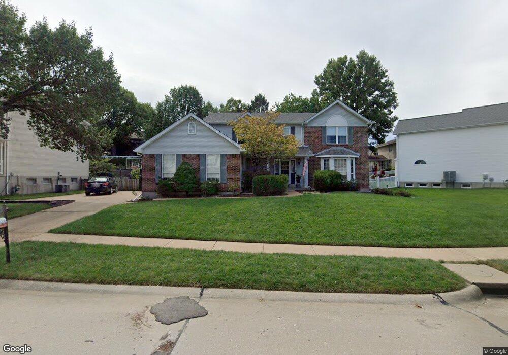
2144 Telford Dr Saint Louis, MO 63125
Lemay NeighborhoodEstimated Value: $434,000 - $464,000
4
Beds
4
Baths
2,621
Sq Ft
$173/Sq Ft
Est. Value
About This Home
This home is located at 2144 Telford Dr, Saint Louis, MO 63125 and is currently estimated at $453,479, approximately $173 per square foot. 2144 Telford Dr is a home located in St. Louis County with nearby schools including Forder Elementary School, Margaret Buerkle Middle School, and Mehlville High School.
Ownership History
Date
Name
Owned For
Owner Type
Purchase Details
Closed on
Jan 23, 2012
Sold by
Melville Mark W and Melville Cheryl R
Bought by
Melville Mark W and Melville Cheryl R
Current Estimated Value
Purchase Details
Closed on
Mar 11, 2009
Sold by
Melville Mark W and Melville Cheryl R
Bought by
Melville Mark W and Melville Cheryl R
Purchase Details
Closed on
Aug 22, 2005
Sold by
Melville Mark W
Bought by
Melville Mark W and Melville Cheryl R
Home Financials for this Owner
Home Financials are based on the most recent Mortgage that was taken out on this home.
Original Mortgage
$211,000
Interest Rate
5.81%
Mortgage Type
Fannie Mae Freddie Mac
Purchase Details
Closed on
May 12, 1999
Sold by
Melville Mark W and Melville Cheryl R
Bought by
Melville Mark W
Create a Home Valuation Report for This Property
The Home Valuation Report is an in-depth analysis detailing your home's value as well as a comparison with similar homes in the area
Home Values in the Area
Average Home Value in this Area
Purchase History
| Date | Buyer | Sale Price | Title Company |
|---|---|---|---|
| Melville Mark W | -- | None Available | |
| Melville Mark W | -- | None Available | |
| Melville Mark W | -- | Abstar Title Company | |
| Melville Mark W | -- | -- |
Source: Public Records
Mortgage History
| Date | Status | Borrower | Loan Amount |
|---|---|---|---|
| Closed | Melville Mark W | $211,000 |
Source: Public Records
Tax History Compared to Growth
Tax History
| Year | Tax Paid | Tax Assessment Tax Assessment Total Assessment is a certain percentage of the fair market value that is determined by local assessors to be the total taxable value of land and additions on the property. | Land | Improvement |
|---|---|---|---|---|
| 2025 | $5,000 | $74,100 | $21,410 | $52,690 |
| 2024 | $5,000 | $68,270 | $13,930 | $54,340 |
| 2023 | $4,709 | $68,270 | $13,930 | $54,340 |
| 2022 | $4,734 | $63,600 | $11,100 | $52,500 |
| 2021 | $4,344 | $63,600 | $11,100 | $52,500 |
| 2020 | $4,307 | $59,680 | $12,030 | $47,650 |
| 2019 | $4,295 | $59,680 | $12,030 | $47,650 |
| 2018 | $4,309 | $53,310 | $9,250 | $44,060 |
| 2017 | $4,298 | $53,310 | $9,250 | $44,060 |
| 2016 | $4,386 | $52,230 | $8,320 | $43,910 |
| 2015 | $4,131 | $52,230 | $8,320 | $43,910 |
| 2014 | $3,704 | $46,580 | $9,990 | $36,590 |
Source: Public Records
Map
Nearby Homes
- 645 Vista Conn Dr
- 2105 Telford Dr
- 669 Vista Conn Dr
- 2228 Hagenstone Terrace
- 800 Dumont Place Unit B
- 1745 Herault Place Unit E
- 1725 Herault Place Unit G
- 1716 Mayenne Ct Unit E
- 333 Pentonville Dr
- 408 W Ripa Ave
- 824 Dumont Place Unit C
- 1677 Herault Place Unit B
- 1673 Herault Place Unit B
- 1678 Blue Ridge Dr Unit A
- 846 Dumont Place
- 1656 Herault Place
- 1660 Blue Ridge Dr Unit G
- 853 Dumont Place Unit B
- 502 Nannette Dr
- 317 Tacoma Dr
- 2140 Telford Dr
- 2202 Telford Dr
- 719 Autumn Ridge Ct
- 2210 Telford Dr
- 2136 Telford Dr
- 2141 Telford Dr
- 2145 Telford Dr
- 2137 Telford Dr
- 723 Autumn Ridge Ct
- 2218 Telford Dr
- 715 Autumn Ridge Ct
- 2149 Telford Dr
- 2133 Telford Dr
- 2132 Telford Dr
- 2203 Telford Dr
- 2226 Telford Dr
- 2211 Telford Dr
- 711 Autumn Ridge Ct
- 2129 Telford Dr
- 833 Shady Ridge Ct